.webp?language=en-US)


From Pixels to Stewardship: Advancing Conservation Through Digital Innovation
This project shows an admirable sense of stewardship.
Awards Jury
-
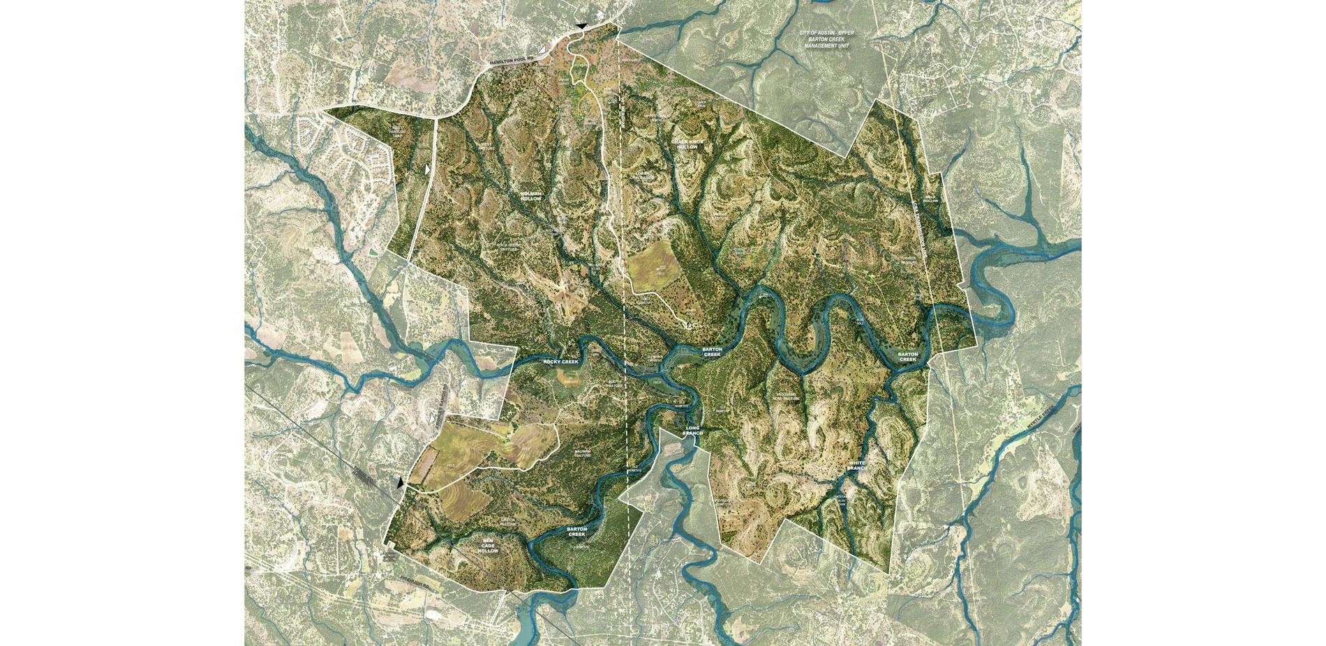
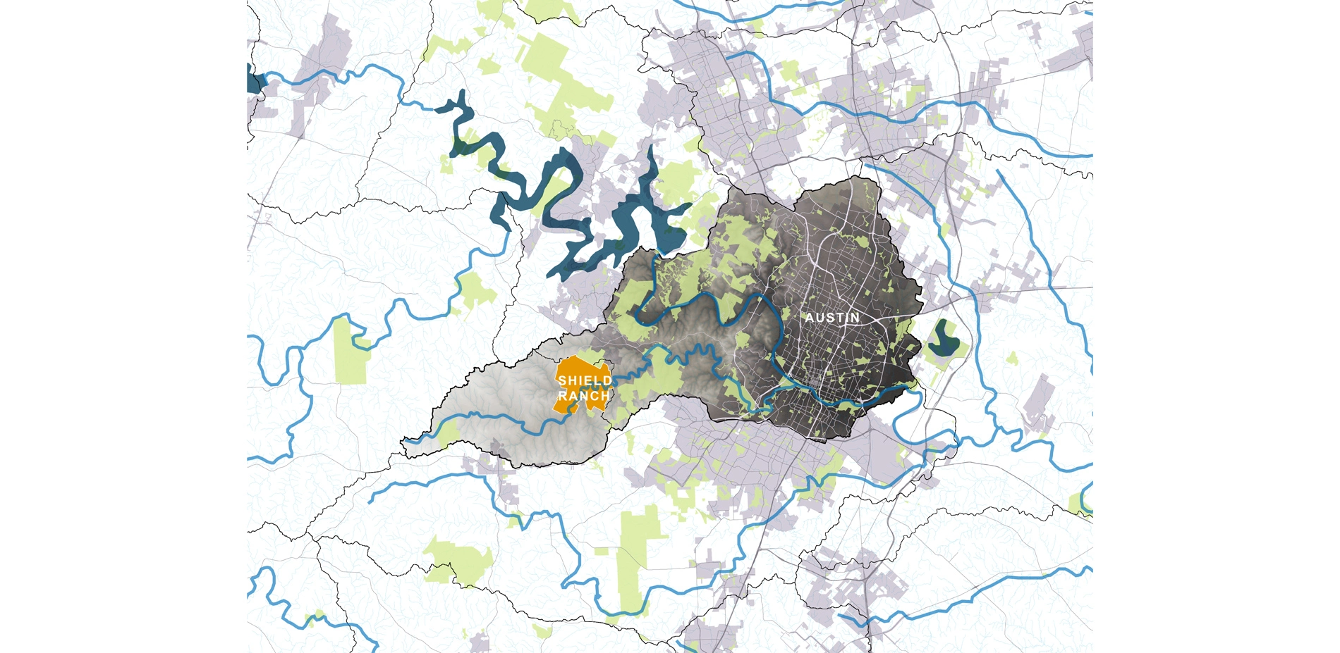
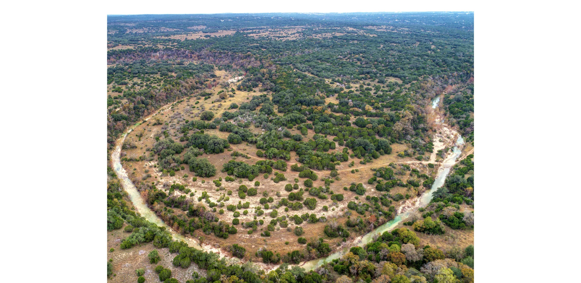
Ninety-five percent of Texas is privately owned, thereby providing land owners the unique capacity to enhance the landscape's ecosystem services, embed resiliency, and reinvigorate Texans about their distinctive natural and cultural environment. The Shield Ranch Master Plan demonstrates one family's evolving approach to land stewardship and advocacy during a pivotal point in their 80-year journey. To protect, connect, and share Shield Ranch's 6,800-acre, Austin, TX landscape with the next generation of family and community, the master planning team pioneered an innovative process for modelling and categorizing the iconic landscape's complex, natural and cultural systems. Using state-of-the-art digital tools; high–resolution, publically-available data; and on-site data collection with experts, the team and family collaboratively "read" the landscape and developed a highly-attuned network of new program areas. This master planning process is widely applicable to other land owners in the American Southwest and Texas who wish to advocate for sustainable land development, conservation, and enhanced resiliency within arid landscapes that are particularly vulnerable to climate change.
-
"The power of generative listening: listening to the land, listening to the past, listening to our deepest longings and one another, and listening to what wants to and can be." On the master planning process - Robert A. Ayers, Shield Foundation Managing Partner and Shield Ranch Co-Owner
Conservation for the Future
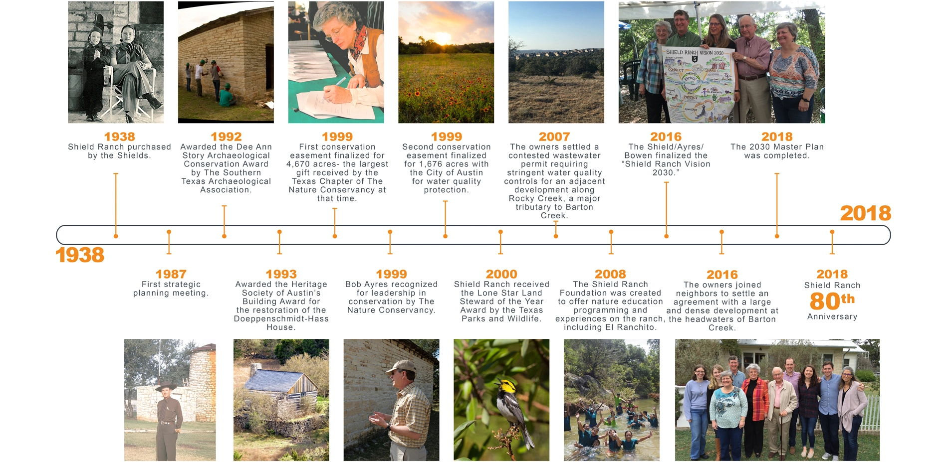
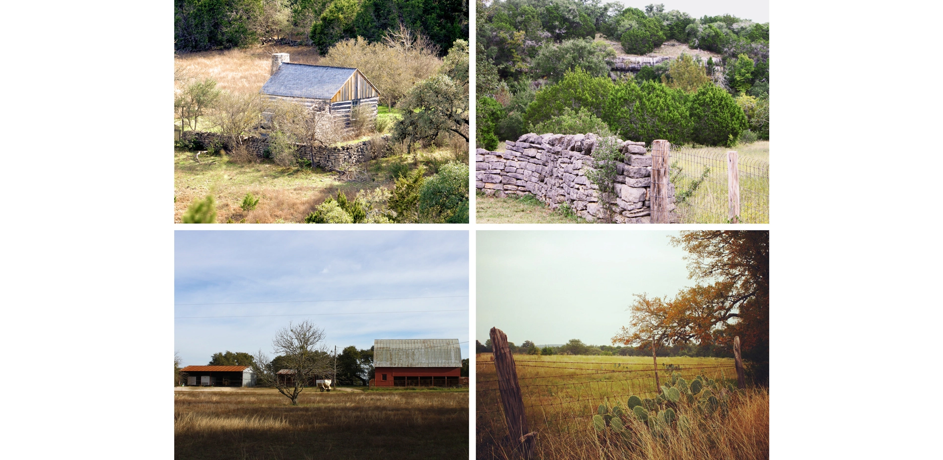
The Shield-Ayres-Bowen Family has maintained leadership in land stewardship within South-Central Texas for 80 years. The family heightened its long-term commitment to conservation and advocacy in 1998, when placing 95-percent of the family's 6,800-acre Shield Ranch under conservation easement, with an eye toward protecting water quality, water quantity, and sensitive habitats. Now, the family has committed to adapting their vision of Shield Ranch to the needs of future generations through an innovative, technology-driven master planning process, completed in 2018. The 10-year master plan integrated a pioneering process for modeling and categorizing the iconic landscape's complex, natural and cultural systems, with a consensus-building process for distilling long-term development and management priorities.
Why is This Important?
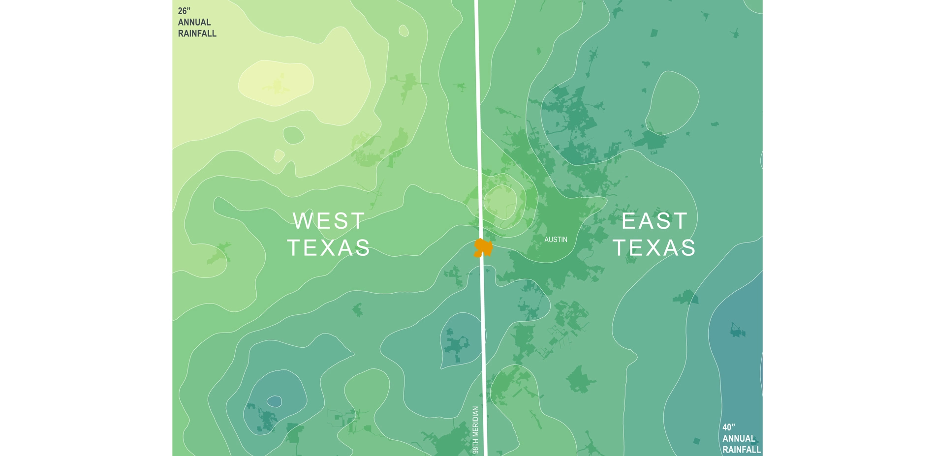
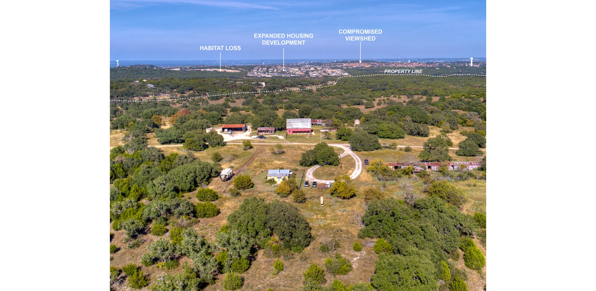
Shield Ranch lies at the American Southwest (98th meridian) gateway, which is considered a "danger zone" due to the extreme impacts of climate change paired with rapid population growth. Large storm events typically intersperse extended periods of drought within this zone, a phenomenon that's exacerbated by climate change. Regionally, the ranch lies within the Balcones Canyonlands of the Edwards Plateau (ecoregion 30c), and the Barton Creek watershed. This watershed drains to the Edwards Aquifer recharge zone - the primary water supply for more than 2-million people - and is impacted by the hydrologic performance of Shield Ranch and neighboring, large-scale land holdings. Through resiliency planning, the Shield Ranch Master Plan leverages physical intervention and long-term stewardship to mitigate these threats, along with others that plague Texas Hill Country: habitat loss; imminent domain for public infrastructure and roads; limited water availability; degraded water quality; fire risk; light and noise pollution; and viewshed degradation.
Master Planning Guided by an 80-Year Family Land Ethic
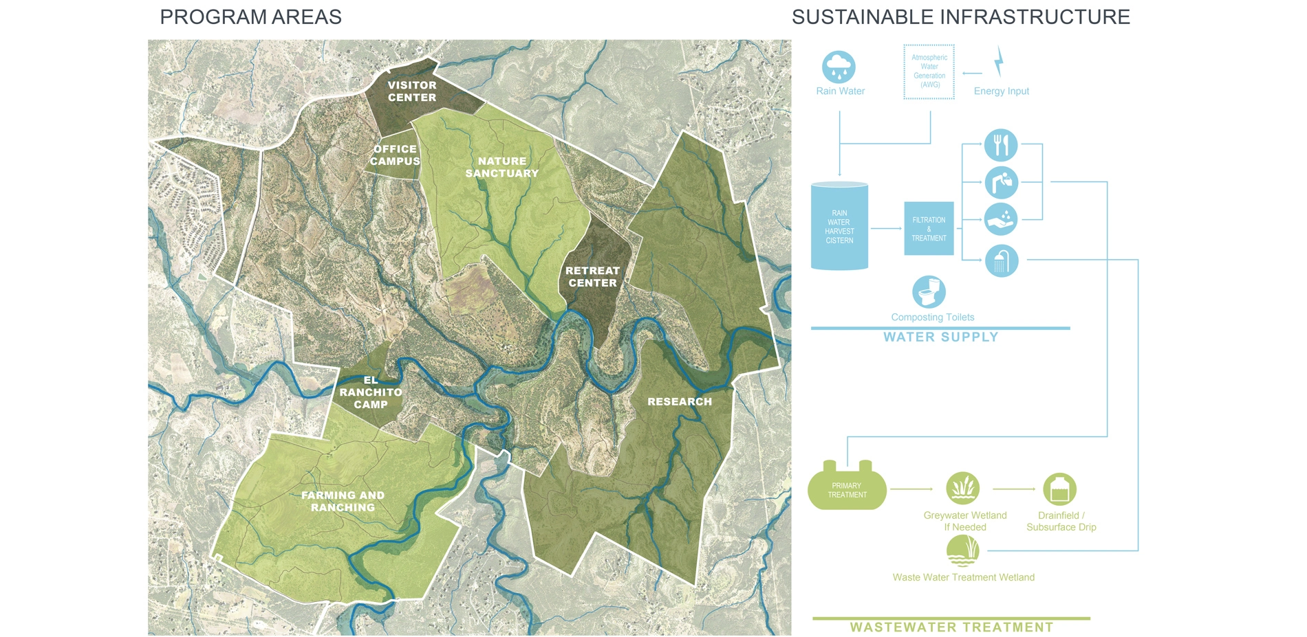
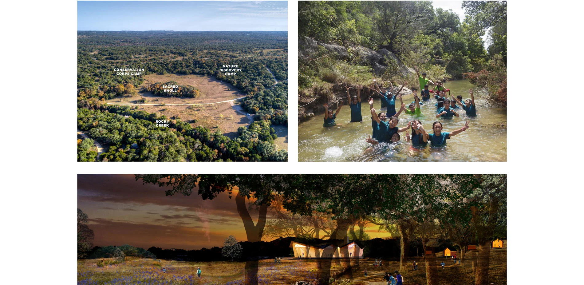
The owner's longstanding commitment to stewardship, advocacy, and education spans four generations. An inclusive master planning process, from 2016-2018, enabled the family to collectively modernize their stewardship approach, to guide the ranch's physical and programmatic trajectory for future generations. Through a pre-master plan visioning process, the family committed to sharing the beauty of Shield Ranch's natural and cultural landscape with the public by developing multiple "program areas." These include a visitor center, nature sanctuary and trail system, retreat center, and research hub, as well as permanent facilities for Shield Ranch's existing, nature-immersion camp for children and youth. To advance this vision, the Shield Ranch Master Plan's primary objectives were to: 1) Establish consensus within the family regarding program area development decisions; 2) Site these areas based on protection of sensitive site features and cultural needs; and 3) Empower family members to execute the ranch's buildout and operations in a regenerative manner, with minimal impact to the land.
Master Planning Process
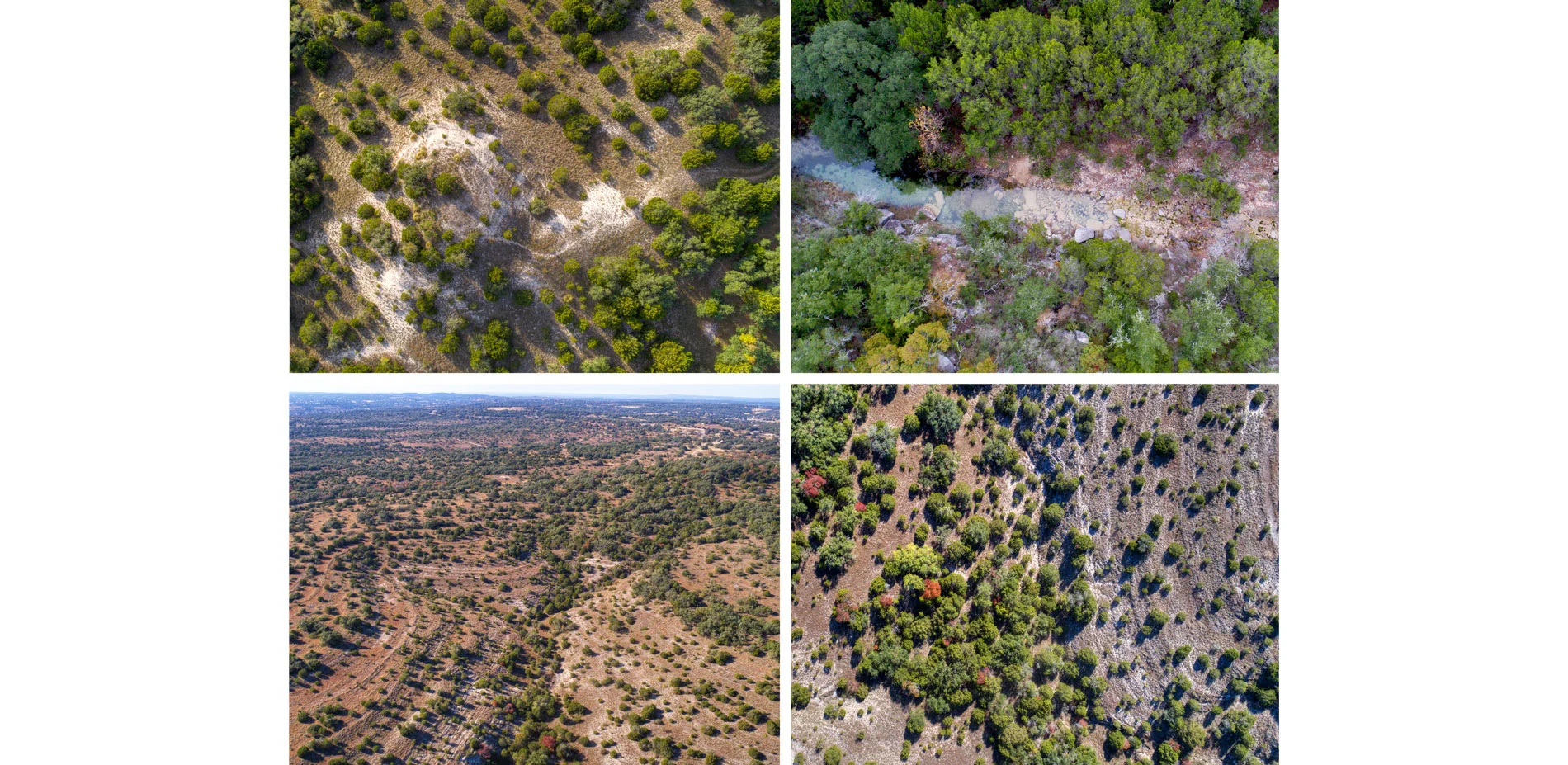
Achieving these goals, as with any sustainable planning and design process, starts with understanding and respecting the landscape's natural and cultural systems. The Shield Ranch Master Plan's initial "Discovery Phase" supported this process through six months of gathering, listening, and learning. Through this process, the master planning team analyzed Shield Ranch's regional context and external threats; inventoried natural resources (including geology, hydrology, wildlife and habitat, no development zones, land stewardship, and hydro-suitability); took stock of cultural resources (including pre-historic archeological sites, historic and cultural landscapes, existing infrastructure, and site and landscape evaluation); created a working group for each program area, composed of family and staff (to build consensus on goals, program, targeted user groups, and sustainable economic strategies for operations and management); and facilitated land partition planning with the family to lay the groundwork for future generation land ownership.
During the "Master Plan Phase" that followed, the team applied the inventory and analysis findings to the physical site in order to locate the program areas and develop sustainable management guidelines.
Advancing Planning with Technology
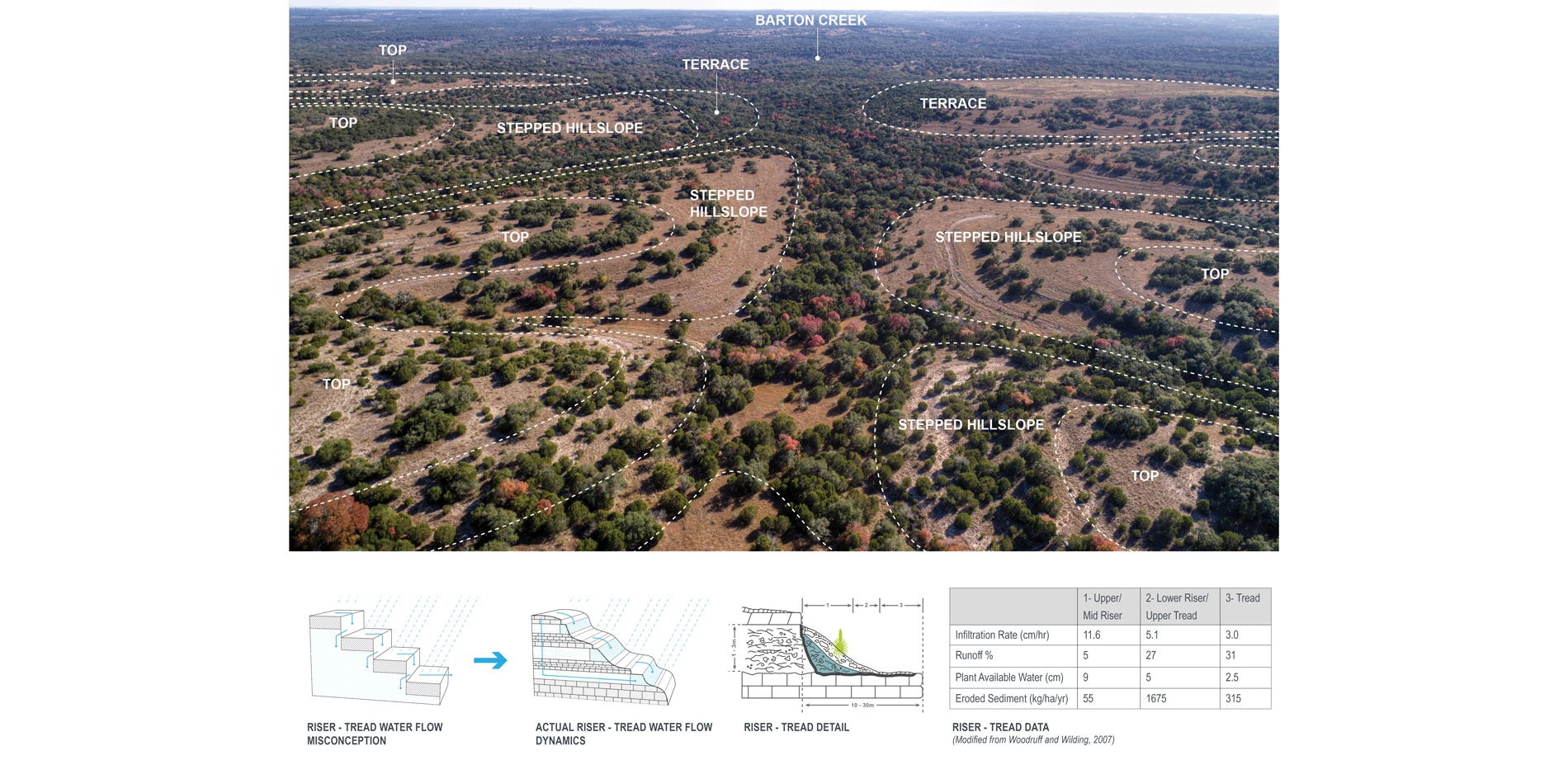
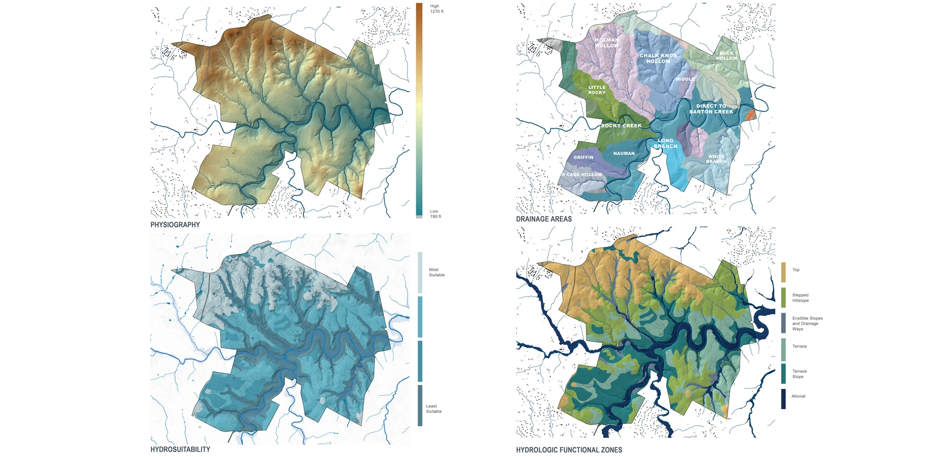
Recent research reveals that misconceptions about the region's eco-hydrogeological processes (interactions between ecology, hydrology, and geology) are resulting in destructive land management practices throughout this vulnerable landscape. As one of the most rapidly growing areas in the U.S., these misinformed practices are placing natural and cultural resources at risk. To protect these resources and accommodate programmatic experiences within Shield Ranch that require nature immersion and interpretation of local history, fine-scale analysis over the expansive landscape was required. Conventional planning approaches proved inadequate for this effort, and furthermore often fall short within expansive, highly-variable landscapes. So, how are small details catalogued? What framework exists for identifying the landscape's character zones? How will development scenarios impact precious soundscapes and viewsheds?
To address these needs, the master planning team pioneered a high-tech process for modelling and categorizing the landscape's complex, natural and cultural systems, and identifying sensitive areas. This process, which is widely applicable to other land owners in the Texas and the American Southwest, included:
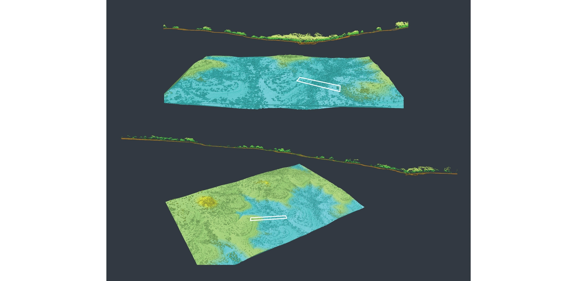
- LIDAR data hydrogeological modeling - Using high-resolution, point cloud elevation data from the State of Texas and input from leading scientists, the master planning team modeled hydrogeological systems and regional water movement, then developed a water management strategy for each hydrological zone.
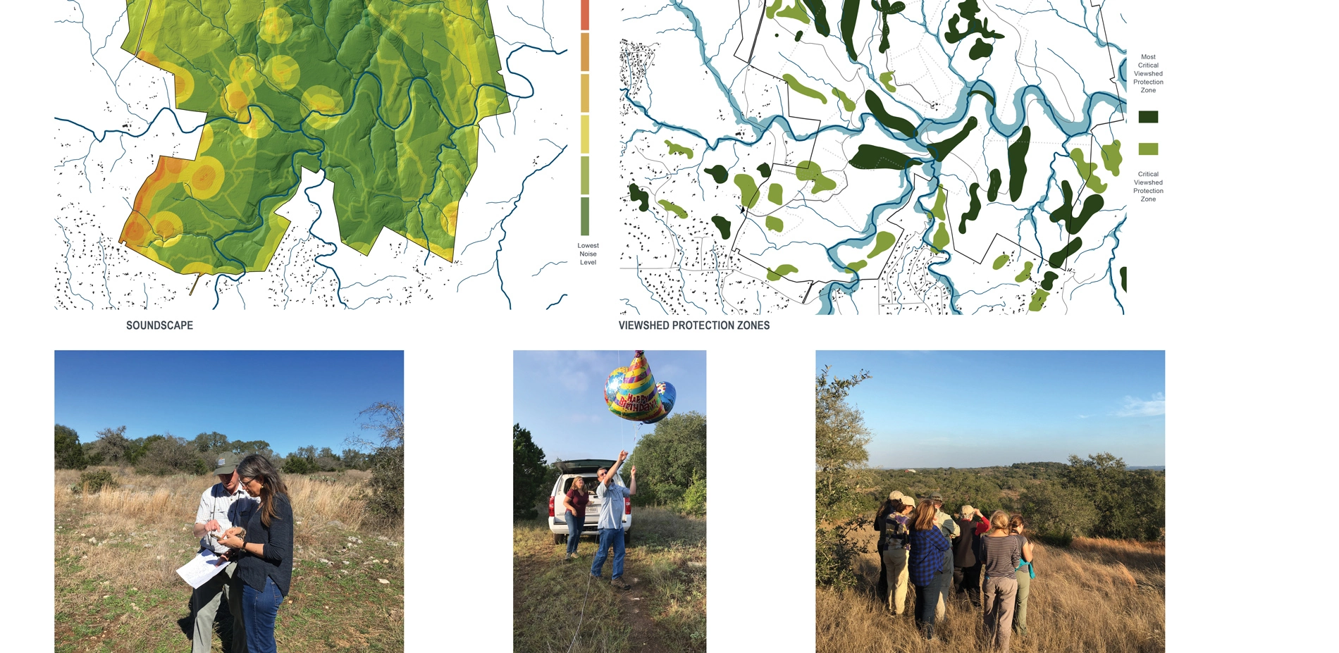
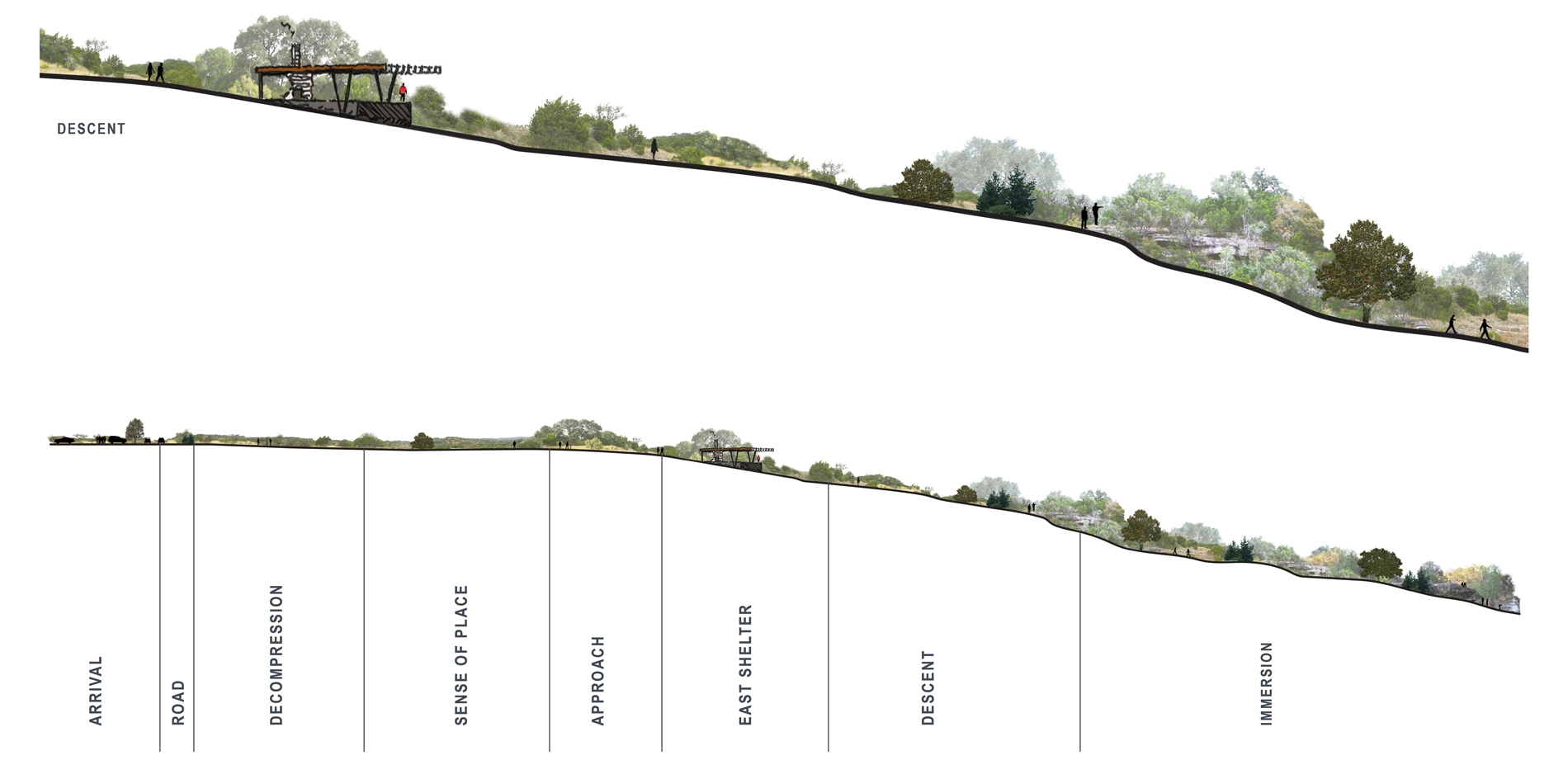
- LIDAR data viewshed and soundscape modeling - Using high-resolution, point cloud elevation and vegetation data, the team analyzed existing auditory and visual conditions and potential future scenarios to site program that requires a preserved, nature-immersion experience.
- Client-engaged GIS and smartphone app use - The team trained each working group to digitize and record 80 years' worth of family knowledge about the ranch; digitize and record visiting scientists' findings; ground-truth the analysis findings; test fit proposed program area design iterations; and identify future threats to the integrity of the ranch.
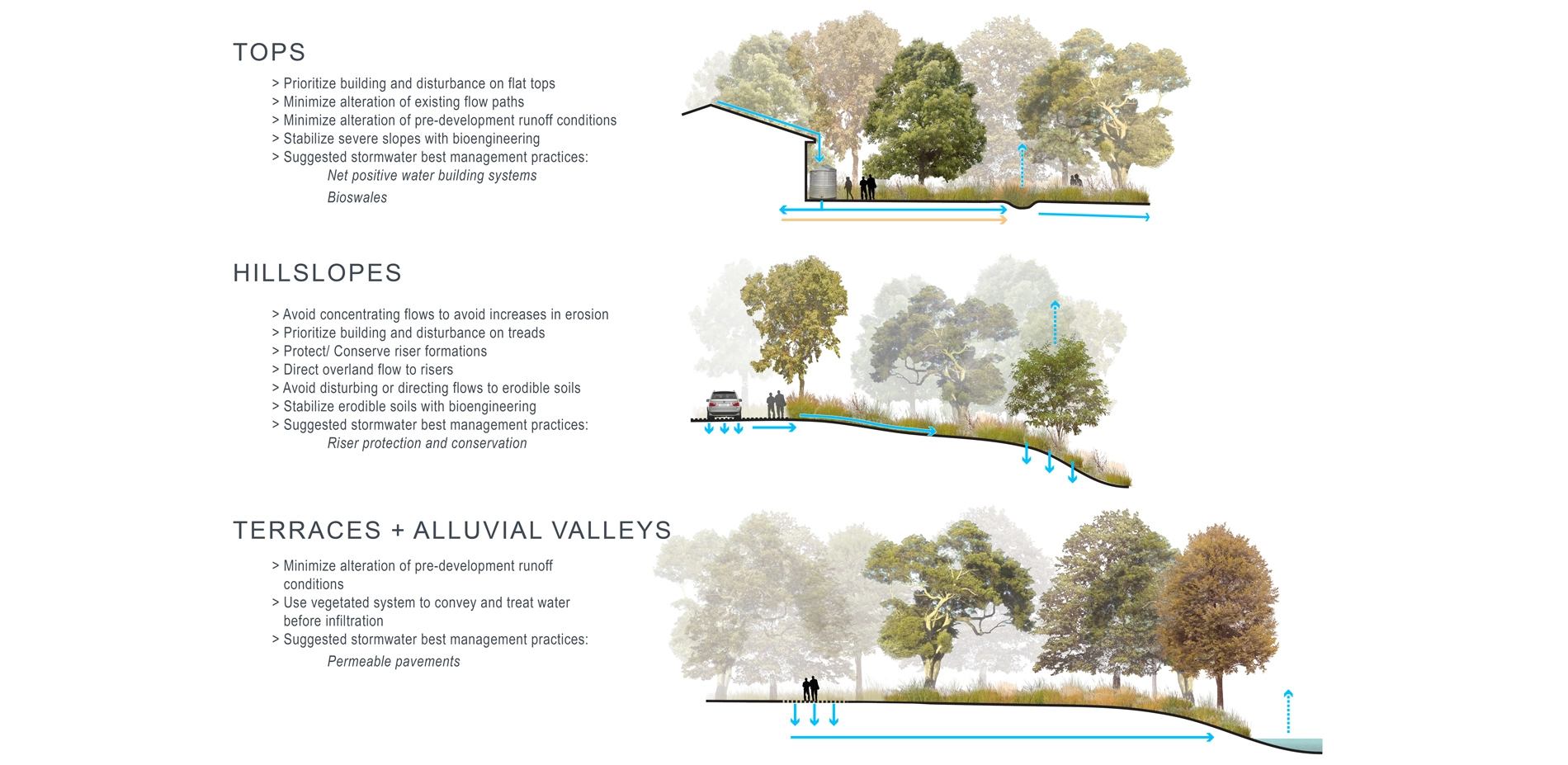
- Eco-hydrogeological planning frameworks - By combining GIS data and information from interviews with local scientists and policy makers, the team tailored design guidelines that support Shield Ranch's: 1) Variable geologic features (including protection of the stair-stepped geology's, high-performing "risers"); 2) Need to improve water quality; and 3) Desire to provide high-quality habitat for two resident, endangered species (the golden-cheeked warbler and black-capped vireo).
Making the Future Real
To fine-tune an executable master plan, the team collaborated with the client and various experts to:
- Refine each program area through field verification of proposed built elements.
- Pursue net-positive water and energy using strategies including water capture and reuse, and innovative wastewater treatment.
- Develop an economically-sustainable, operations and management plan for the retreat center program area.
- Determine a phased implementation approach based on various potential funding sources.
The Shield Ranch Master Plan embraces the Shield-Ayres-Bowen family vision, while functioning as a benchmark for sustainable development that navigates programmatic needs, family interests, and long-term stewardship goals of a beloved place. This master plan validates a multi-generational evolution of land stewardship and advocacy, and provides a significant opportunity to influence the future development of privately-owned lands throughout Texas and the American Southwest.
-
Lead Designers
- José Almiñana
- Emily McCoy
Landscape Architects
- José Almiñana
- Emily McCoy
Master Planning Team
- Shield-Ayres-Bowen Family - Client
- Patricia Shield Ayres and Robert M. Ayres Jr.
- Vera Ayres Bowen, Robert A. Ayres and Margy Ayres
- Kathleen Ayres, Elizabeth Ayres Domenech, Marshall Bowen, Gentry Bowen, Sophie Bowen Rupp, Mallory Bowen
- Shield Ranch Staff
- Dee Dee Wilson, Dr. Blake Murden, Christy Muse
- Andropogon Associates, Ltd.
- José Almiñana, PLA, FASLA, SITES AP, LEED AP – Principal-in-charge
- Emily McCoy, PLA, ASLA, SITES AP - Associate Principal and Project Manager
- John Collins, Senior Designer
- Lauren Mandel, PLA, ASLA- Integrative Researcher and Landscape Architect
- Eric Thomas, ASLA – Landscape Planner and Designer
- Hanna Gold, ASLA - Landscape Designer
- Le Xu (Cindy), LEED BD+C AP, ASLA - Landscape Designer
- Loretta Desvernine - Senior Graphic Designer
- Todd Montgomery- Senior Landscape Designer
- Martha Eberle, PLA, ASLA- Landscape Architect
- Chao Yang, ASLA – Landscape Designer
- Regenerative Environmental Design
- Heather Venhaus, ASLA
- Biohabitats
- Claudia Browne
- Erin English, PE, LEED AP
- Consulting Geologist
- Dr. Charles (Chock) Woodruff
- Vermeulens
- Blair Tennant, LEED AP
- Spot Inquiry
- Alexis Sanford
- Drone Imagery
- Jonathan Jackson
- Sound Consultant
- Dr. Michael Mandel
Advertisement
Related Awards

Honor Award, Analysis & Planning
A Cultural Approach: The Fort Peck Tribes Hazard Mitigation Plan
In collaboration with the Fort Peck Assiniboine and Sioux Tribes, EPA, and FEMA, the Fort Peck Tribes Hazard Mitigation Plan (HMP) adopts a culturally responsive approach to hazard mitigation planning that features connection to place.


Related Articles
Landscape Architecture Magazine
LAM Wins Five ASBPE Awards
Landscape Architecture Magazine earned national and regional honors for editorial excellence, publication design, and profile.
Jun 1 2026