
.webp?language=en-US)


Extending Our History, Embracing Our Future
Firms
SmithGroup (Team Lead) + Hoerr Schaudt
It was a campus masterplan, but it went very much into the culture of the place.
Awards Jury
-
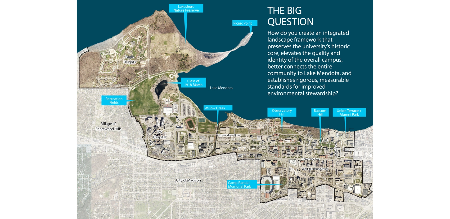
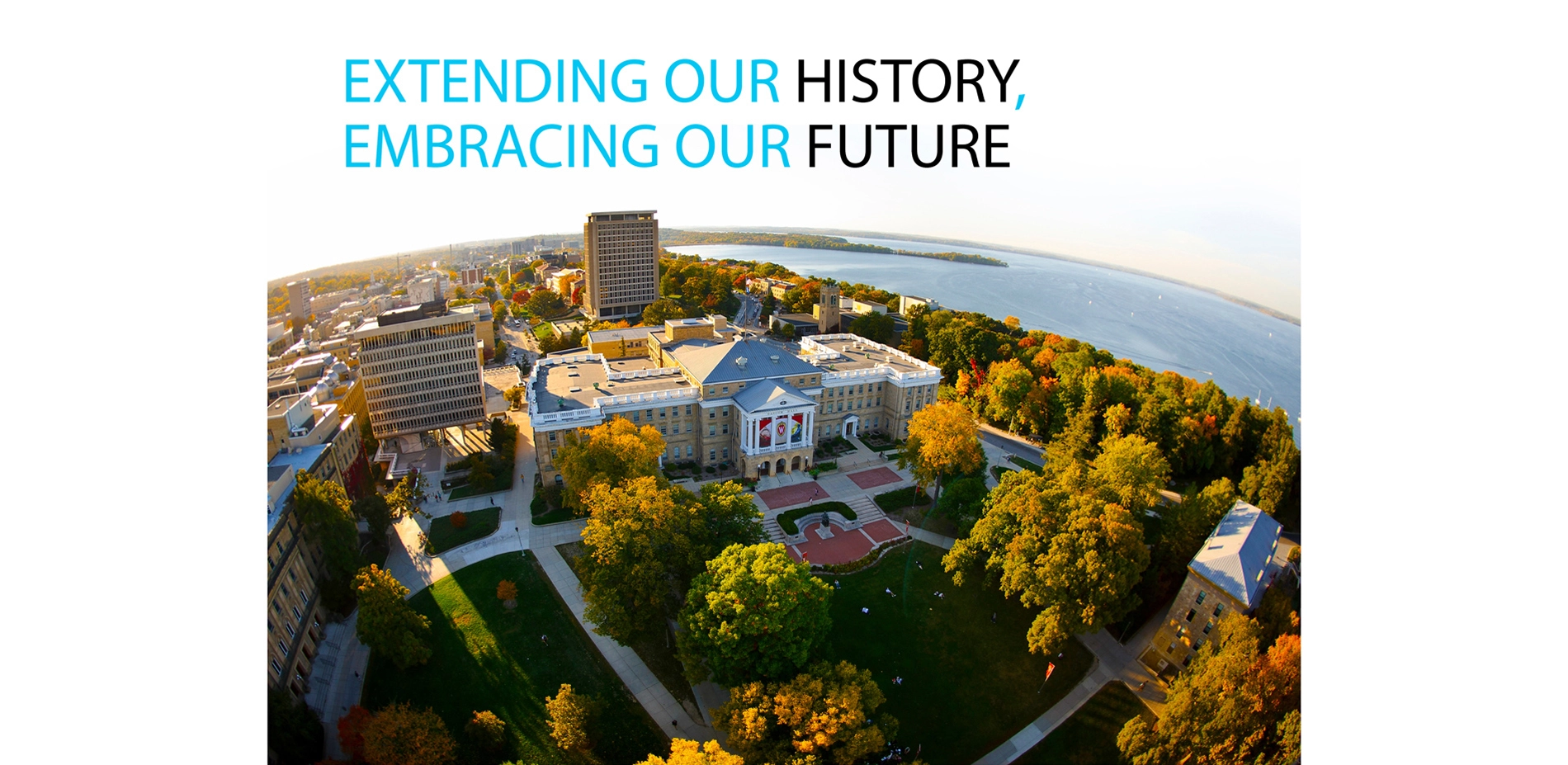
The University of Wisconsin-Madison's 936-acre campus occupies a vital intersection between the capital city and Lake Mendota, and between the institution's long history and enduring legacy. Founded in 1848, the State's oldest and largest university features over 4.5 miles of shoreline; a compelling diversity of cultural, historic, natural and urban landscapes; and a range of past and future development impacts that require improved stewardship practices.
As an integrated part of its Campus Master Plan Update, UW-Madison merged a more traditional campus landscape planning process with a performance-based green infrastructure approach. Recognizing that the future health of the campus and lake are interdependent, this innovative, precedent-setting plan achieves significant, measurable improvements in stormwater management and water quality within a restored and more connected network of historic and culturally rich landscapes.
As the first landscape-focused master plan in University history, it also sets a new national standard for the integrated development of public and performance landscapes in a campus environment, providing a proactive benchmark for other institutions to emulate.
-
The UW-Madison Campus Landscape and Green Infrastructure Master Plan was developed to meet a challenging range of institutional goals:
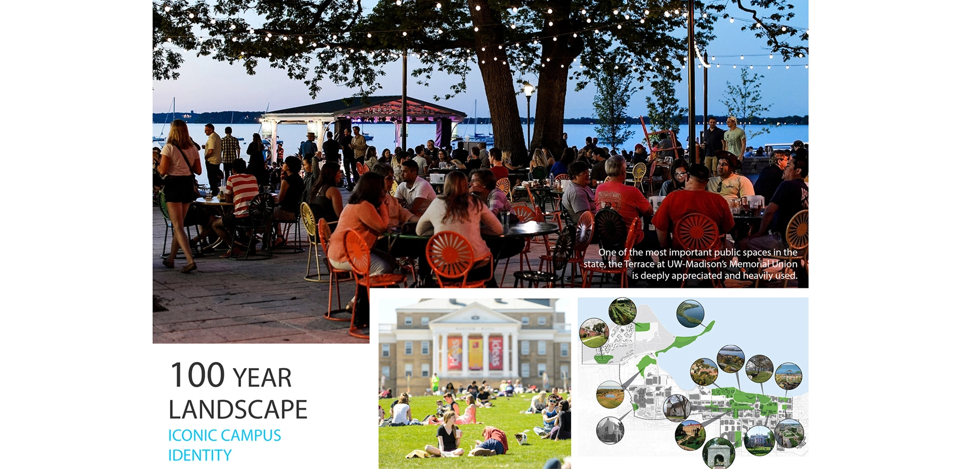
- Protect and enhance open spaces and create new gathering spaces.
- Maintain lands in the Lakeshore Nature Preserve as undeveloped natural areas that support teaching, research and outreach.
- Protect and enhance known historical cultural landscapes, quadrangles and courtyards.
- Establish open space design principles to guide growth and sustainable development on campus.
- Provide a campus environment that supports physical, emotional and psychological well-being.
- Enhance the campus as a living laboratory for teaching, learning and research.
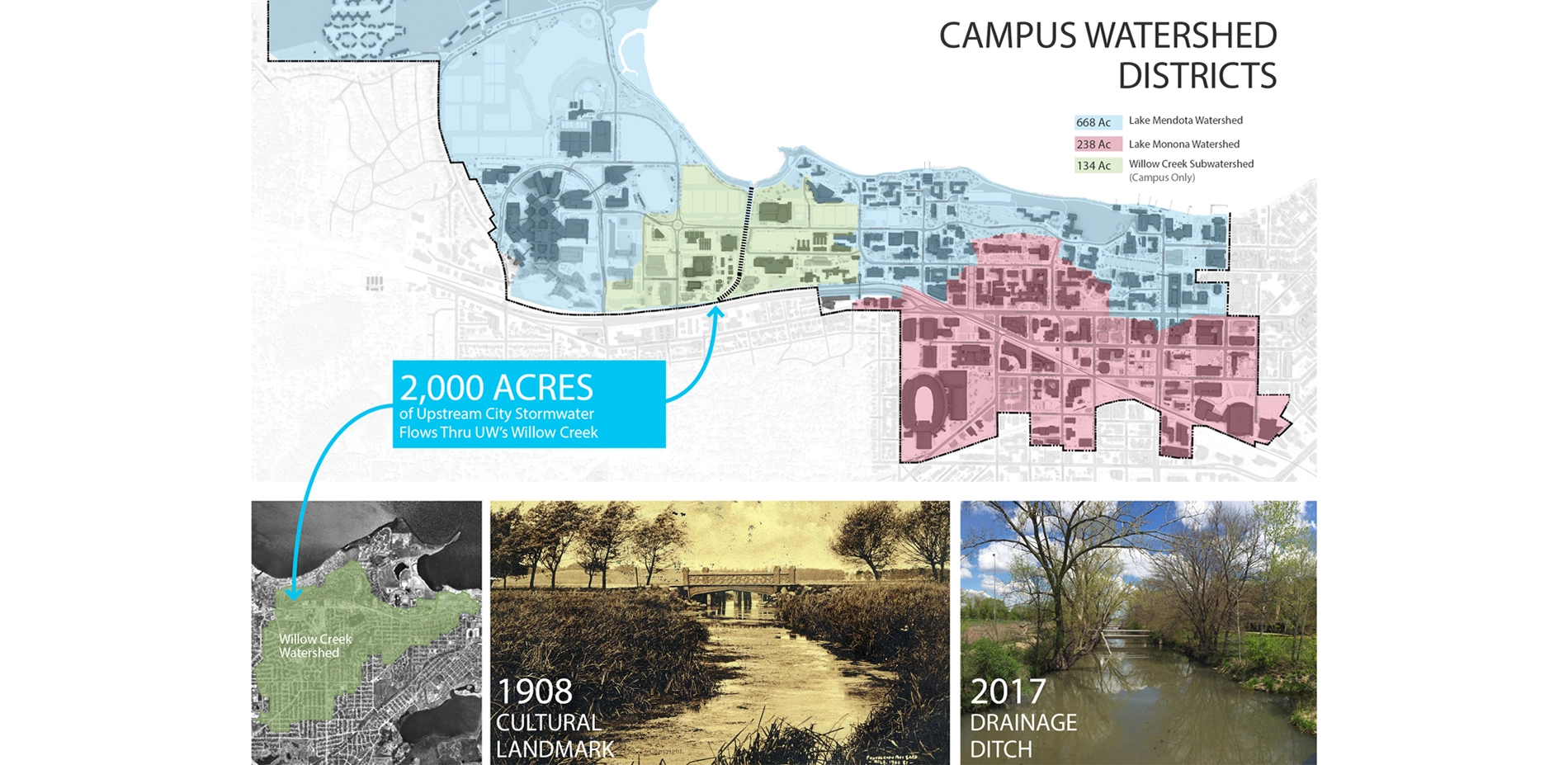
- Strengthen the campus connection to Lake Mendota and its larger watershed.
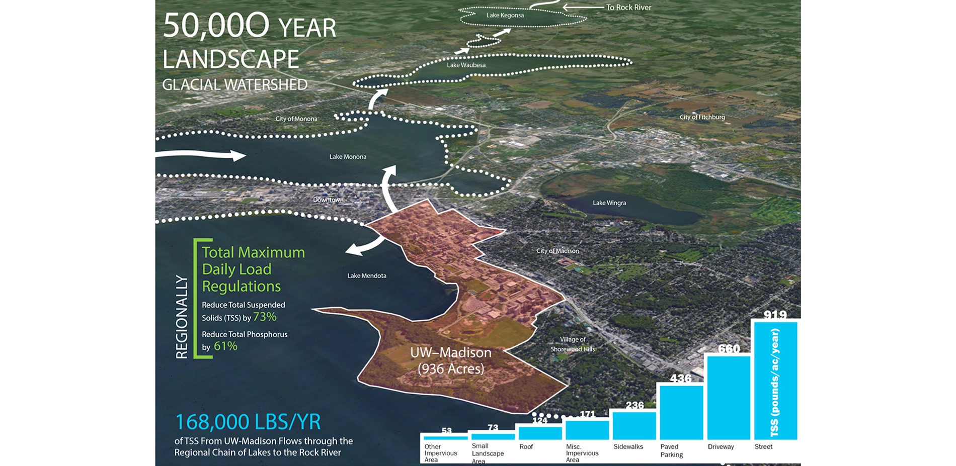
The University was also facing new state and federal water quality regulations requiring significant reductions in the Total Maximum Daily Loads (TMDL) for municipalities and state institutions within the impaired Rock River Watershed. Extensive green infrastructure development would be needed to achieve these reductions. Given the University's legacy of environmentalism, preservation and ecology, the team approached the campus landscape as a living laboratory and posed this Big Question:
How do you create an integrated landscape framework that preserves the University's historic core, elevates the quality and identity of the overall campus, better connects the entire community to Lake Mendota and establishes rigorous, measurable standards for improved environmental stewardship?
The answer lies in the plan's unique integration of public and performance landscapes, which establishes a comprehensive approach for preserving and enhancing the great outdoor spaces of the University. The green infrastructure analysis goes well beyond recommending a menu of isolated site BMPs to identifying a series of interrelated landscape improvements modeled at a campus scale.
Diverse Team with a Rooted Approach
Landscape architects led a wide-ranging, investigatory team of planners; urban designers; civil, waterfront, mechanical and traffic engineers; ecologists; geographers; historians and archaeologists. This diverse team applied a methodology that accounts for all campus development proposed in the overall Campus Master Plan Update, reflecting the highest aspirations for campus aesthetics, ecology and landscape performance over the next 20 years.
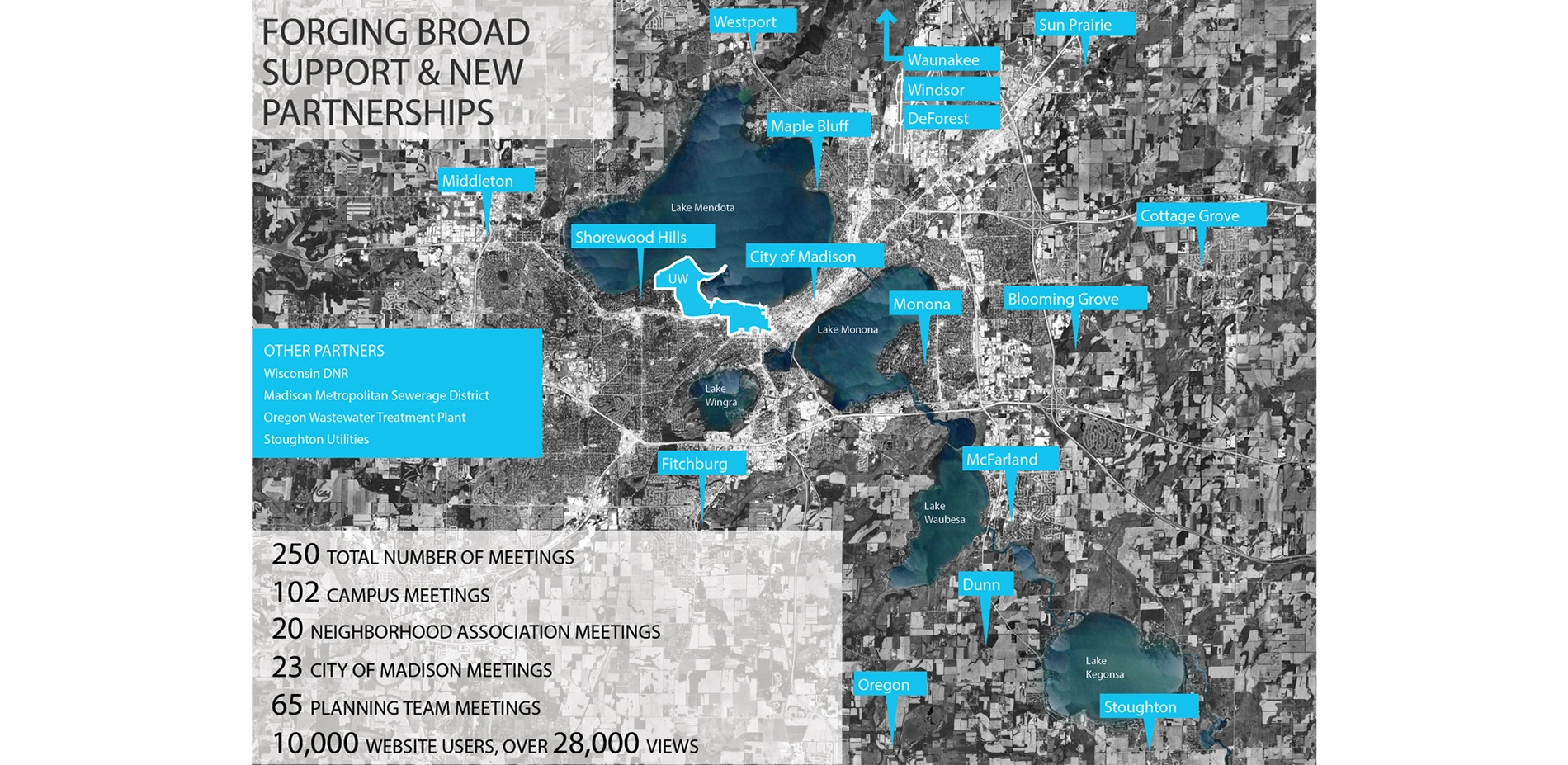
UW-Madison's robust tradition of shared decision-making and transparency was evident in the intensive planning process spanning over two years. The team implemented an interactive online engagement portal and facilitated over 250 meetings with hundreds of stakeholders including neighborhood residents, students, faculty, staff, and City and State officials.
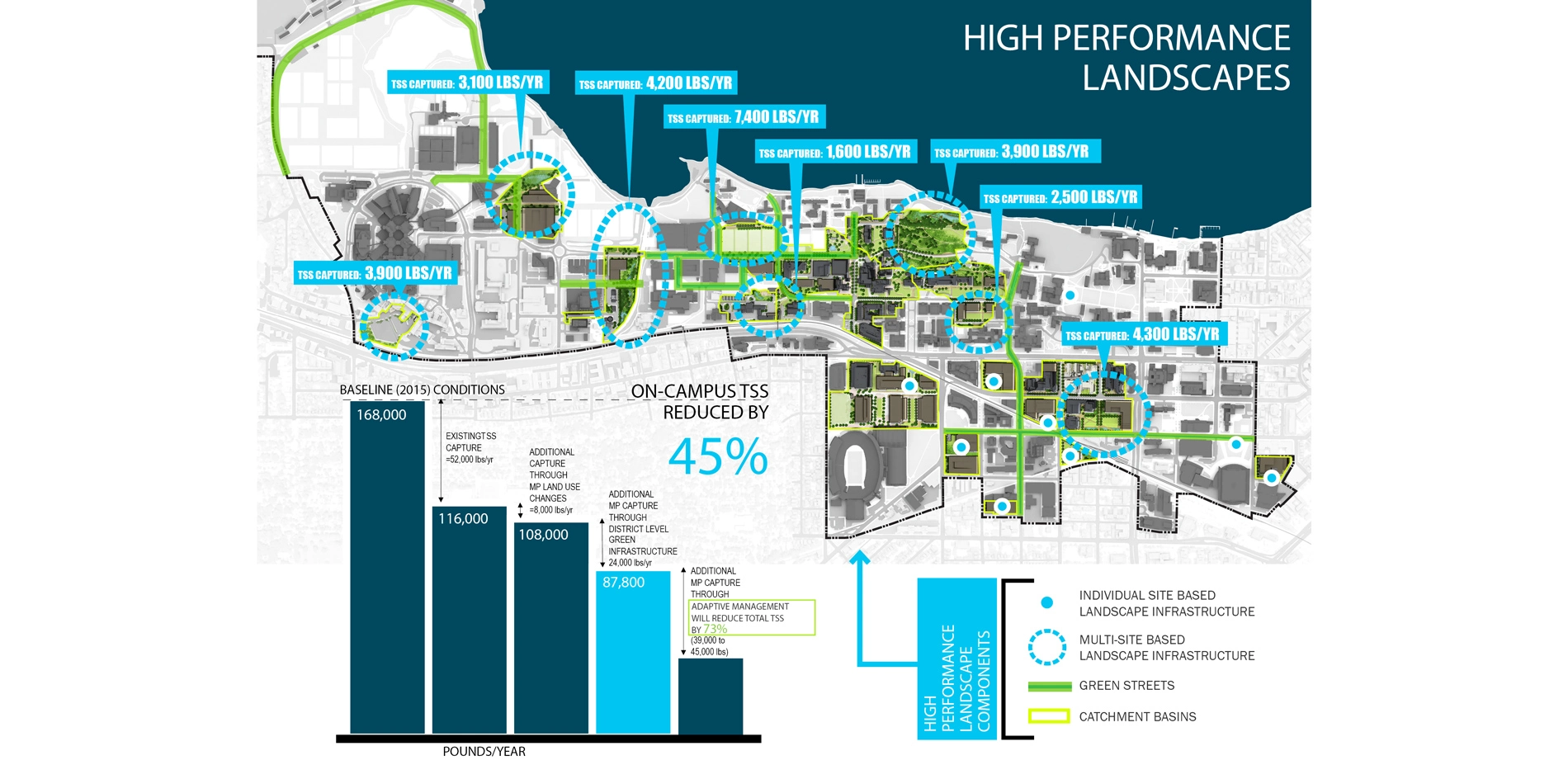
The team also worked closely with UW-Madison's regional watershed partners to address the improvement of water quality by reducing Total Suspended Solids (TSS) and Total Phosphorous. Based on a data-informed, quantified analysis of how all existing campus landscapes and infrastructure are contributing to TSS, the team crafted a plan with a structured timeline to exceed the new TMDL regulations enforced by the Wisconsin Department of Natural Resources and the United States Environmental Protection Agency. Review with the City established a joint framework for funding and implementing urban-scale green infrastructure moving forward.
A unique, galvanizing moment for the client and project team came with the sudden death of the lead landscape architect—a national leader, visionary and master of his craft within the profession. It was determined that the plan would move forward in our lost colleague's honor, and strive to enhance not only the landscape proper, but also its relationship to the human condition.
Rigorous Analysis, Clear Implementation
The team spent over a year on technical analysis using GIS and various stormwater modeling programs to develop the most comprehensive watershed studies the University has ever completed. This analysis helped the team chart a clear course for the future of performance-based landscapes on campus, putting the University well out in front of meeting water quality regulations. The team also modeled and quantified the runoff reduction benefits of the existing campus green infrastructure to establish an effective baseline for plan recommendations.
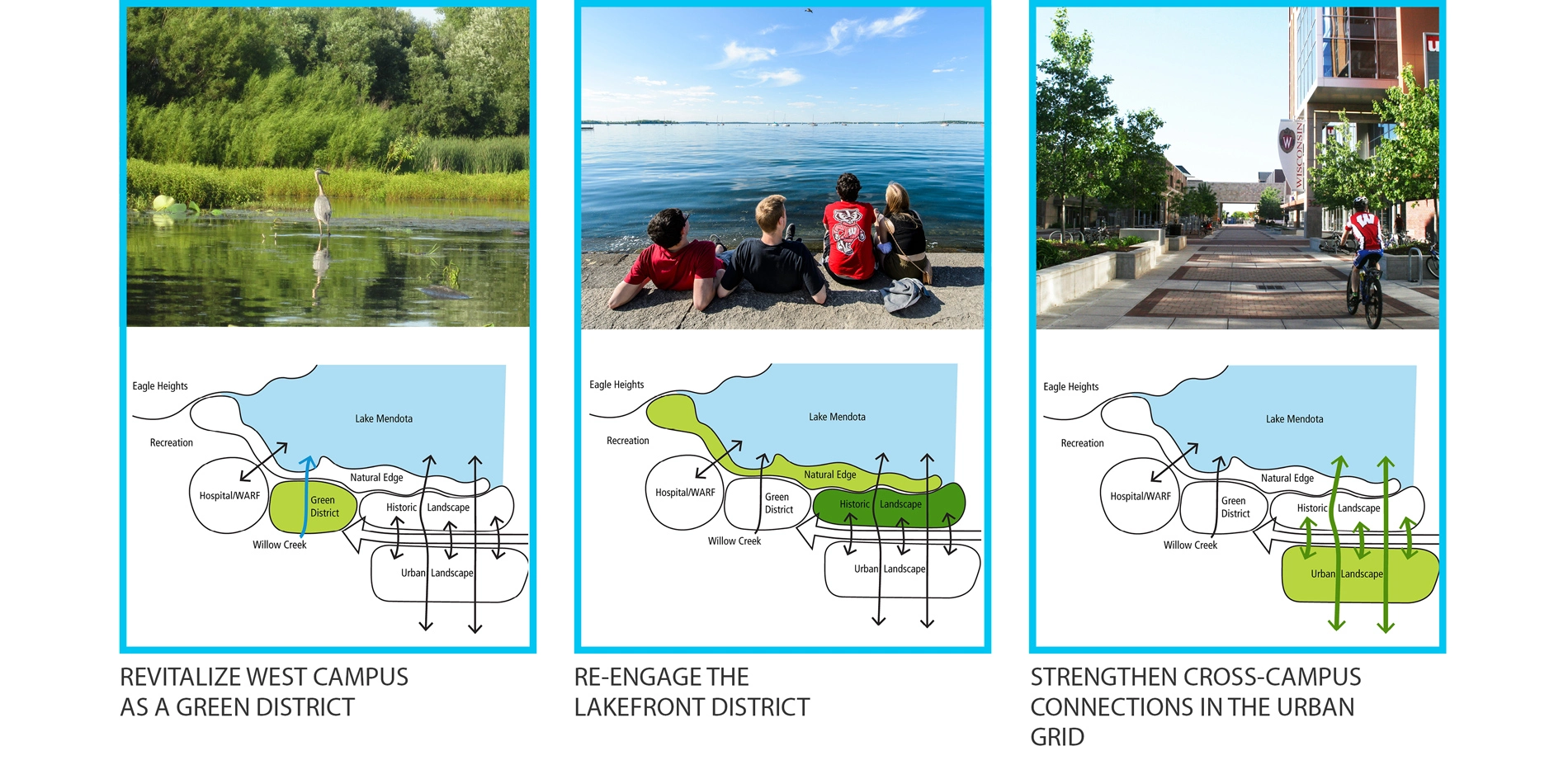
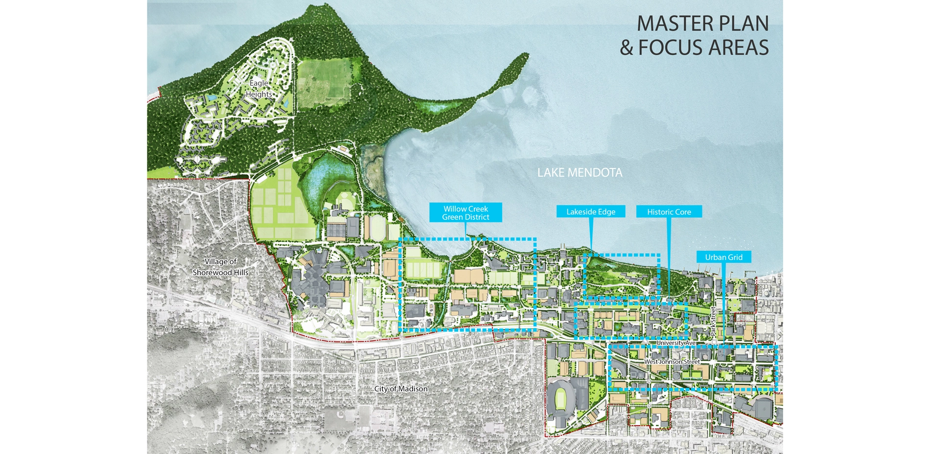
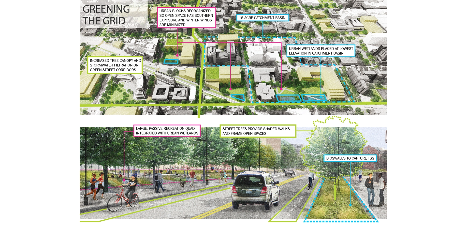
The campus-wide landscape framework and typology plans ground recommendations within three place-based districts, each with a guiding goal for improved campus identity, open space and connection. For each district, the planning team analyzed the impacts that proposed building, open space, parking, and roadway projects would have on the campus landscape and future water quality. Green infrastructure sites were identified by targeting areas where multi-site runoff tributaries could be collected and treated to provide maximum benefits for every dollar spent. Next, a menu of site-specific practices and their intended outcomes (TSS capture, groundwater recharge, etc.) was assessed on a block-by-block basis across the entire campus. Proposed green infrastructure improvements were integrated with the preservation and restoration of culturally and historically significant landscapes, providing a holistic guide for landscape improvements.
The plan updates University stormwater standards to ensure that all new development and construction projects contribute towards campus sustainability goals. Recommendations also promote landscape maintenance practices to enhance GI performance including street sweeping, snow and leaf litter collection, and the diversion and isolation of waste areas to keep campus runoff as clean as possible.
Restoration, Connection and Continuity
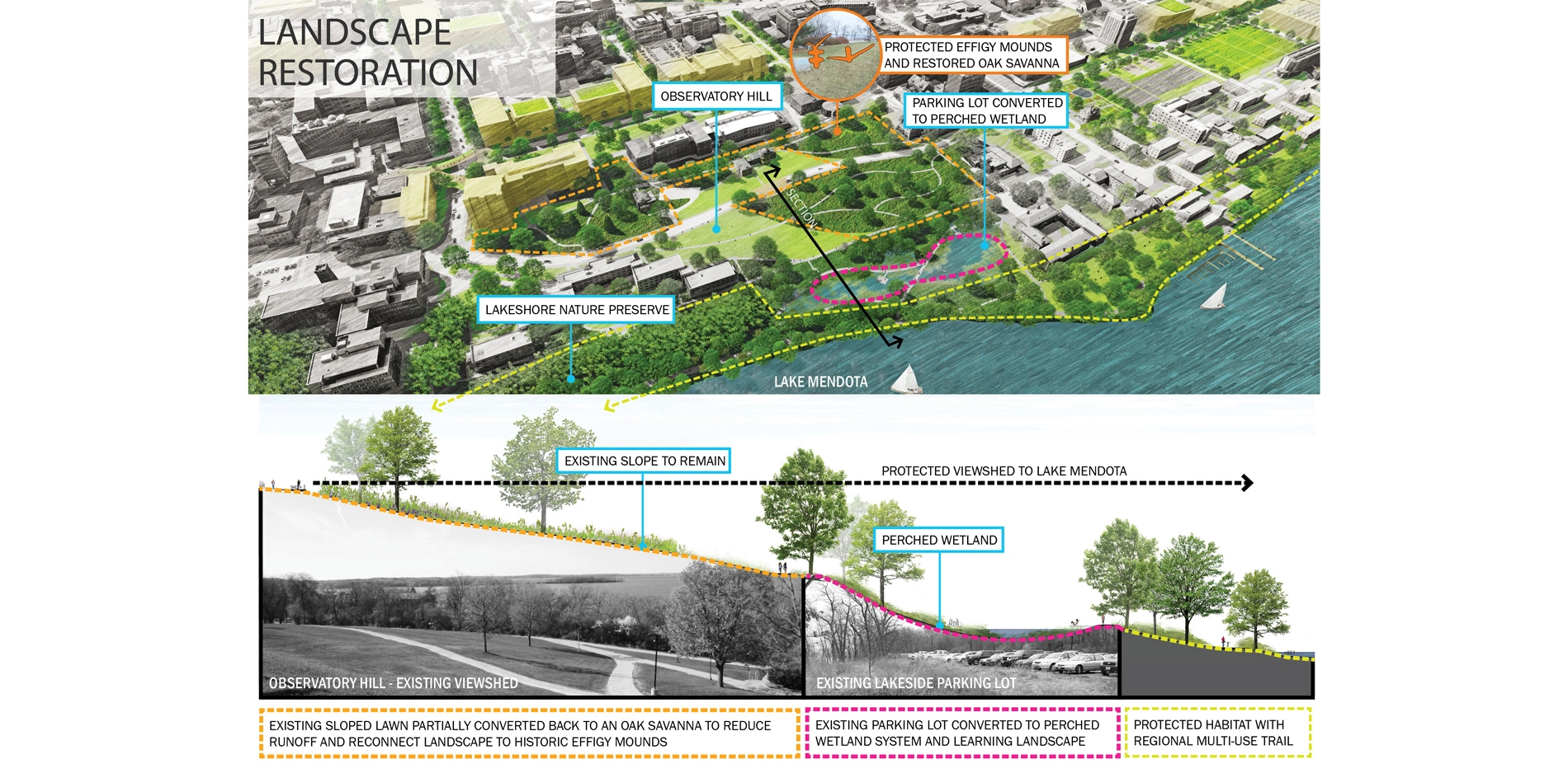
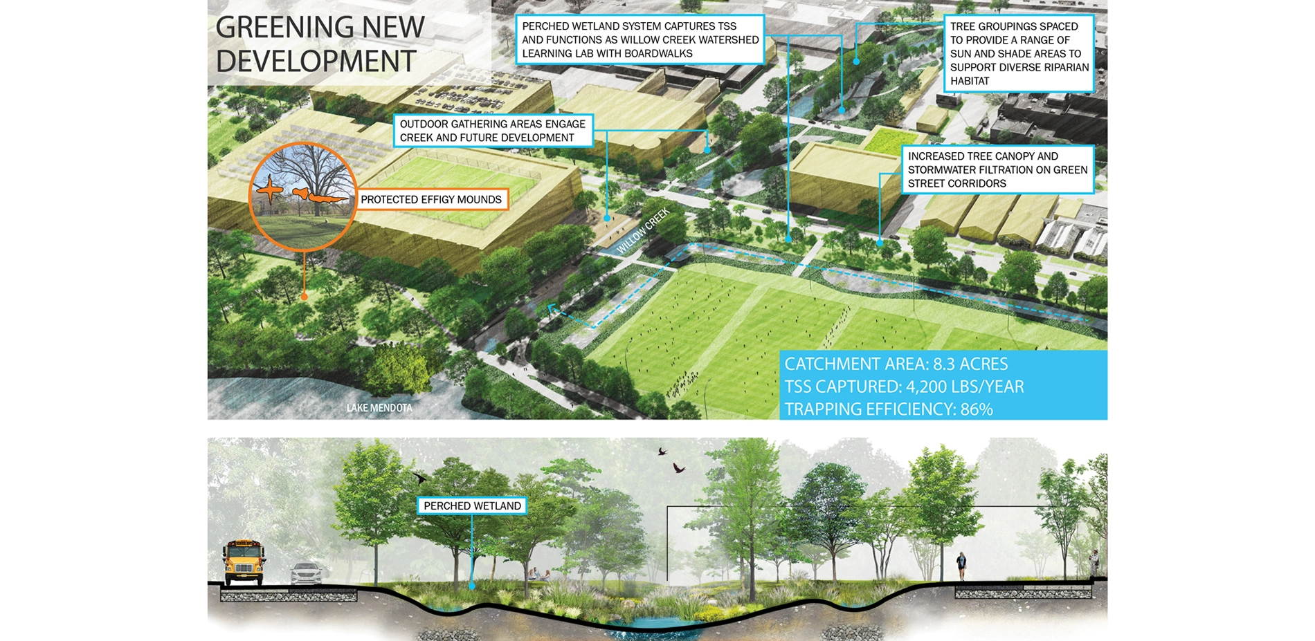
The team employed a "Green District" approach to merge the goals of traditional campus landscape planning and design with the requirements of GI performance. Recommendations for the historic Observatory Hill (slide #10) exemplify the plan's overall approach to iconic, yet culturally and environmentally sensitive areas of the campus landscape fabric.
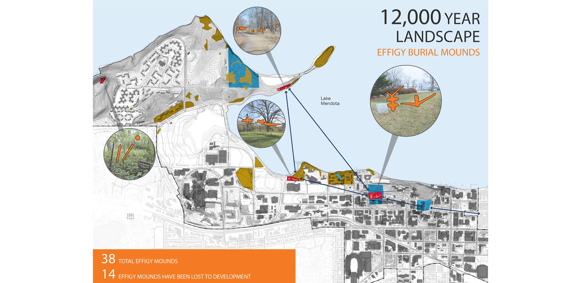
Views to the lake here are the most dramatic in the region, providing the inspirational grounding for one of UW-Madison's oldest open lawn spaces, as well as the site's much older effigy mounds. The plan enhances this key viewshed, provides better protection and interpretation for its Native American heritage, reduces runoff through a restored oak savanna and a perched wetland converted from a lakeside parking lot, and centers lakefront access around a multi-use trail balanced with the preservation of a shoreline habitat corridor. The historic open lawn remains at the center, providing the deep sense of connection and appreciation of place that has long been a defining feature of campus life.
While the planning effort placed considerable emphasis on the University's most iconic spaces, it also focused careful attention on landscapes that were not realizing their placemaking potential. The pressing need to address campus stormwater issues provided the opportunity to leverage one of UW-Madison's most defining sources of identity and place—its beautiful natural character and connection to the water.
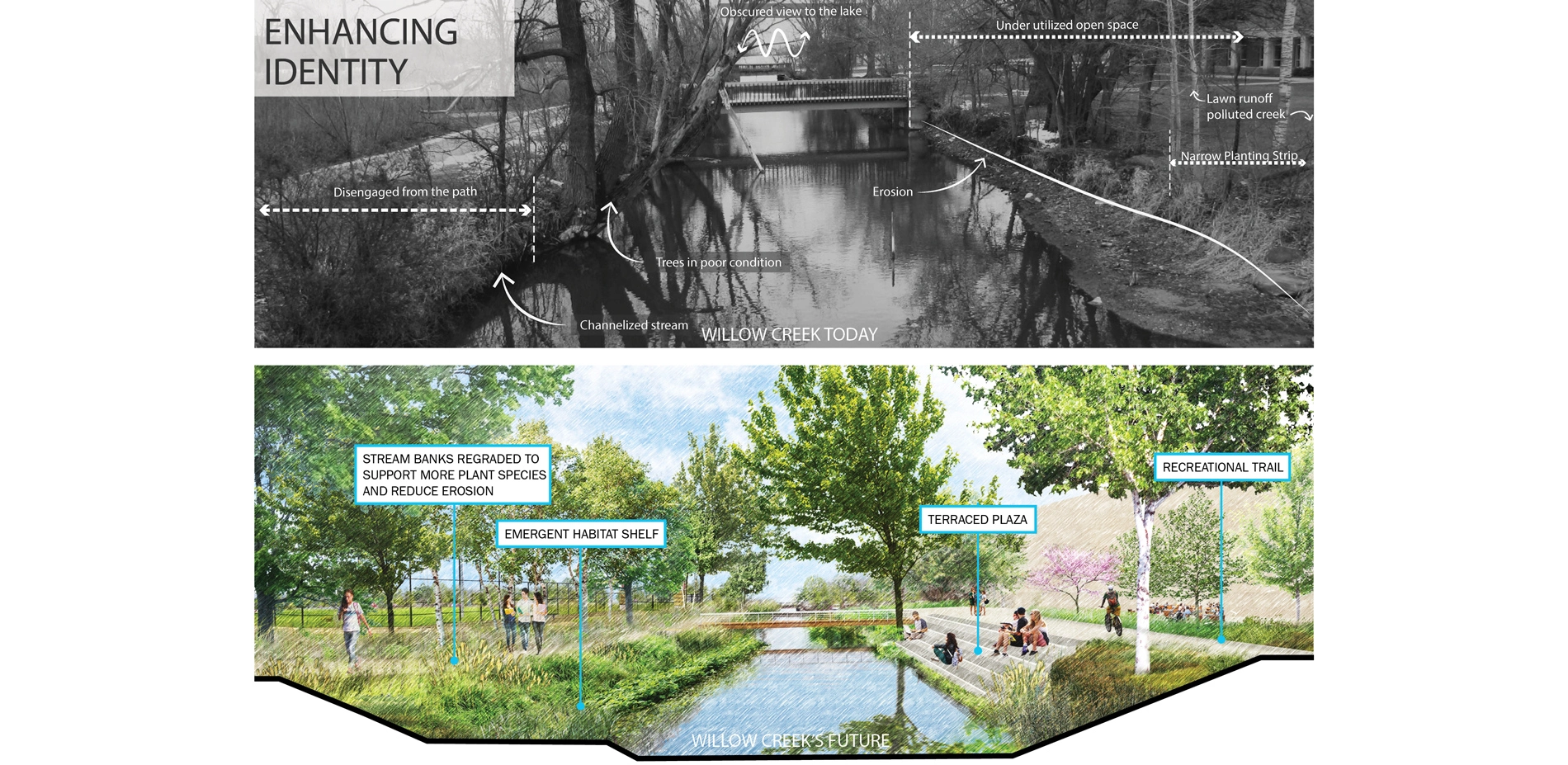
The degraded Willow Creek corridor exemplifies the placemaking power of this integrated approach. The University had turned its back on Willow Creek as development occurred around it. The plan's vision for a restored Willow Creek will reconnect it to the campus fabric in ways that will measurably enhance student life, natural habitat and institutional identity. This example highlights the deeply rooted vision for the entire campus landscape.
Success and Significance
While universities typically develop separate landscape and stormwater management plans, UW-Madison is leading the charge in higher education by developing one of the first joint plans fully integrated with the institution's larger campus master planning efforts.
The plan is already guiding development on numerous projects in the urban core, advancing the "green-street" recommendations for street tree soil volumes, phosphorus and runoff volume controls. The effort has also been a springboard for UW–Madison to participate in community-based water quality initiatives outside of campus. Adaptive Management in the Yahara Lakes Watershed is a program that includes dozens of municipalities and governmental agencies working together to target urban and non-urban sources of pollution.
Ultimately, the plan provides a path towards a physical campus facilitating the type of place-based learning and experience that cannot be achieved in isolation from its larger social and ecological context. It establishes a guiding vision for UW-Madison's campus landscape as a fulcrum of engaged institutional life, balancing and connecting Madison's urban vitality with the natural beauty of Lake Mendota.
-
Lead Designer
- SmithGroup
Landscape Architect
- SmithGroup (Team Lead) + Hoerr Schaudt
Project Credits
- SmithGroup (Team Lead)
- Hoerr Schaudt
- Kimley-Horn and Associates
- Affiliated Engineers
Advertisement
Related Awards

Honor Award, Analysis & Planning
A Cultural Approach: The Fort Peck Tribes Hazard Mitigation Plan
In collaboration with the Fort Peck Assiniboine and Sioux Tribes, EPA, and FEMA, the Fort Peck Tribes Hazard Mitigation Plan (HMP) adopts a culturally responsive approach to hazard mitigation planning that features connection to place.

