.webp?language=en-US)


The Ecological Atlas Project
It shows how all the parts fit in—the birds, the plants, the insects, the soil types; it offers a synthesis.
Awards Jury
-
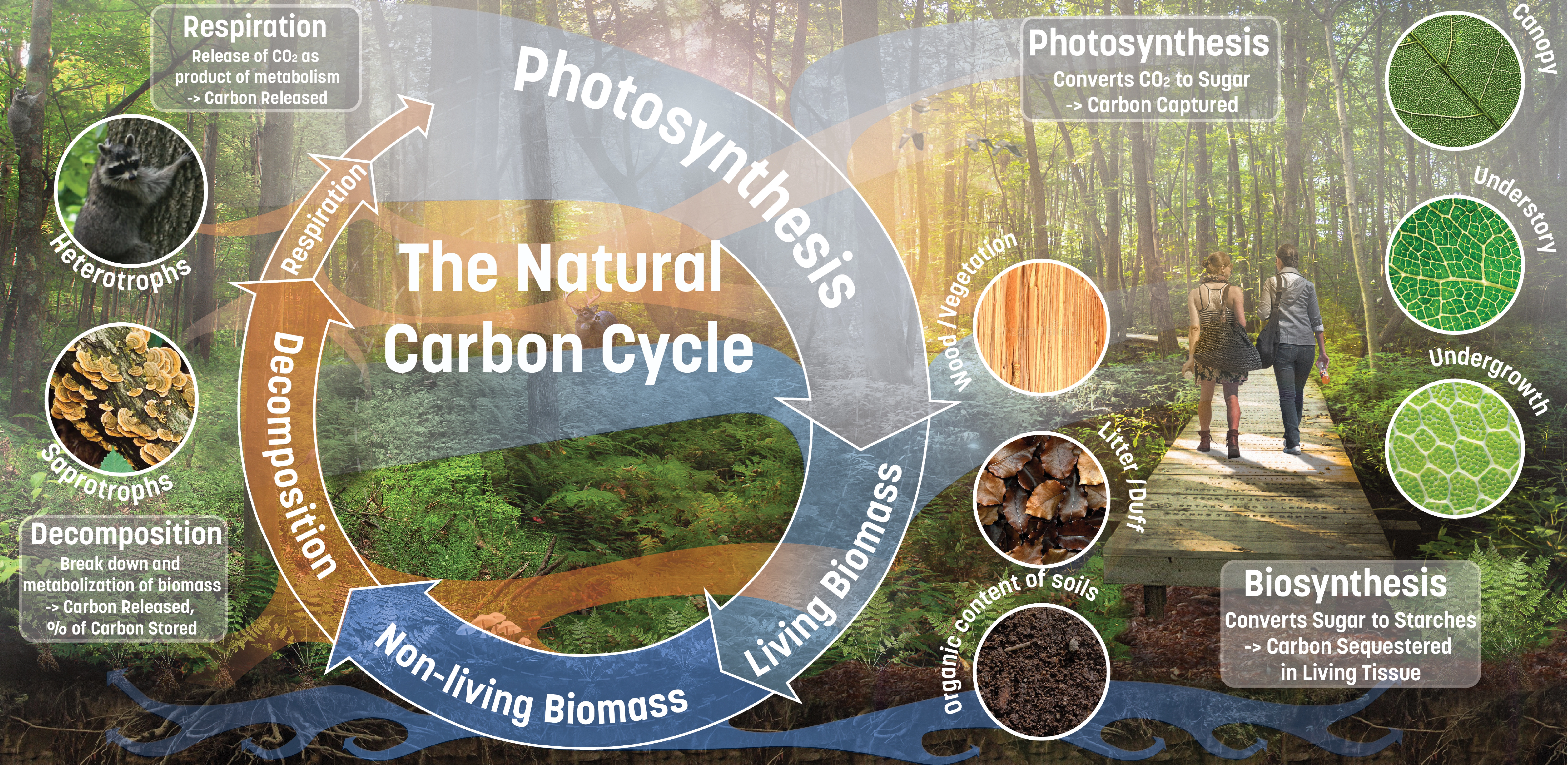
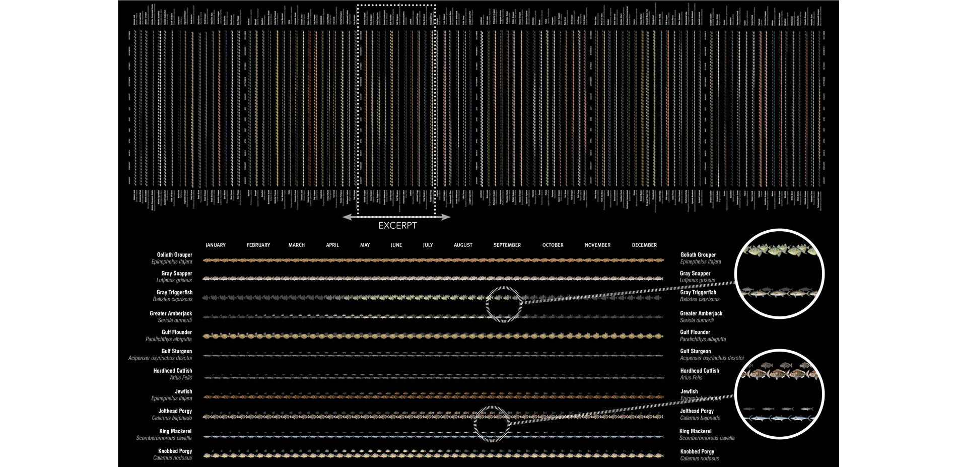
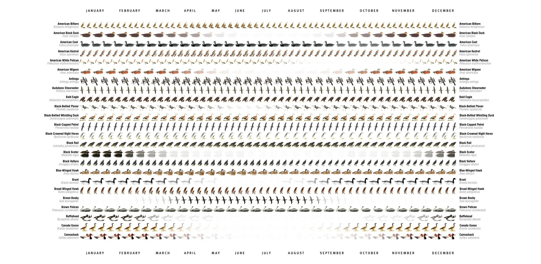
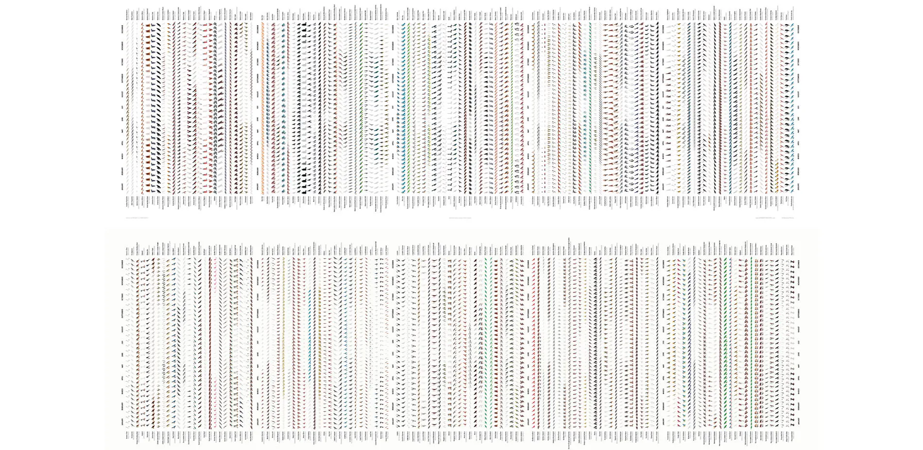
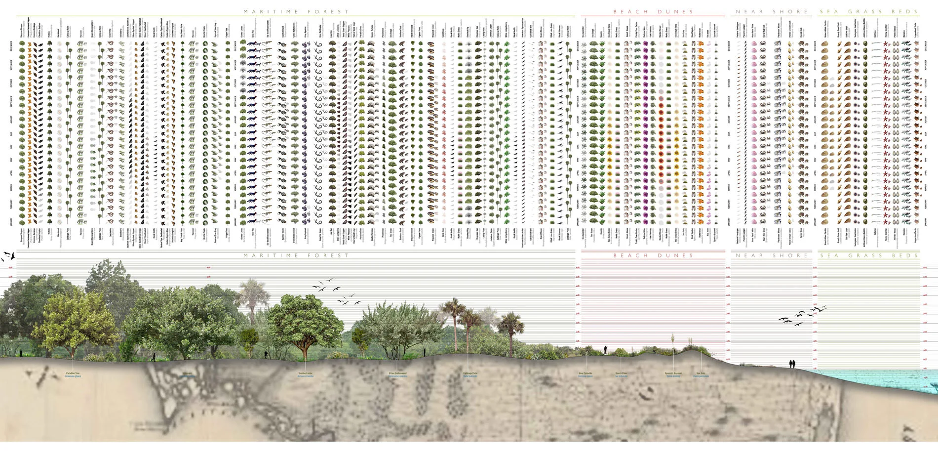
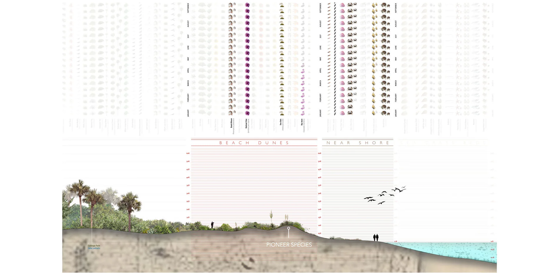
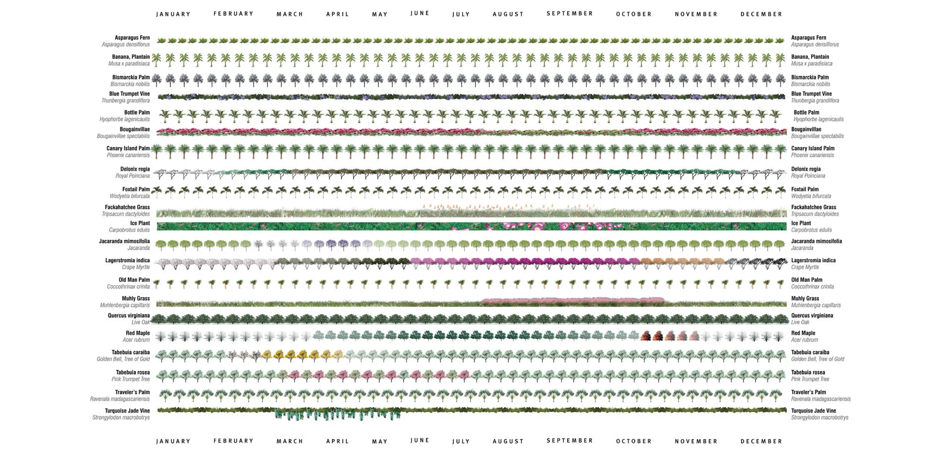
While extensive information on individual plants and animals is available to landscape architects in print and online, few resources give a holistic sense of ecological systems and fewer still provide a way of understanding their changes over time. The Ecological Atlas Project works at the intersection of art, science and technology. By developing intuitive mappings of natural patterns such as bloom times, deciduous patterns, vegetative seasonality, animal migrations, and other time-dependent phenomena, the Ecological Atlas enables understanding and building in sustainable and resilient ways. Tools that embrace technology and facilitate the transfer of landscape architectural knowledge in simpler and more elegant ways are essential to building ecological literacy, as much as they are critical to making informed design decisions that rest on extensive research. The Ecological Atlas Project builds a scalable technology that advances the methods and techniques of landscape architectural research and practice, and strengthens the value of landscape architecture to any project.
-
Understanding the complex relationship between living and built systems is fundamental to their meaningful and sustainable transformation and design. While extensive information on individual plants and animals is available to landscape architects in print and online, few resources give a holistic sense of ecological systems and fewer still provide a way of understanding their changes over time. The Ecological Atlas Project works at the intersection of art, science and technology. By developing intuitive mappings of natural patterns such as bloom times, deciduous patterns, vegetative seasonality, animal migrations and other time-dependent phenomena, the Ecological Atlas research project enables understanding and building in sustainable and resilient ways. Like mappings of the human genome, the Ecological Atlas Project provides an interpretive design tool that can be used to design and build in ways that work in tandem with the natural patterns of a site.
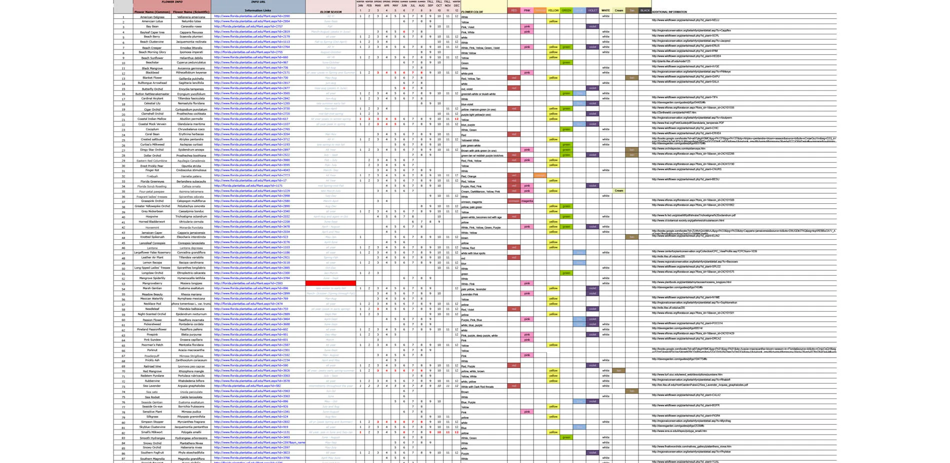
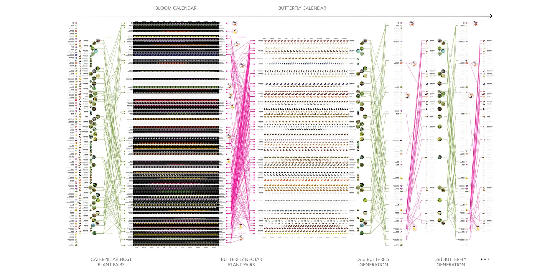
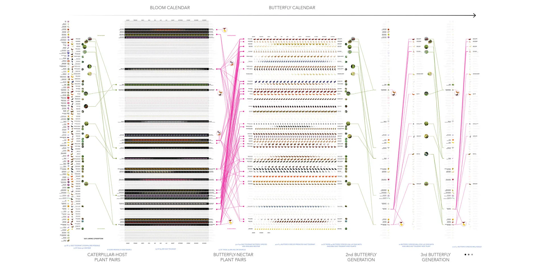
As a discipline that is capable of bridging art, science, and technology, landscape architecture has historically relied on holistic thinking to carry out the design process. While many publications and online resources provide inventories of plants and animals, many of these focus on creating an archive of individual species without giving a sense of how they relate to one another, how they evolve over time, or how they could be integrated into a cohesive design strategy that operates successfully in both micro and macro scales. While the Ecological Atlas research builds on extensive inventories and databases of plants and animals, it addresses the challenge of comprehensively understanding the relationships among individual species, intuitively. Beyond merely being a communication tool, the Ecological Atlas research aims to democratize the overwhelming complexity of information found in websites, horticultural books, plant nursery catalogs, and environmental databases. Technology has an important role to play in sorting through the myriad options, but having information and data alone falls short of building a useful knowledge base that can be easily accessed, sorted, and leveraged to arrive at valuable insights and appropriate design decisions.
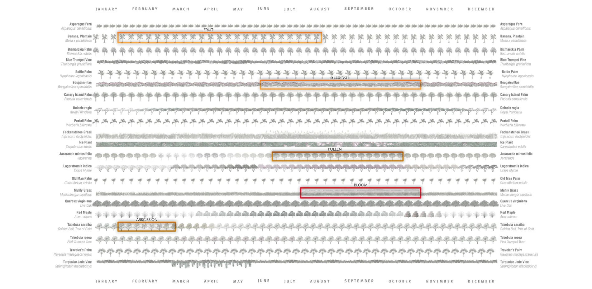
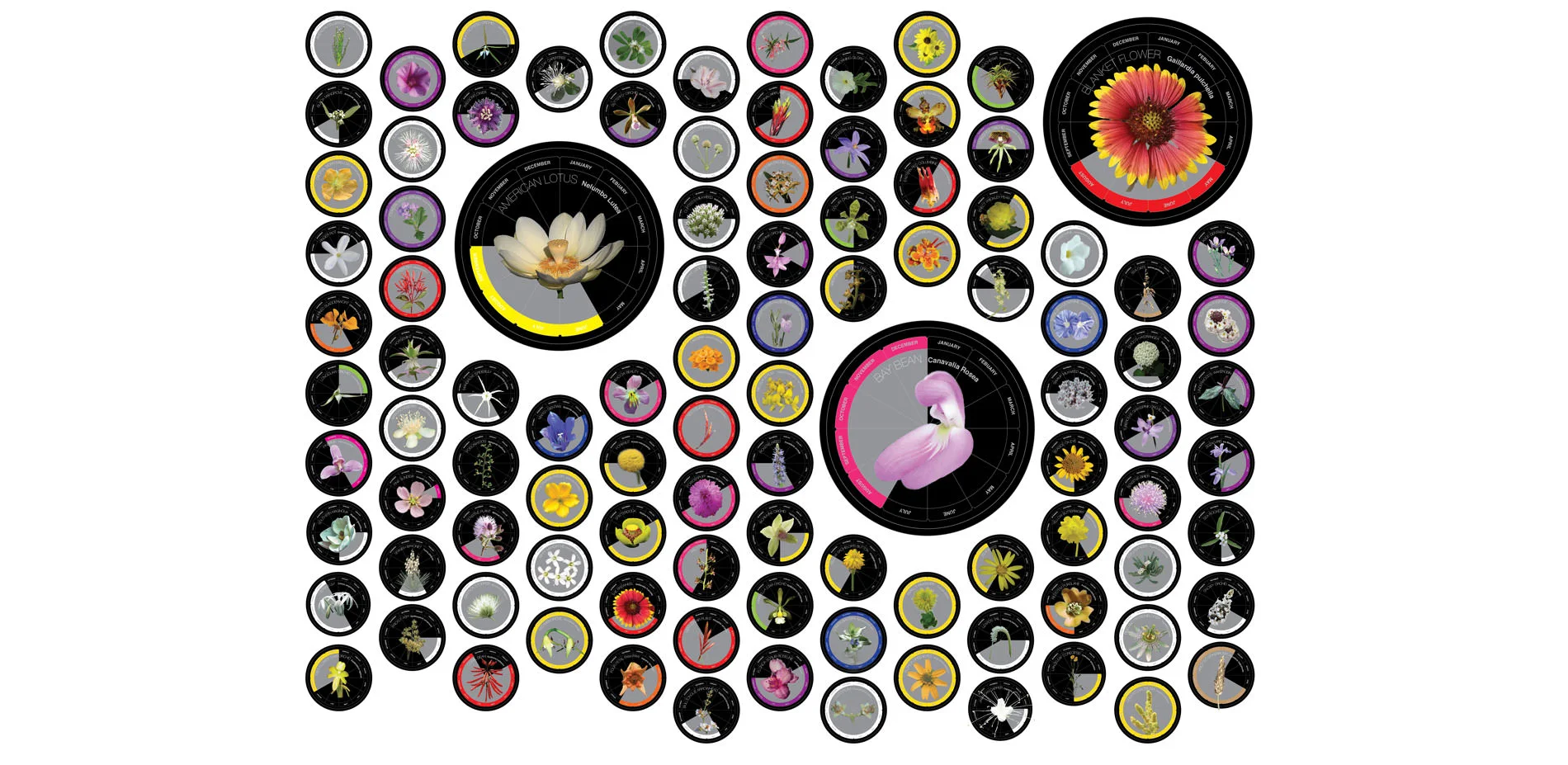
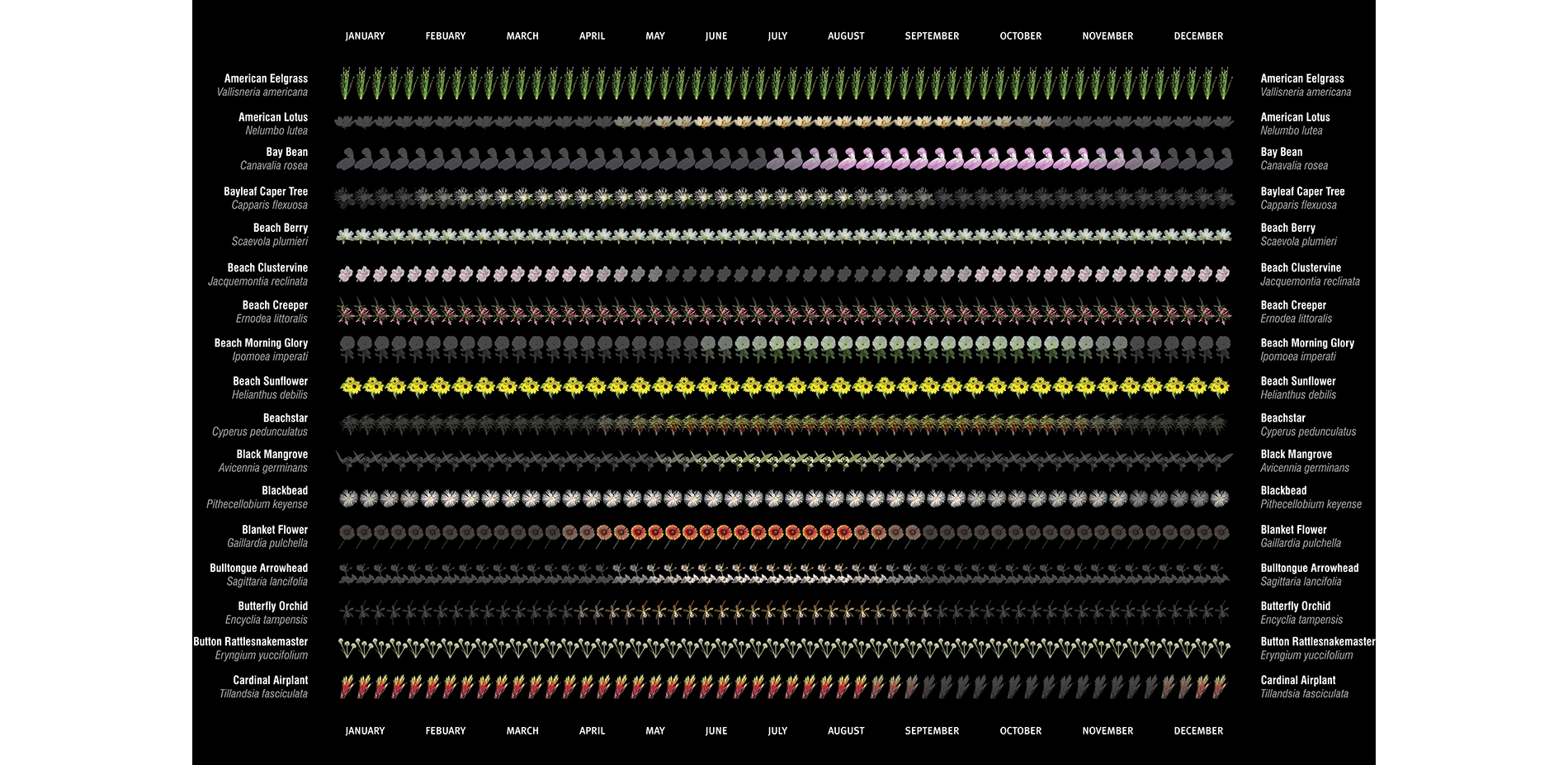
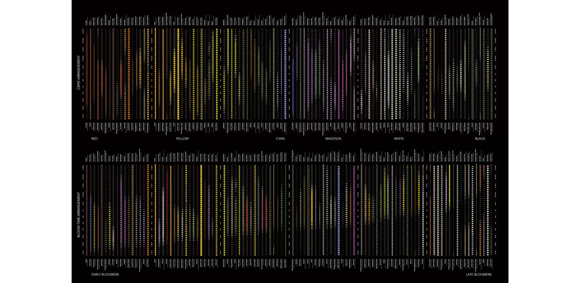
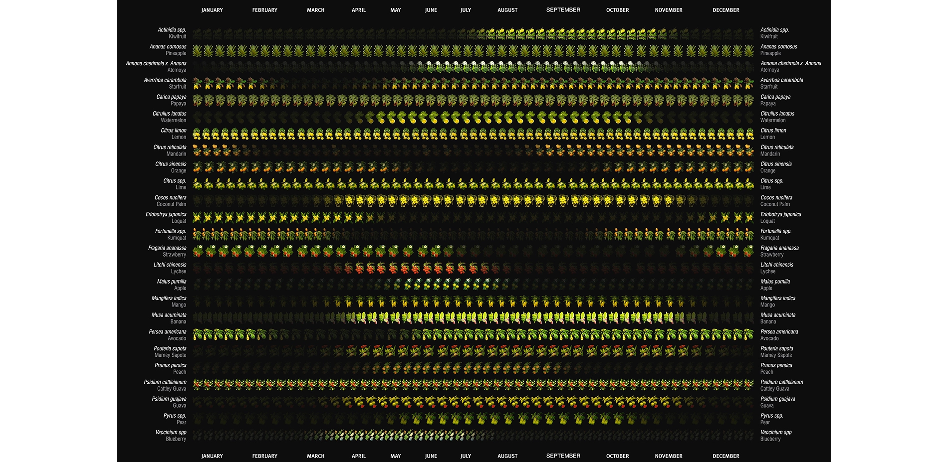
Tools that embrace technology and facilitate the transfer of landscape architectural knowledge in simpler and more elegant ways are essential to building ecological literacy. Better research tools are critical to making informed design decisions that strengthen the value of landscape architecture to any project. The Ecological Atlas Project builds a scalable research database and technology that advances the methods and techniques of landscape architectural research and practice. Some examples of how the Ecological Atlas Project could add value to a project include: sorting through thousands of possibilities and immediately identify the appropriate species, narrowed down and arranged to illustrate bloom times when working in an unfamiliar region; further narrowing the selection by design criteria such as salt tolerance, maintenance requirements, or water needs and generating a visual map that could be expanded digitally to communicate detailed information about each species; immediately identifying fruit trees and vegetables that will be in season in any given month based on geographic location; quickly understanding how a particular set of plants will maximize habitat value for native birds and butterflies. While it is certainly invaluable to consult regional experts who have an intimate understanding of local conditions, the Ecological Atlas Project aims to create a comprehensive resource that streamlines extensive bodies of knowledge and empowers landscape architects to design and make informed design decisions that consider context and time as essential to any design.
The visually intuitive mapping method of the EcoAtlas draws from art and design and provides a means with which to understand the evolving relationships of living systems. In the same way that carefully illustrated botanical prints captured the vast biodiversity of the Americas and expanded explorers’ and colonizers’ imaginations, so too can technology like the Ecological Atlas Project capture the imagination of the public and reaffirm landscape architecture’s value and relevance in design planning and execution. As seductive as botanical and ornithological illustrations have been over the centuries, we have yet to leverage state of the art technology to dynamically model the natural world’s staggering amounts of data upon which landscape architects base many design decisions.
The immediate objective of the Ecological Atlas Project is to develop a graphic language for understanding, comparing, and relating the transformation and activities of living systems over time by using pattern recognition to sort through massive amounts of information. The long term objective, however, is to create a scalable and digital technology that promotes a better understanding and awareness of ecosystem relationships and leverages vast research troves that are otherwise unintuitive to use and access. The research behind the the Ecological Atlas can therefore be used for designing, planning and engaging the natural and built environments complementarily.
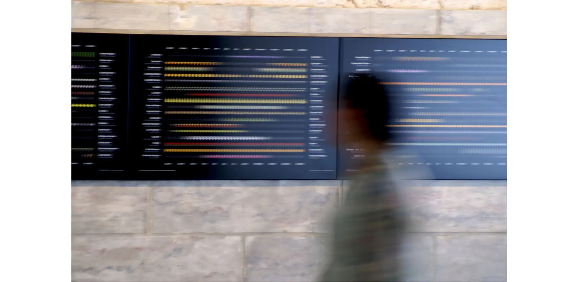
To date, the Ecological Atlas Project has been featured and disseminated through museum exhibits, conferences, and arts venues like the American Public Garden Association, the Coral Gables Museum, Arte Americas, Art Wynwood, and Art Miami during the international art fair event known as Art Basel. While effective when displayed as art, the Ecological Atlas Project is meant to work as a research and design tool that can be deployed in any region. It strives to appeal aesthetically in order to fulfill an agenda of awareness about the natural environment as much it aspires to become an essential tool for understanding and designing it.
-
Project Lead:
- Roberto Rovira, ASLA
Research Associates:
- Daniela Menéndez
- Brennan Baxley
- Martina Gonzalez
- Ryan Correia
- Alejandro Pérez, ASLA
- Luis Jiménez
- Andrés Pineda
- Mario Graña, Associate ASLA
- José Alvarez, ASLA
- José Fonseca, Associate ASLA
- Meredith Lambert
- Emily Vandenoever
- Rufino Gil
- Séfora Chavarría
- Jorge Rodríguez
- Fatima Montoya
- Kevin Arrieta
- Selene Varela
- Bruno Sanabria
Illustrations:
- Butterflies:
- Rick Cech
- Birds:
- Karl Karalus
- Plants:
- Robert O’Brien
- Tropical Plant Pictures
- RealWorldImagery
- the USDA Plant Database and the Atlas of Florida Vascular Plants
- Charles R. Boning / Pinneaple Press
- Other References:
- University of Florida Museum of Natural History
- Institute of Food and Agricultural Sciences
- Florida Native Plant Society
- Institute for Regional Conservation
Advertisement
Related Awards
Honor Award, Research
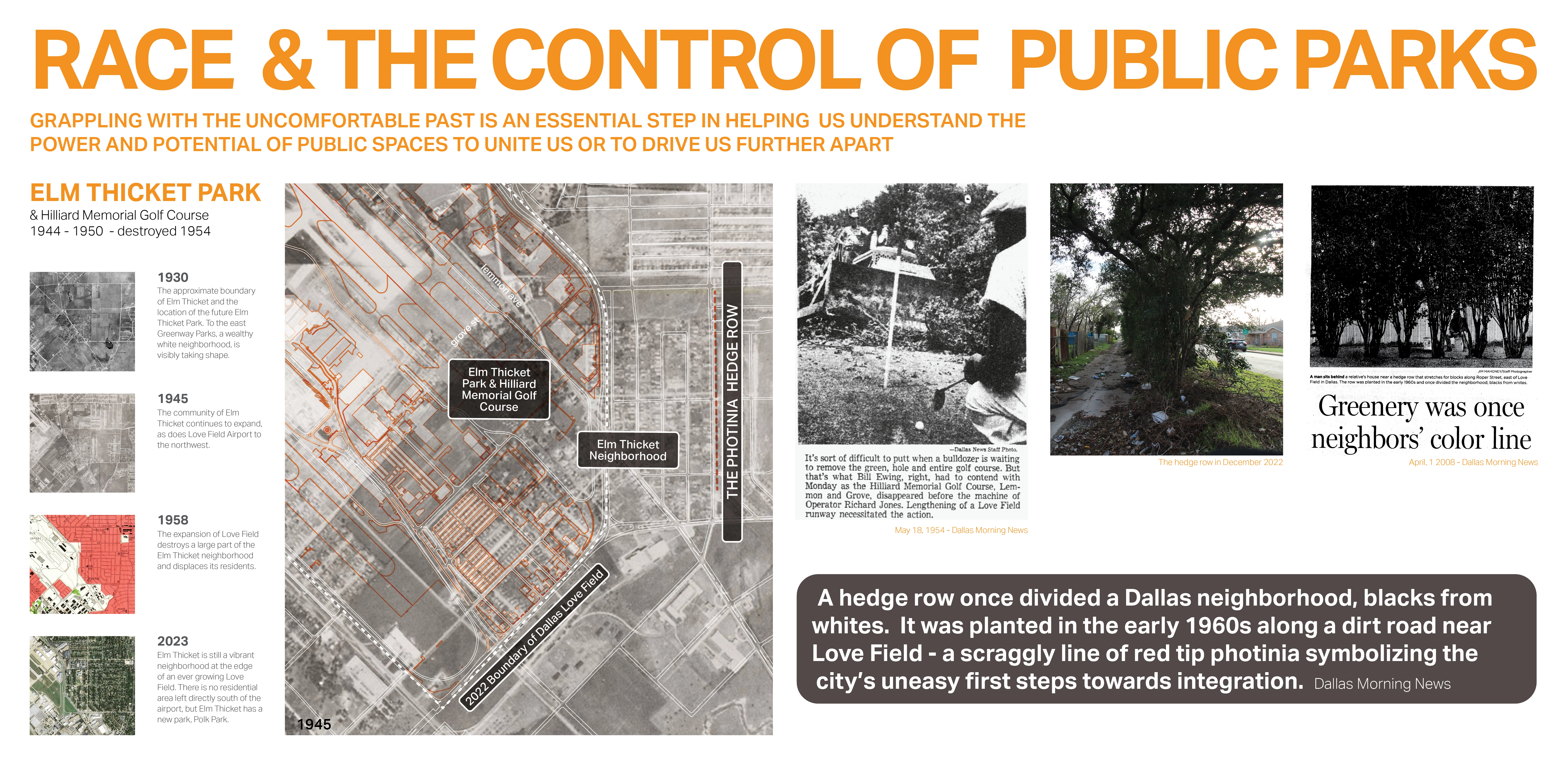
Race and the Control of Public Parks
This research uses a century long historical analysis of the public park system in Dallas, Texas, USA to uncover the physical and psychological ways in which public landscapes and the works of landscape architects have segregated urban spaces and how we might fight against these design practices. Through reframing past practice this work seeks to create a method for informing design thought and practices that seek to create a more just built environment.