
.webp?language=en-US)


Conservation at the Edge - Prototyping low-intervention conservation in the Patagonian wilderness
A simple, straightforward approach to a complex problem.
Awards Jury
-
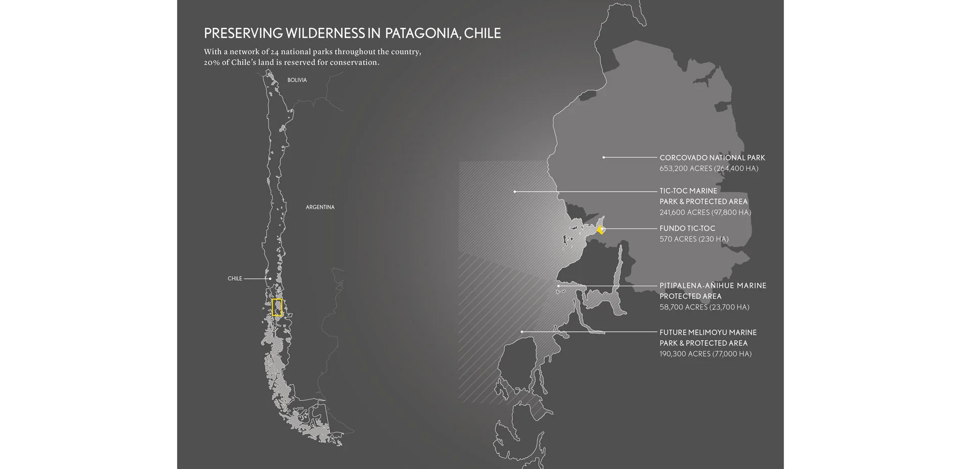
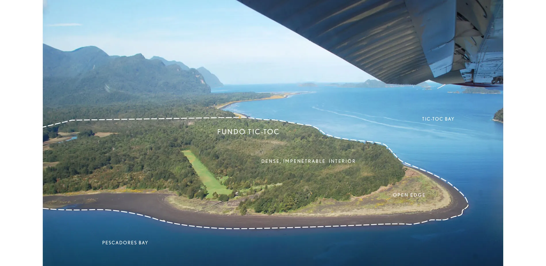
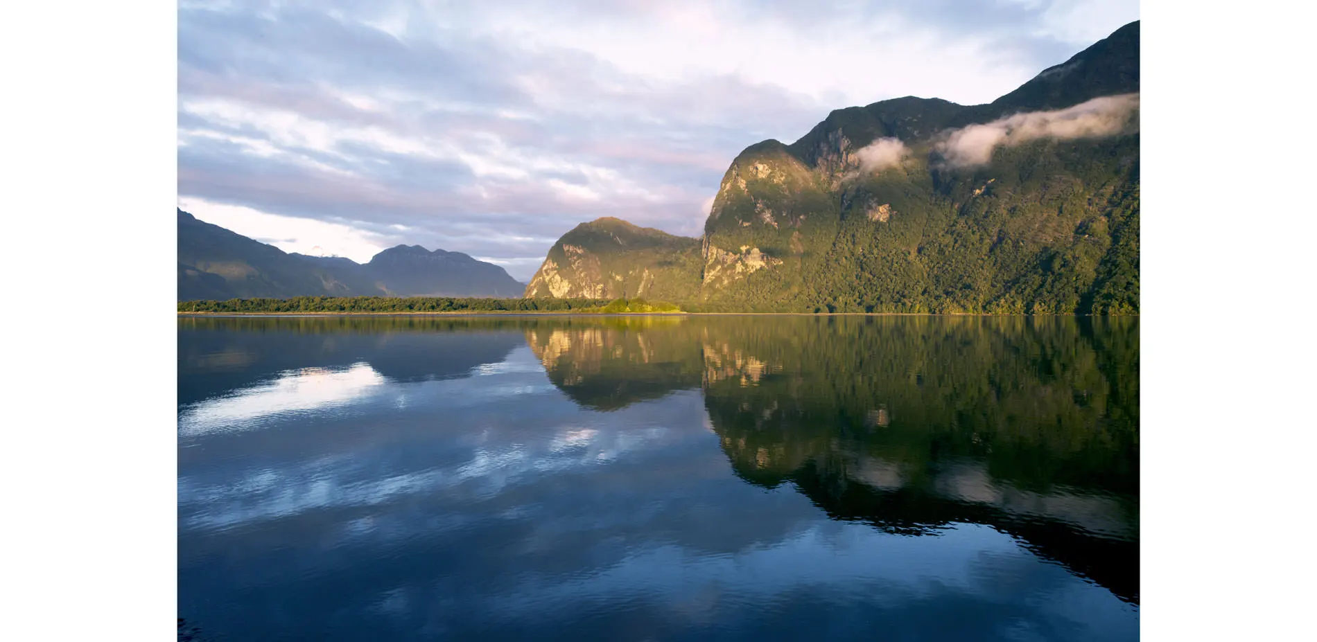
Tucked into Chile’s remote Patagonian fjords, the project area is a privately-held 570-acre promontory within Chile’s 750,000-acre Parque Nacional Corcovado. The site overlooks Tic-Toc Marine Park, one of the most bio-diverse and productive marine ecosystems on Earth. Situated between these critical components of Chile’s conservation network, the commission represents an opportunity for landscape architecture to effect positive change at the intersection of national park traditions and individual stewardship. This project addresses a requirement for sensitive intervention to stabilize conditions threatened by a changing world. The resulting plan proposes a conservation ethic tuned to specific local skills and capacities, advances minimal human intervention as a mode to manage damaged or threatened ecosystems, and foregrounds a belief that controlled access to and occupation of sensitive landscapes are necessary to know, appreciate, and preserve them. These efforts to protect a pristine, remote wilderness site also result in a prototype stewardship model.
-
Purpose
The health of intact wilderness is society’s collective responsibility. This project addresses the challenge of conserving wilderness in the era of globalism and climate change. The purpose of this planning project has been (1) to assess the situation, (2) to create a plan to restore, enhance and protect a fragile site, (3) to devise a process of research and analysis that can be deployed by others in similarly sensitive situations, and (4) to advise on the creation of a facility that can be used as a research base.
A framework for knowing and accessing
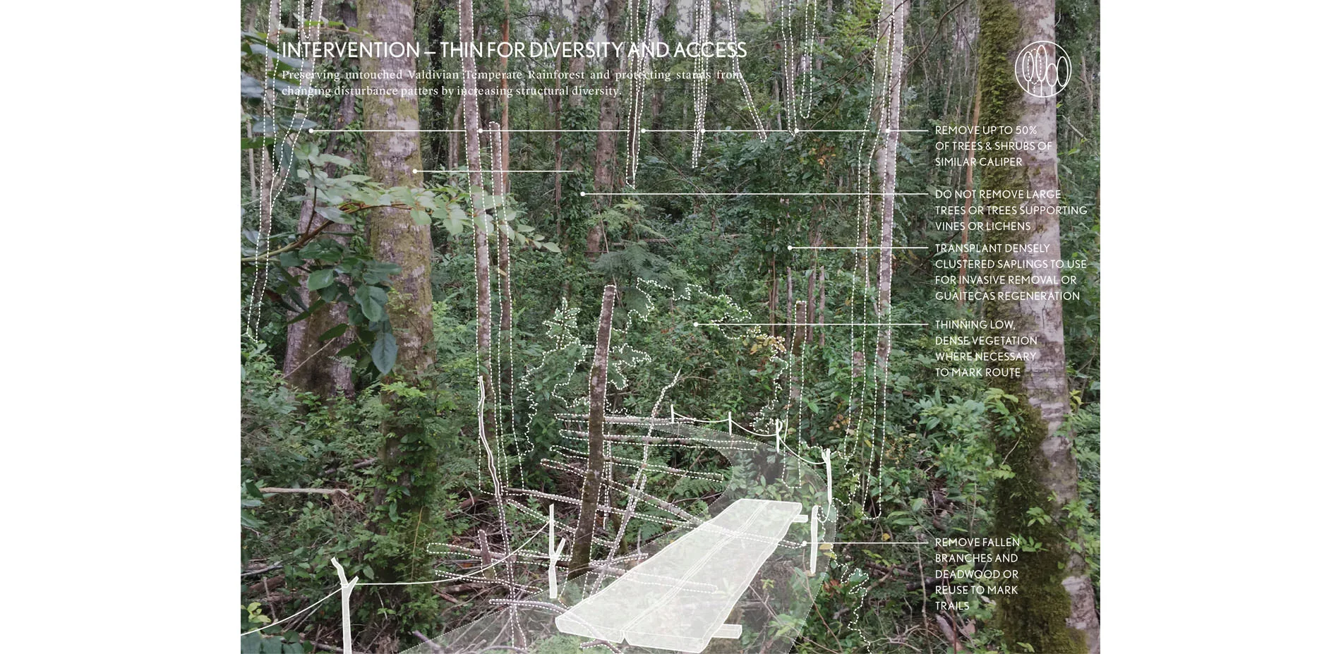
To visit Tic-Toc is to return to a moment much earlier in our history, when humans encountered the tides, the winds, and the rugged, dangerous beauty of remote land. The promises of modern infrastructure cannot apply in this secret corner of the world, one of its last pristine wildernesses. This project pursues a tightly contained scope of human intervention. The landscape architect leverages deep appreciation of Tic-Toc’s dramatic landscape to renew and protect rare ecological systems that define the site’s unique character. By increasing structural diversity within Tic-Toc’s forest, for example, we pre-empt risks of wildfire within the untouched Valdivian Temperate Rainforest. Such proposed operations are highly tailored to local patterns and the capacities of local crafts people, however the underlying strategies make the framework an effective model for intervening in remote sensitive areas held in private conservation.
Drawn from experience
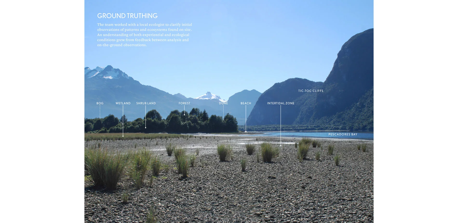
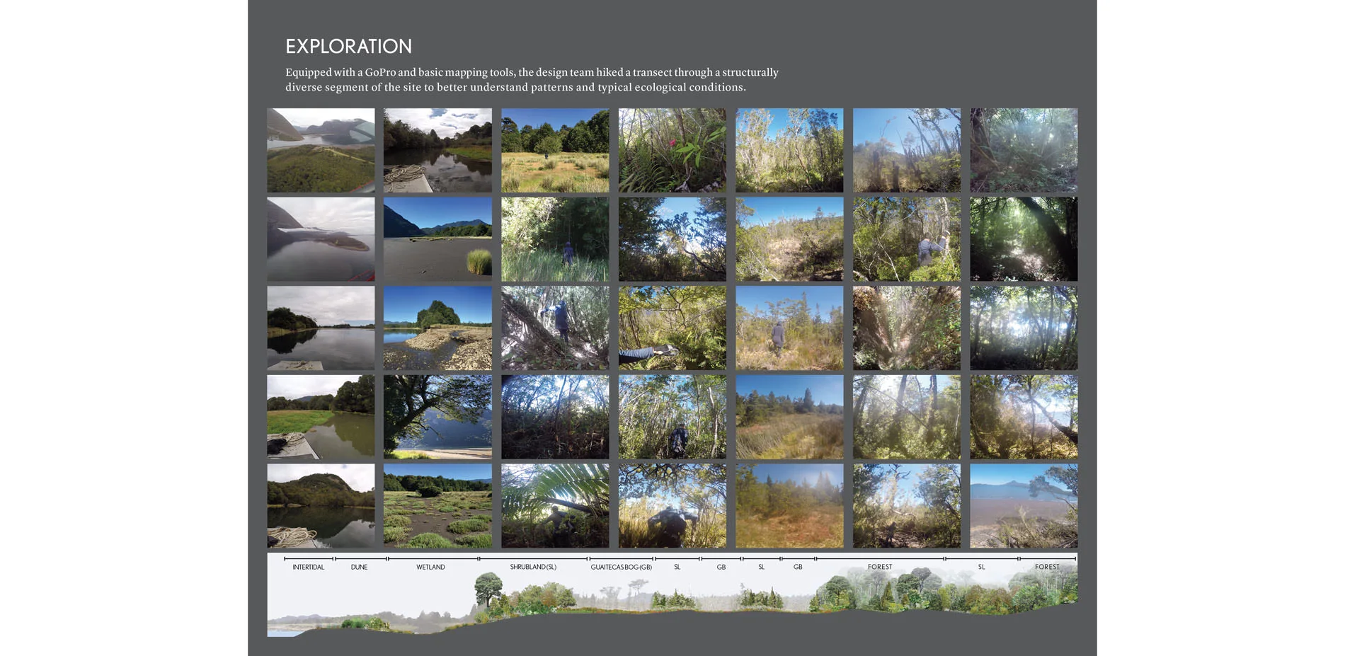
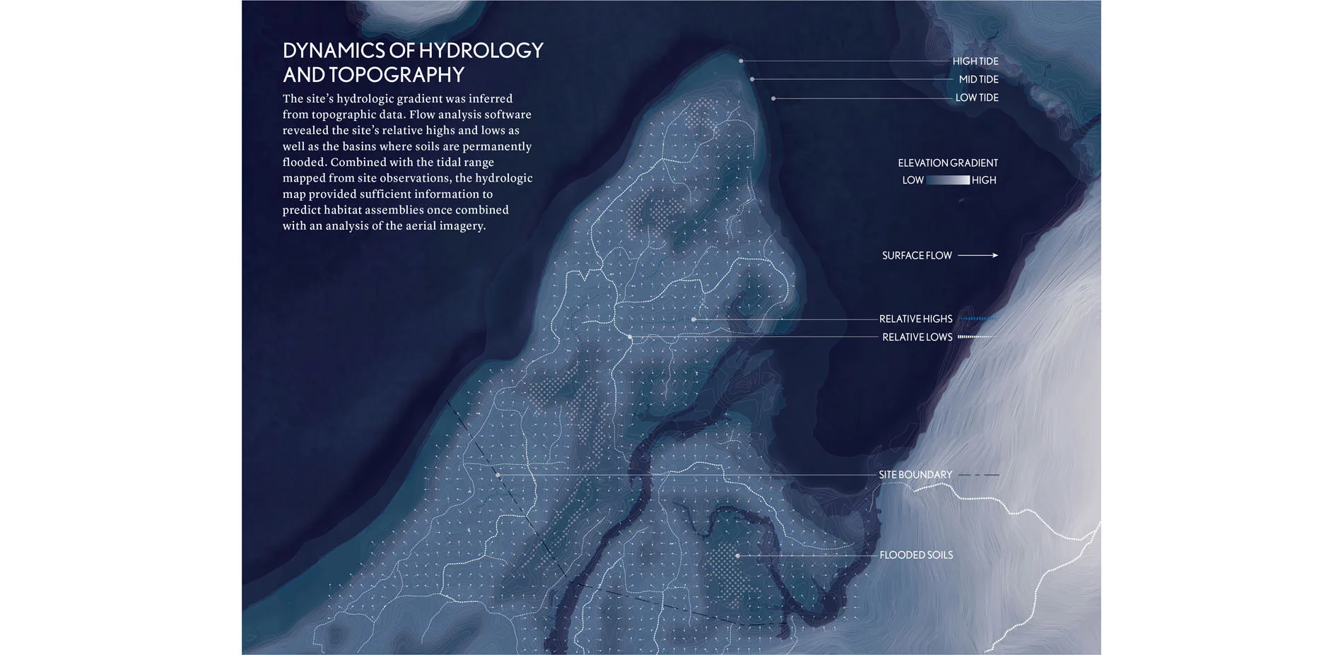
No detailed survey information exists for Tic-Toc. An impenetrably dense forest covers most of the property. To assess site features, the landscape architect appropriated field biology techniques. Traveling on foot, the landscape architect completed a series of transects across the varied topography and ecological conditions of the site. This augmented a visual survey of the property’s more open edge. We acquired coarse geospatial data as well as narrative knowledge from a local ecologist who is also the founder of the Melimoyu Foundation (the conservation group that created Tic-Toc Marine Park).
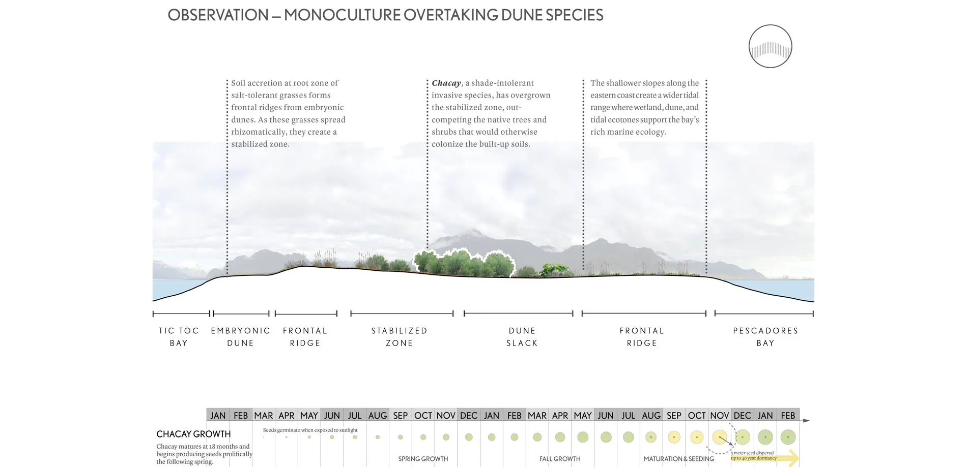
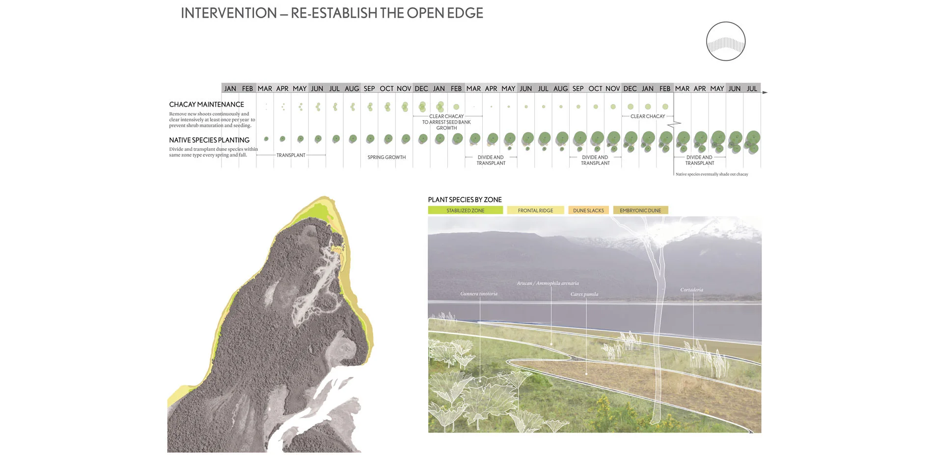
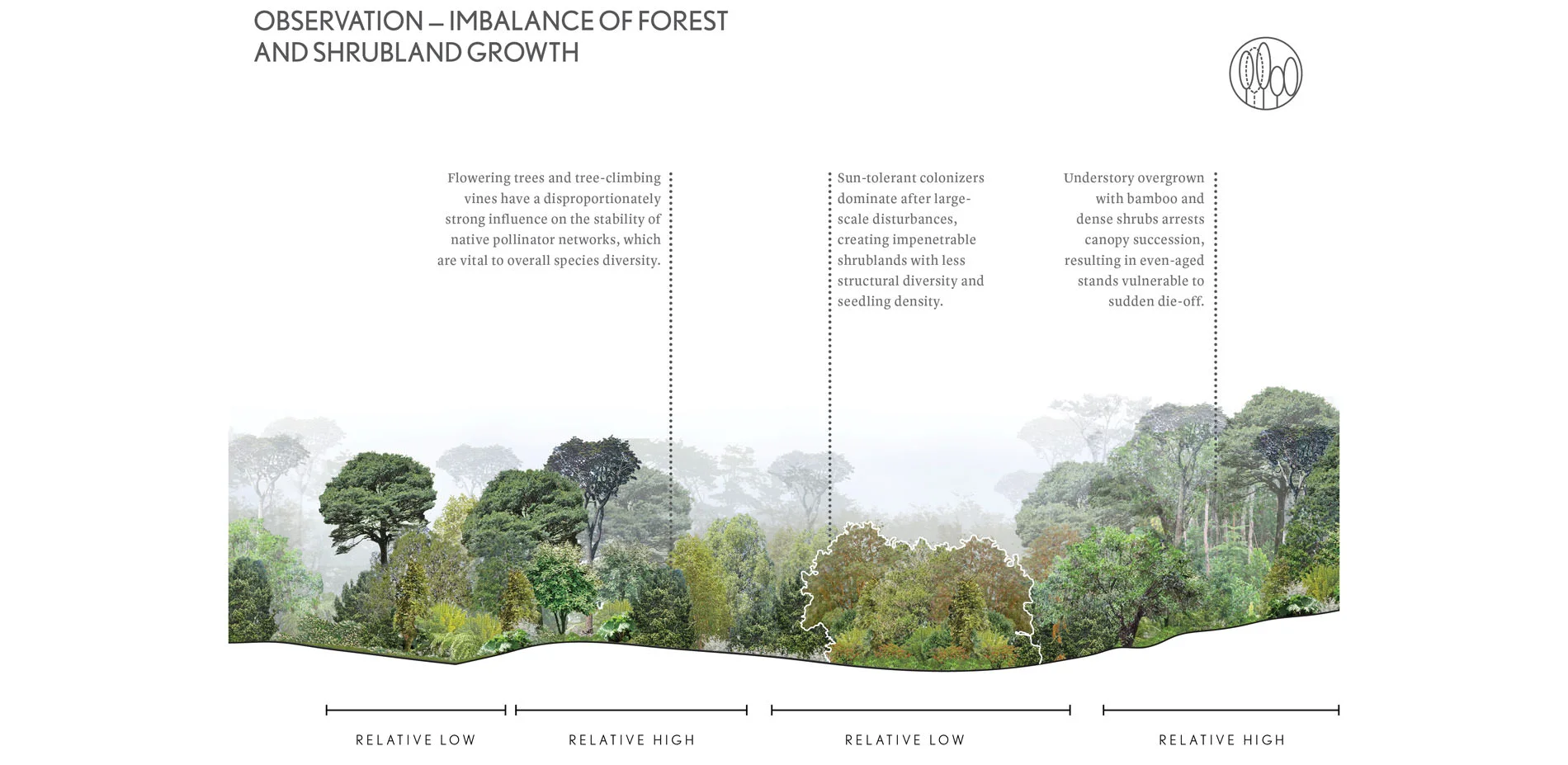
From this information the landscape architect identified relationships between underlying topographic and hydrological dynamics and ensuing habitat character. A series of analytical sections and conjectural plan diagrams allowed us to recognize relationships between contemporary landscape patterns and areas of relative ecological degradation with areas which had been impacted by earthly twentieth-century logging operations, which stripped areas of this peninsula of some key native plants. In addition, we observed the encroachment of invasive species, notably Chacay, introduced to Chile by European settlers, taking over open areas particularly at the edges between forest and ocean.
Through a paired experiential and analytical understanding of these patterns, we developed a series of strategies to improve ecological health and provide for appropriate levels and types of human access. This approach posits that expanded site access is a positive impact, allowing for further observation and understanding and creating a feedback loop linking access, knowing, and stewardship.
Operating sustainably
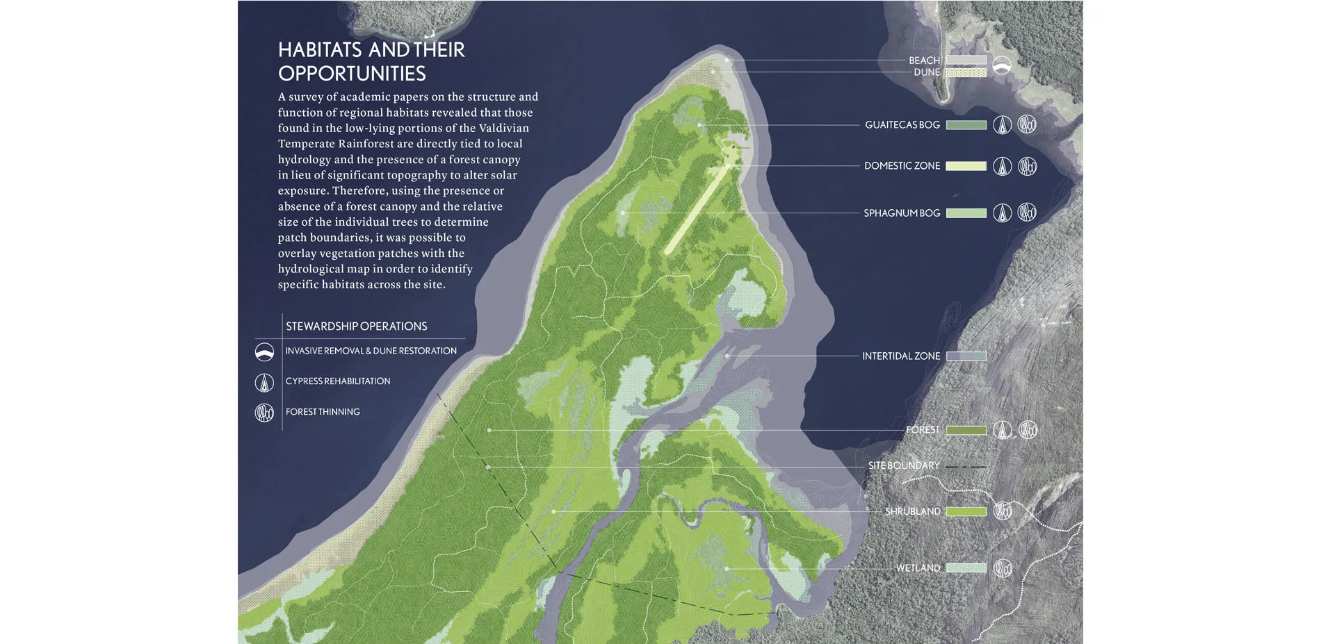
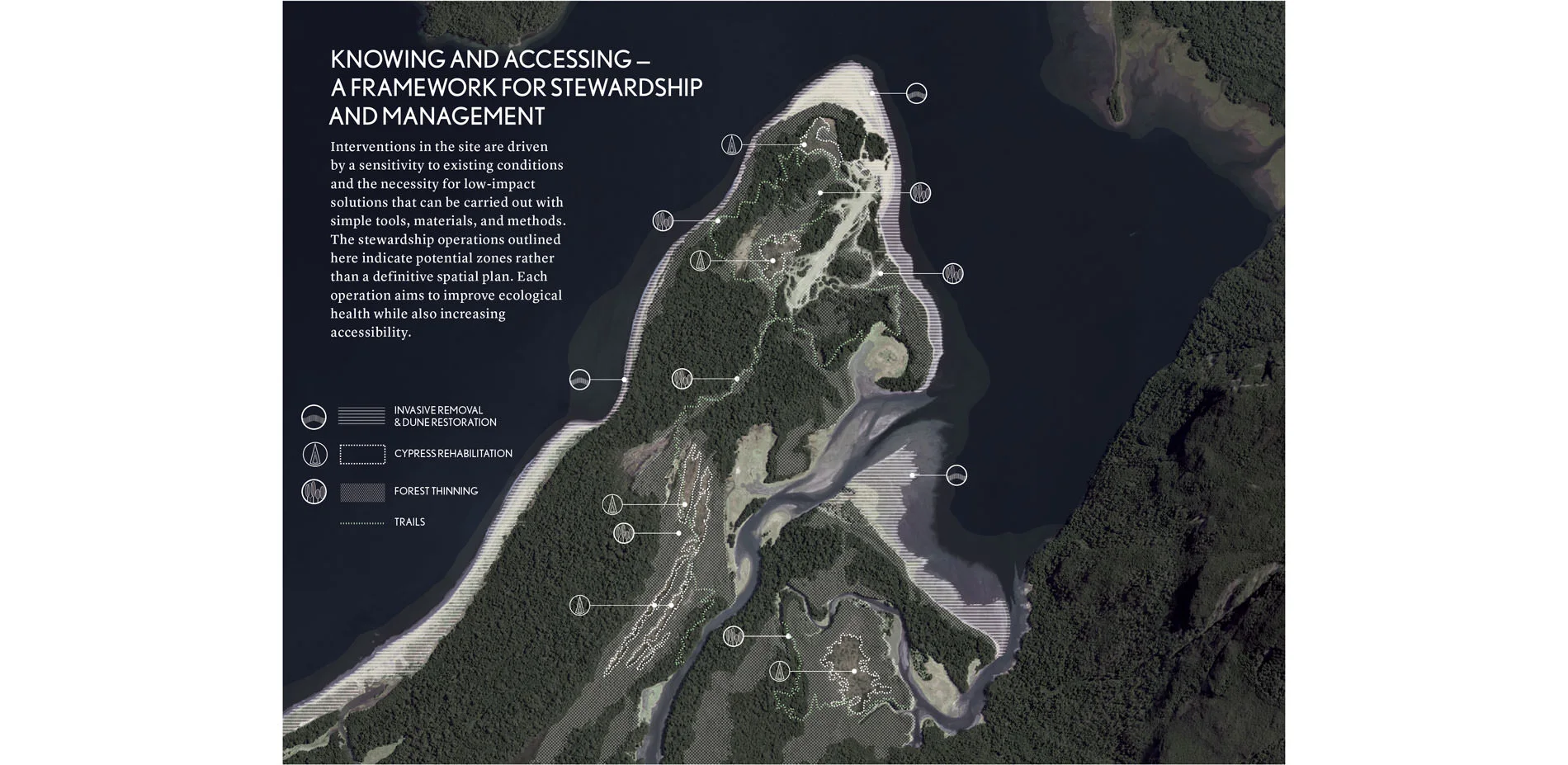
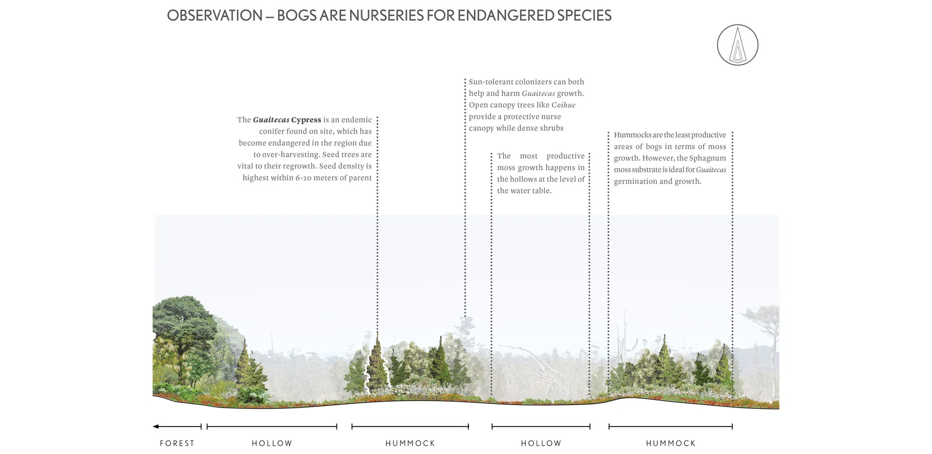
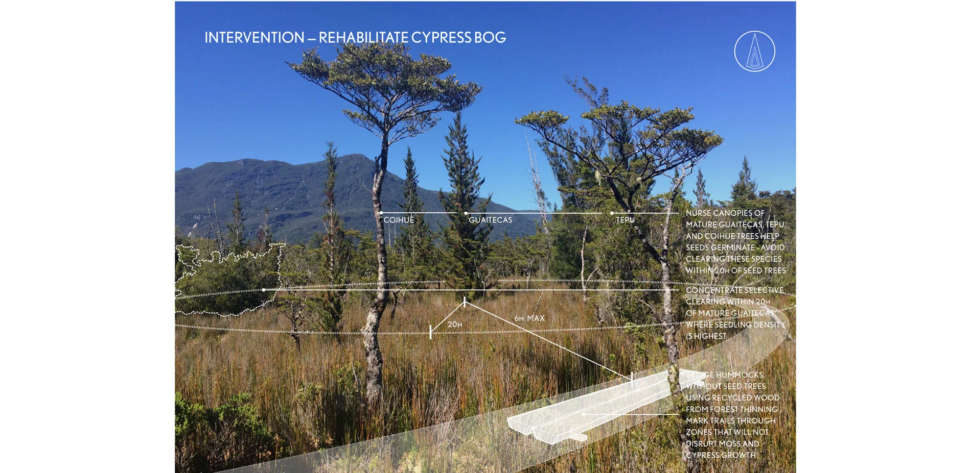
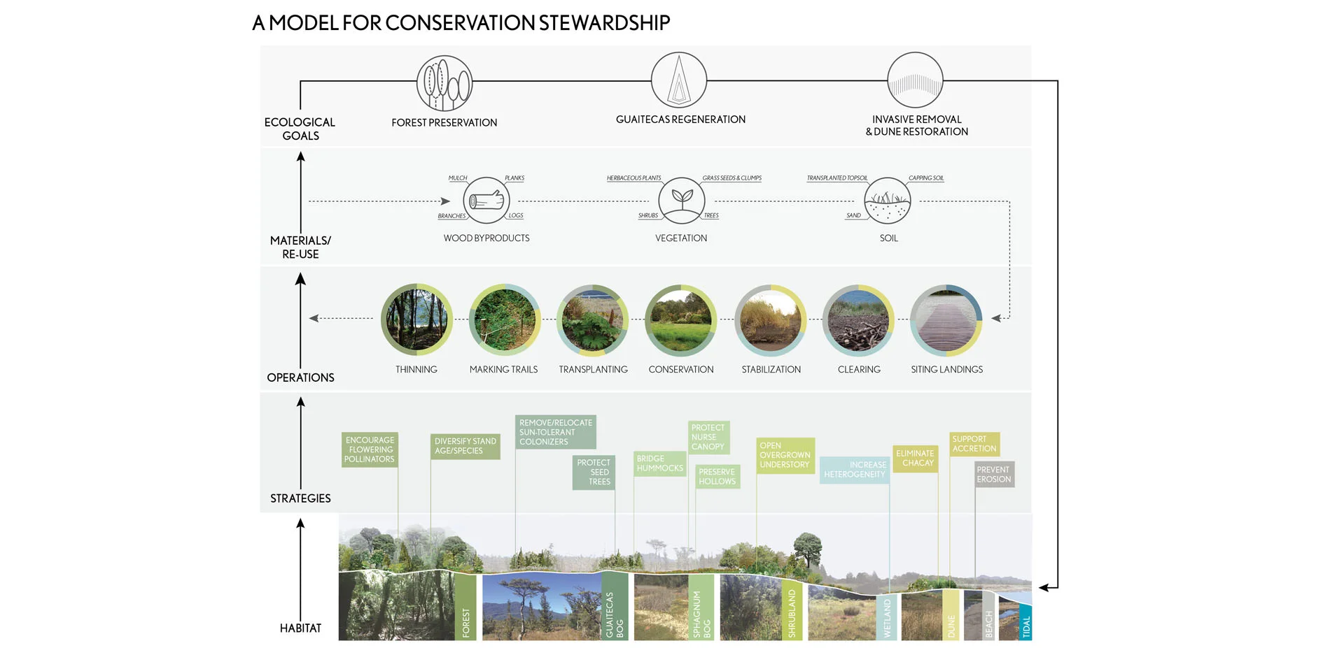
The site contains a rich variety of habitats: beach, dune, wetland, intertidal, forest, shrubland, sphagnum and Guaitecas bogs. Not surprisingly these contain a wide variety of flora and fauna. Some areas require preservation, others restoration, and yet others, at risk from potential impacts of climate change, need reinforcement and increased resiliency. The process of detailed site analysis resulted in the identification of four key areas of intervention: (1) clearing invasive species like Chacay and restoring the dunes; (2) selective thinning of trees on the wooded promontory to diversify stand age and species while reducing dead/combustible undergrowth, all to improve health and increase the forest’s resiliency; (3) nurturing the bog area by re-establishing the nurse canopy for the Guaitecas cypress and preventing damage to the critical sphagnum moss during harvesting; and (4) restoring the fragile forest/ocean interface through attention to the salt-tolerant grasses and health of the wetlands and dunes in the tidal zone.
A major focus falls on the control of Chacay, a shade-intolerant invasive species which has overgrown the stabilized zone, out-competing the native trees and shrubs that would otherwise colonize the built-up soils. All mature Chacay plants have been removed, seedlings are lifted by hand so that over time, as native species recolonize the area, Chacay will be starved of the sunlight it needs and will fail to out compete the native species. Discarded Chacay is highly flammable and is burned in the nearby local residents’ wood stoves. All of these operations can be achieved with minimal tools and mostly on-site materials, using a tractor for heavier clearing but otherwise standard chainsaws or hand tools. All such interventions are checked against key ecological parameters such as impacts on pollinator networks, bird diversity, and resilience to wildfires.
Site construction materials are limited to what can be found or re-used on site, including timber felled through thinning, re-deployment of vegetation collected from the site, and the application of soils, sands, and rocks of all types. Trails, boardwalks, and the very limited infrastructure for access on site has been produced in this way. Such simplicity of means and methods ensures their feasibility in this remote region and their flexibility support evolving priorities and necessary improvisations.
Significance
The significance of this project lies in its role as a prototype for stewardship practices and as a model for collaboration among designers, scientists, and conservation patrons towards respectfully inhabiting and caring for the most precious regions on Earth.
Prototype
It is the intention of this landscape framework to construct a prototype of ecological intervention which is (1) low-tech (so can be achieved by local labor without importing expertise), (2) scalable (can be learned by a local community and done over time and in small and large areas), and (3) integrative (does not just restore a previous condition, but helps a system out of balance readjust and realign by helping remove what is setting the system out of balance.)
A future for wildernesses
Tic-Toc’s conservation is the result of a visionary private individual who is deeply committed to advancing the conservation of Chile’s Patagonian parkland. The patron has seized the opportunity of this rare site to restore the land to full health, and to make available an understanding of its systems as a model for similarly sensitive landscapes, hopefully globally. The owner intends to establish a research program for scientists, artists, and others who will engage this remote, intensely sensitive site and learn from its evolution to inform future wilderness conservation projects.
-
- Tompkins Conservation
- Sherwood Design Engineers
- BioRegional - OnePlanet
Advertisement
Related Awards

Honor Award, Analysis & Planning
A Cultural Approach: The Fort Peck Tribes Hazard Mitigation Plan
In collaboration with the Fort Peck Assiniboine and Sioux Tribes, EPA, and FEMA, the Fort Peck Tribes Hazard Mitigation Plan (HMP) adopts a culturally responsive approach to hazard mitigation planning that features connection to place.

