.webp?language=en-US)


What I liked about this project was the ease with which it toggled between qualitative and quantitative procedures.
Awards Jury
-
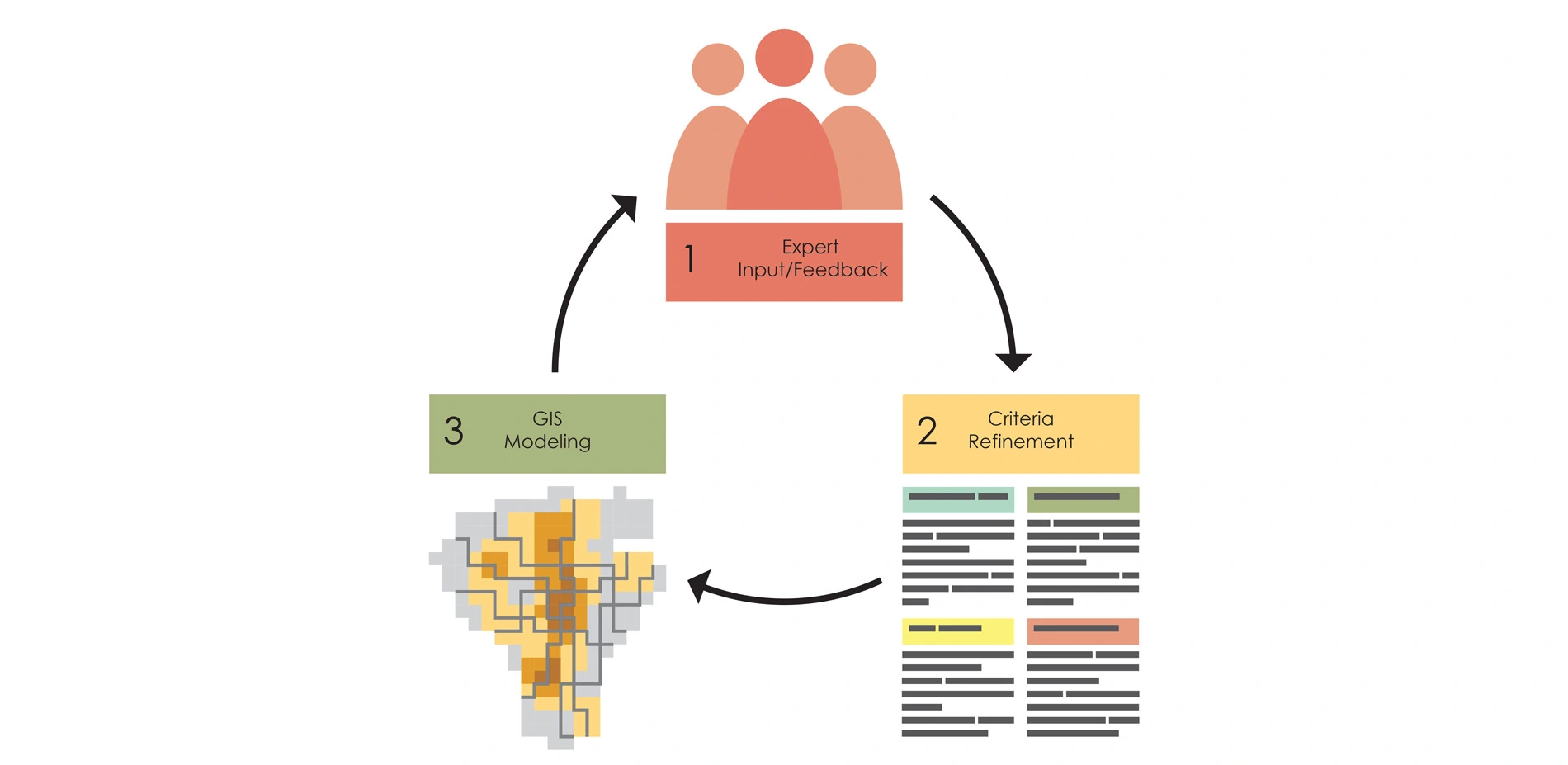
Los Angeles’ streets interrupted an interconnected tributary system that collected and delivered filtered water to the regional mainstem: the LA River. The GRASS analysis began as an attempt to restore some of the benefits of the natural tributary system of built and natural corridors. It builds a dynamic planning process that connects “top down” policy directives with “bottom up” solutions. Agency collaborators, academics and local professionals formed multiple working groups or “charrettes” that aimed to restore natural functions to the paved street corridors that traverse the city. The insights that resulted were integrated with GIS in iterative cycles to refine and enhance the GRASS system and tools.
The result connects geographic water supply and use data and local project-specific data with site-specific characteristics and opportunities for design innovation. Fixed transit elements, open spaces, and intersections offer physical nodes that are storage opportunities and part of a regional system that can address equity as re-hydrated projects provide more livable and viable communities.
-
RESEARCH PROBLEM
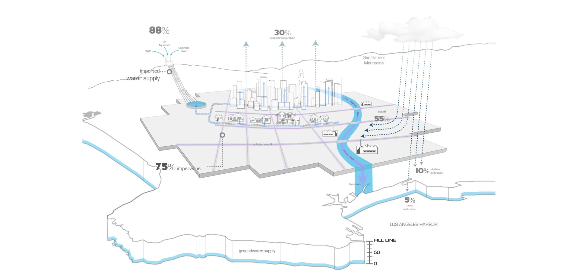
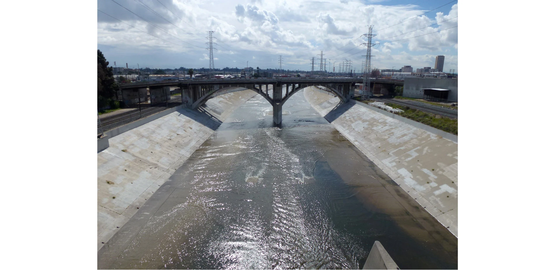
Water quality in the Los Angeles metropolitan area is affected by contaminated urban runoff from over 44 municipalities within Los Angeles County. The quality of runoff is impaired because the current engineered flood control approach concentrates flows from mostly impermeable areas that compromise the natural processes that filter and infiltrate polluted water. Exacerbating this problem, flood plain benefits are circumvented by the predominantly channelized Los Angeles River, Ballona Creek, and Dominguez Channel (Gumprecht 1999).
While effective at limiting flooding, the channelization of the region’s waterways substantially increases the velocity of flows during storm events (USACE 2007). In comparison with the Colorado River, which transports 30,000 cubic feet of water every second, the 80% paved Los Angeles River has the capacity to move 146,000 cubic feet of water per second (Curtiss 1995).
The complex network of urban drainage concrete conduits, which primarily manage stormwater to alleviate the adverse risks associated with flooding, wastes a potentially valuable water resource in a location plagued by drought (Brown 2005). During storm events, higher volumes of discharged polluted runoff containing trash, hydrocarbons, and pathogens severely diminish the ecological integrity of marine and estuarine riparian habitats in the region. This results in fines for the City of Los Angeles due to violations of TMDLs mandated by the federal Clean Water Act (CWA) (Craig 2005).
The project goal of GRASS II was to develop a tool to help designers and engineers to better manage stormwater from the watershed scale within the Los Angeles metropolitan area to the site scale to maximize social, economic, and environmental benefits for the region. Within that goal, objectives needed to be met with parallel challenges to limit the city’s dependence on imported water. The GRASS program also needed to treat runoff to minimize the loading of pollutants in vegetated and riparian habitats.
The availability of a sustainable water supply in Southern California will ultimately determine the viability of proposed green infrastructure (GI), climate change, and coordinated transportation/stormwater projects by design professionals.
METHOD
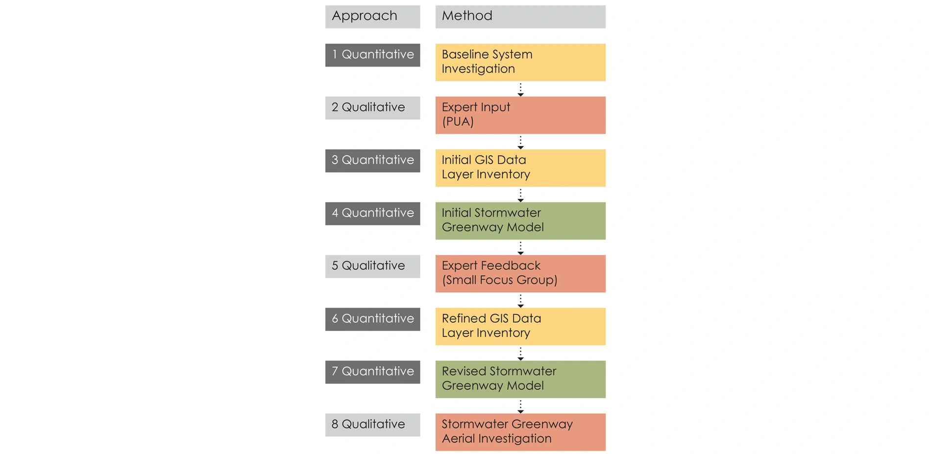
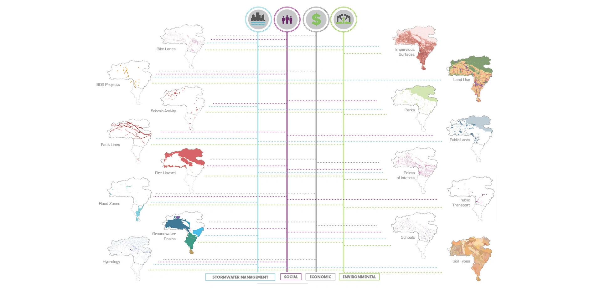
GRASS I used GIS to identify existing street classifications with wide corridors, bike routes, bus routes, and existing storm drains. GRASS I produced an elegant geo-designed solution based on the most current data and a modeling approach developed to identify ideal SWGs as resource-rich and connective “tributary” locations that could serve multiple communities and projects. It offered both rigor and an unbiased technical approach based on a purely GIS-based quantitative analysis of Los Angeles’ infrastructure.
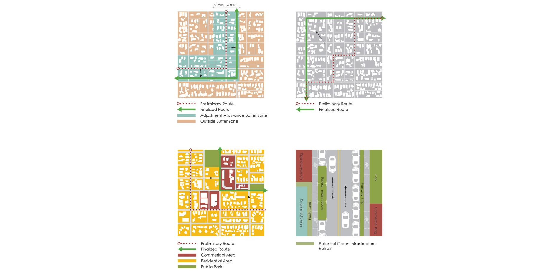
The technical approach of GRASS I failed to integrate the realities of human priorities, political opportunities, and integrative decision making. GRASS II was born. Its research and analysis employed an iterative approach using insights from design professionals, GIS-based modeling, and ground-truthing. Biophysical and socio-cultural data layers gathered as a result of expert input served to inform the creation of a GIS model that was refined and finalized through subsequent rounds design by local practitioners. The research and analysis process concluded with a ground-truthing investigation and field research to identify missed opportunities. Evaluation criteria included performance improvement within a ½ mile adjustment buffer, route directness, public impact and areas with high suitability for green infrastructure.
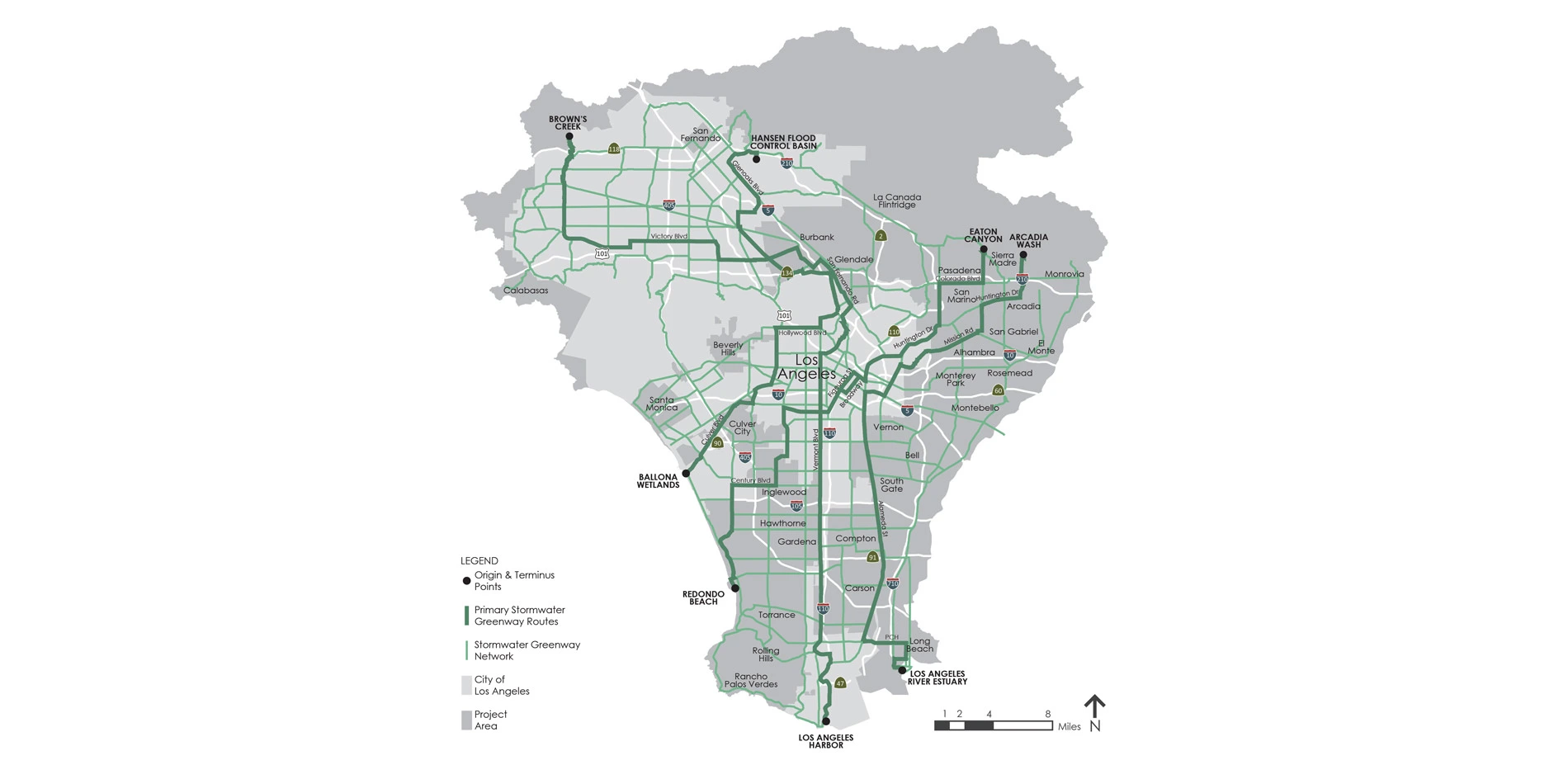
This process resulted in the generation of four Primary Stormwater Greenways (SWGs) and a Secondary Stormwater Green Network. RESULTS
Less than half the length of the Los Angeles Aqueduct, the GRASS Stormwater Greenways are a combined 184.5 miles of contiguous and interconnected BMPs that capture, filter, and infiltrate stormwater through natural processes. Besides managing stormwater for human use, the Stormwater Greenways reshape the region’s physical identity by connecting highly urbanized and under-served communities with the natural environment.
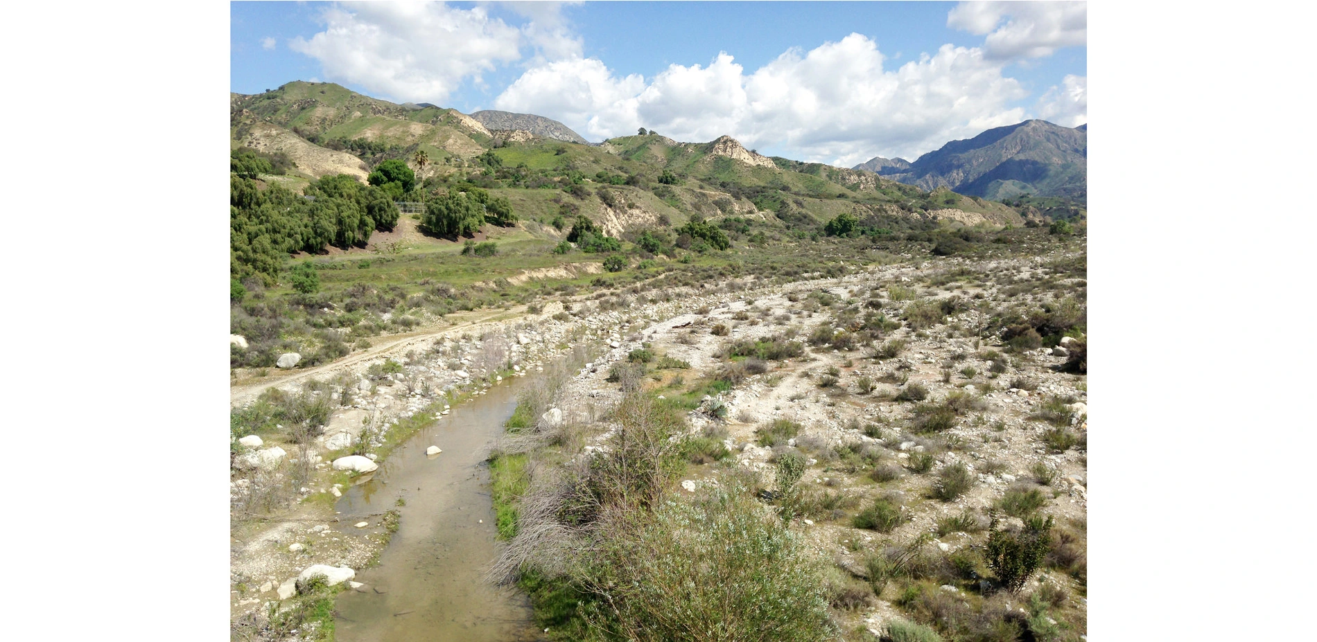
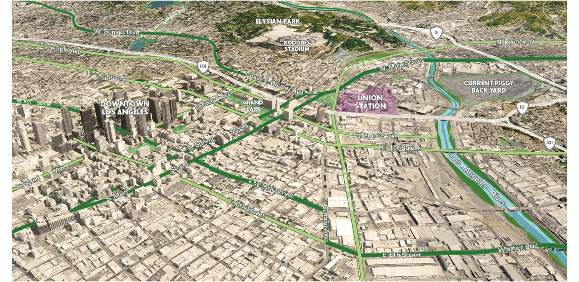
The four SWGs originate in the foothills of the Upper LA River Watershed in areas characterized by high ecological value. The specific origins include the Carter Debris Basin, Eaton Canyon Natural Area, the Hansen Dam Recreation Area and Equestrian Center, and Brown’s Creek Park. The terminus points include the Ballona Wetlands, Redondo Beach Harbor, Los Angeles Harbor, and the Aquarium of the Pacific. Unlike the terminus points that are located in densely-populated urbanized areas, the stormwater greenway origins are primarily located in naturalistic areas that have high ecological and recreational value. These points were primarily selected based on their potential educational value to the public and high visibility and exposure.
They traverse disadvantaged areas of high park poverty, encourage comprehensive multi-modal transit by linking and extending existing bike routes, light rail, and subway lines, connect key opportunity areas and public open space, and connect stormwater projects into one integrative system.
SITE DESIGN AND IMPLEMENTATION
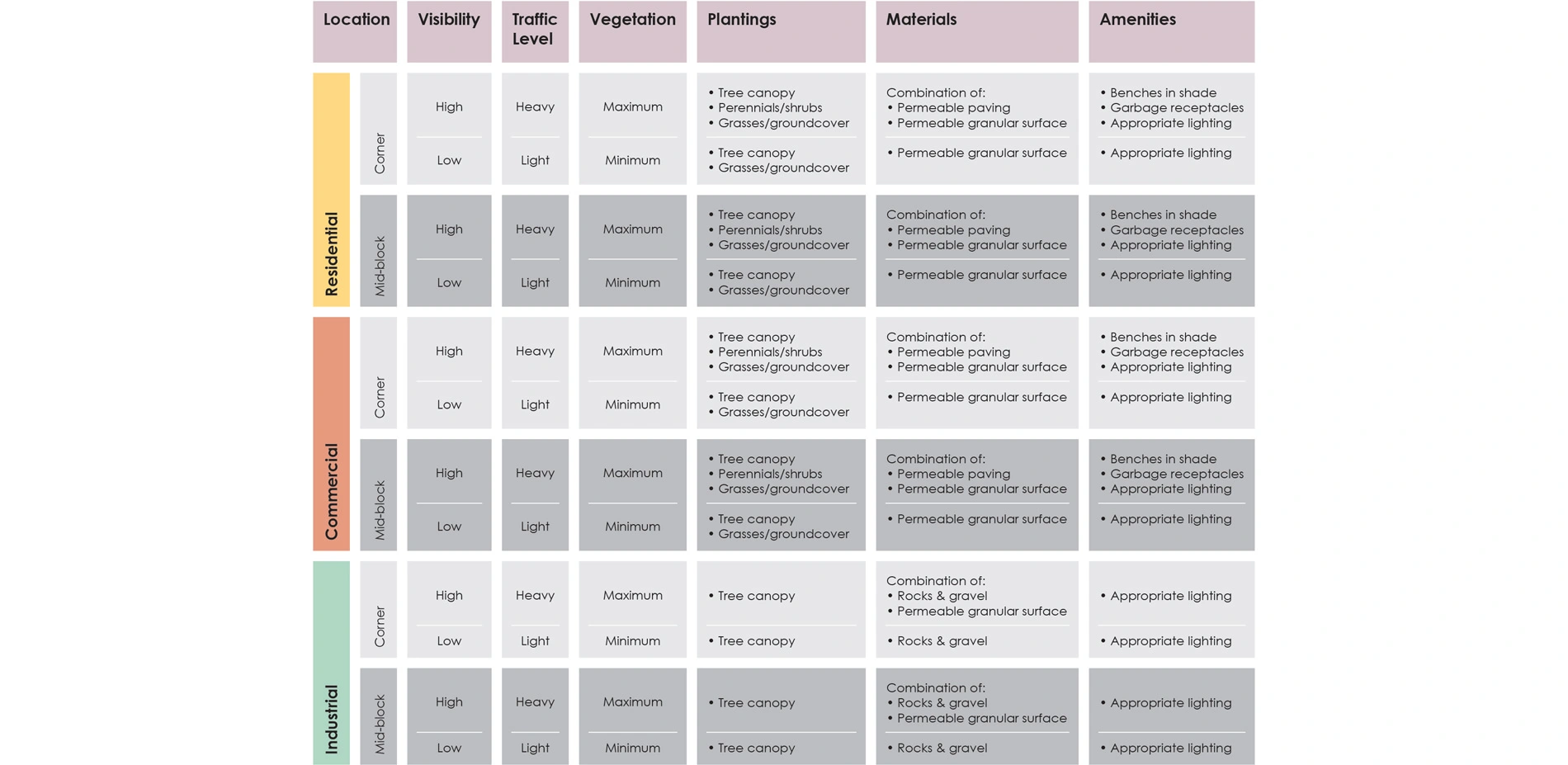
One of the challenges of the green infrastructure approach to water quality is that while the quantity and quality of infiltrated stormwater are improved with pervious surfaces and vegetation, the drought in Los Angeles has called for the removal of irrigation and turf grass areas, which has impacted soils and the urban tree canopy.
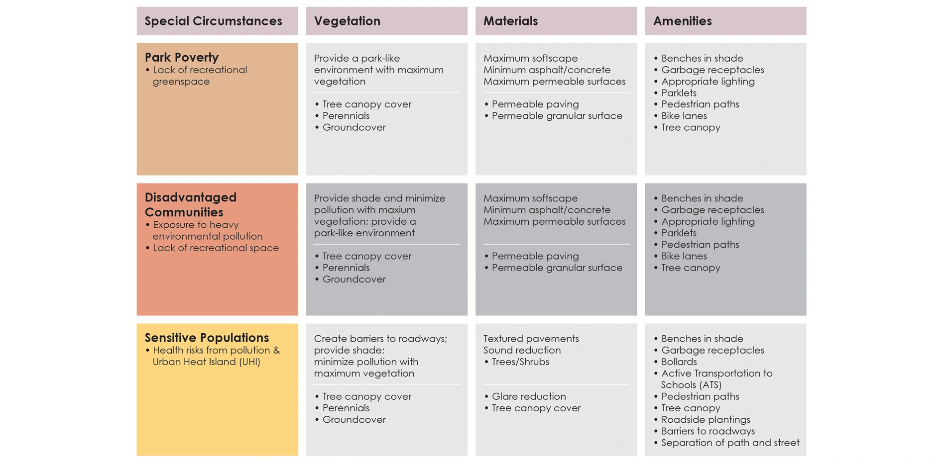
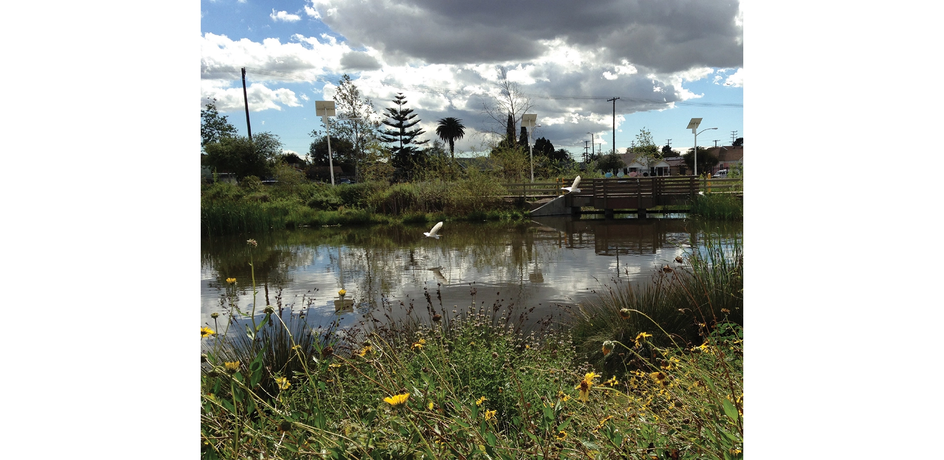
GRASS offers a blueprint for supporting re-use of captured storm water, recycled water, and greater tree canopy while continuing to reduce or manage water consumption. This approach supports increased vegetation, especially in areas where the Stormwater Greenways are intended to ameliorate park poverty or provide urban greening or wildlife habitat functions.
As such, GRASS II assumes a hierarchy of implementation approaches. Where SWGs will be used by large numbers of children, seniors, or other special populations, a higher standard of vegetative density and cover is proposed. This standard is also applied in high use areas, in commercial or tourist areas, in park poor areas, and at the intersections or “nodes” formed by significant street arterials.
IMPACTS
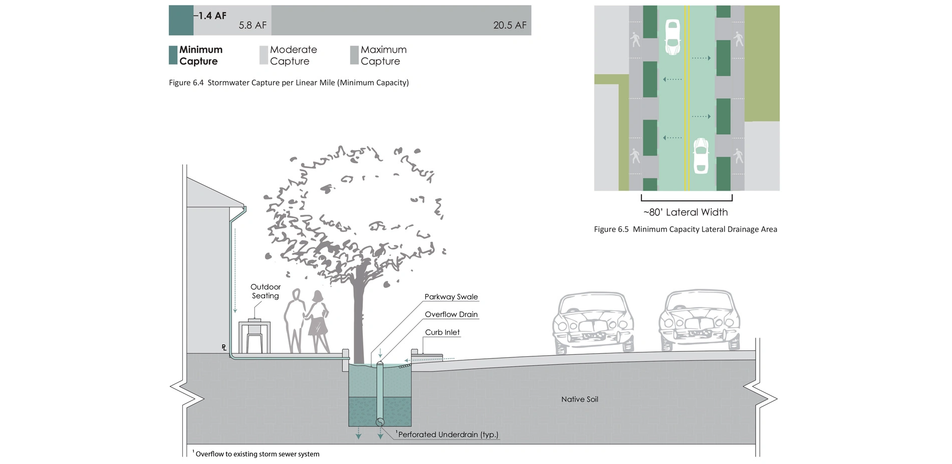
In comparison with the Colorado River, which transports 30,000 cubic feet of water every second, the completed SWG system proposed by this project would capture a minimum of 13,000 acre feet per year (AFY) for the primary network, and a minimum of 59,000 AFY for the combined primary and secondary networks (1/1000 of the annual volume of the Colorado River).
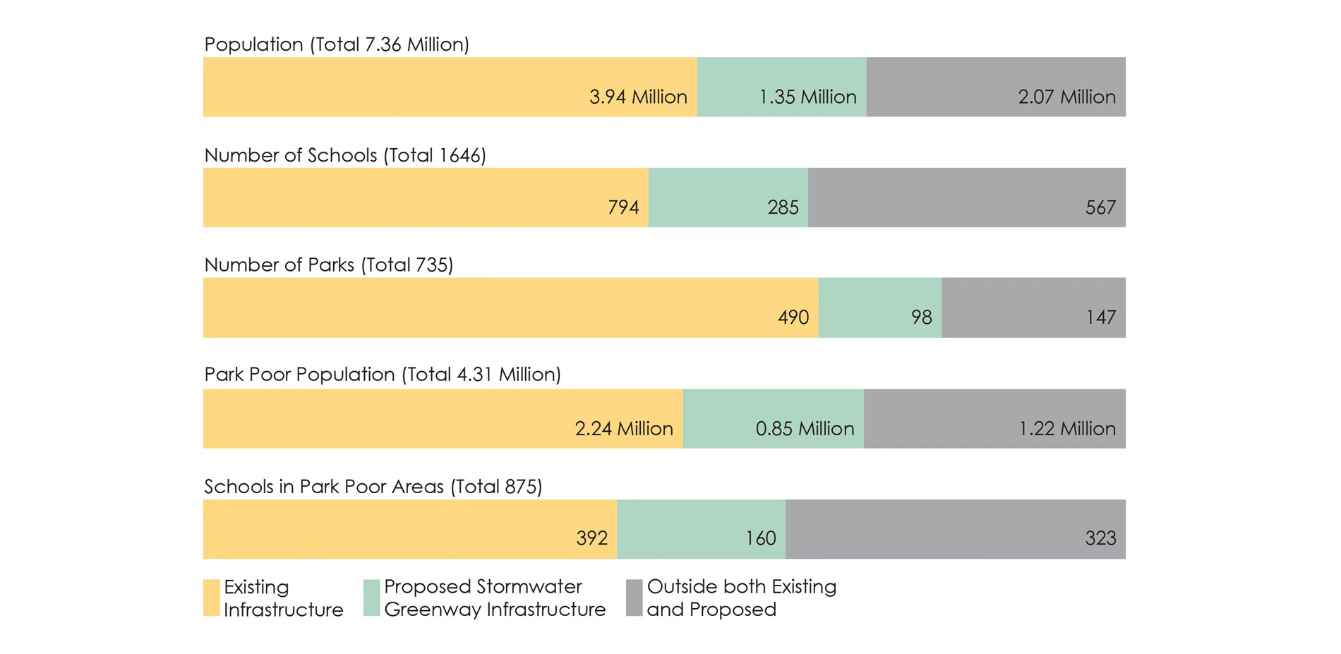
The impact analysis was executed to assess the performance of the SWG system. Along the Primary SWGs, an estimated 298 acres of existing hardscape will be replaced by vegetation, while the acreage of hardscape currently shaded by tree canopy cover will double. At the target of three acres park-space per thousand residents, this area would serve 100,000 people. The GRASS system connects 1.35 million people to trails, and improves park access for 850,000 people living in park poverty conditions. The proposal also connects 285 Los Angeles Unified School District schools and 98 parks to the trail system, supporting active transportation to school, physical activity and the increased used of alternative modes of transportation.
CONCLUSION
The GRASS report will be used in upcoming amendments to the General Plan, to determine infrastructure priorities and funding for the next generation of Los Angeles residents.
It offers a much needed design tool and approach that can be utilized to manage stormwater in urban landscapes more effectively. It provides pragmatic alternatives that support localized regulatory reform, political coordination and compromise, unique and impactful site designs, and implementation with strategic benchmarking, sequencing, and placement.
Less than half the length of the Los Angeles Aqueduct, the GRASS SWGs comprise 184.5 miles of contiguous and interconnected BMPs that capture, filter, and infiltrate stormwater through natural processes. Besides managing stormwater for human use, the SWGs will reshape the region’s physical identity by connecting highly urbanized communities with the natural environment.
-
- Official Entrant: Lee-Anne Milburn, FASLA
- Fidelities Chang
- Karen Hanna-Towne, FASLA
- Jonathan Harnish
- Katie Klein
- Kenneth Lamb
- Stephanie Landregan, FASLA
- Weimin Li
- Roxana Marashi, ASLA
- Mallory Piazzola
- Erik Rowan
- Michael Russell
- Krista Sloniowski
- Trenton Vail
Client
- City of Los Angeles, Bureau of Sanitation - Deborah Deets, ASLA
Advertisement
Related Awards
Honor Award, Research
Race and the Control of Public Parks
This research uses a century long historical analysis of the public park system in Dallas, Texas, USA to uncover the physical and psychological ways in which public landscapes and the works of landscape architects have segregated urban spaces and how we might fight against these design practices. Through reframing past practice this work seeks to create a method for informing design thought and practices that seek to create a more just built environment.