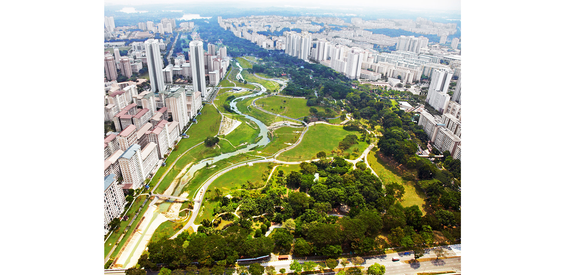
A New Vision
Bishan-Ang Mo Kio Park epitomizes a new vision for blue-green city infrastructure, addressing the dual needs of water supply and flood management while adding ecological, social and biophillic values in the heart of a dense city.
Photo Credit: Public Utilities Board
Media: Please submit high-resolution image requests to images@asla.org.
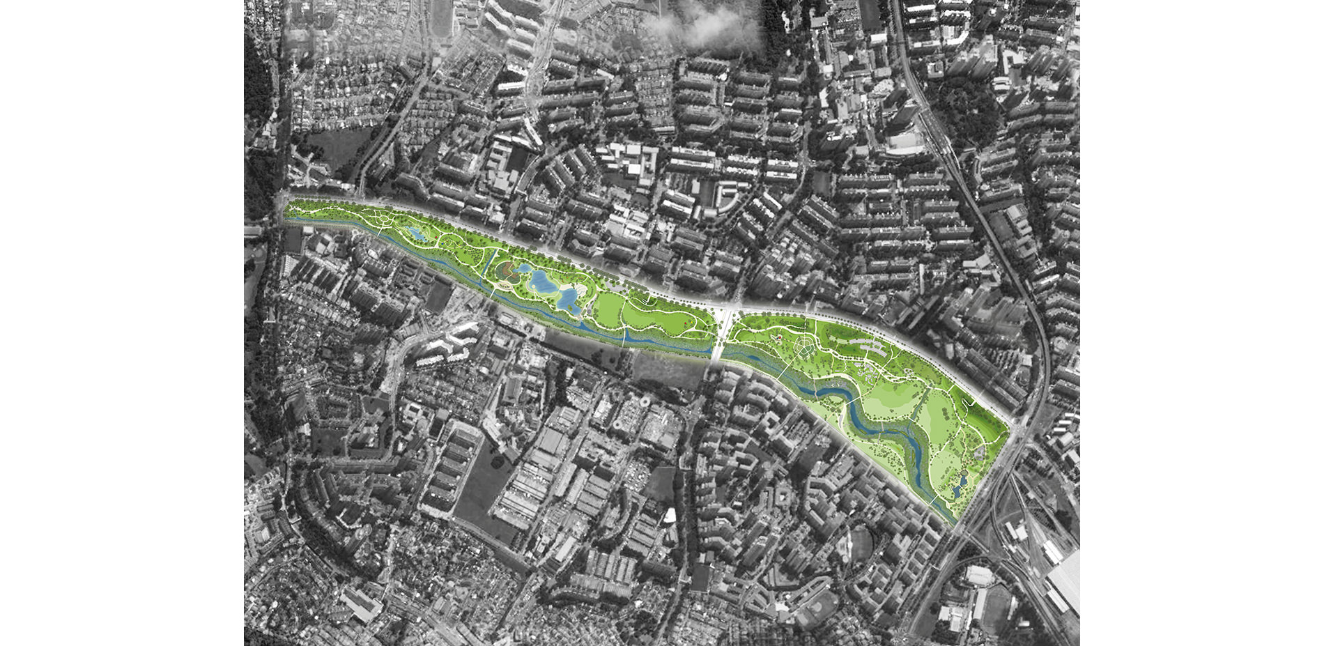
Illustrative Site Plan
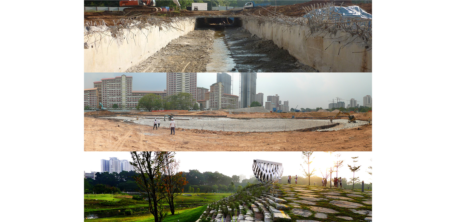
63 hectares of park space has been tastefully redesigned to accommodate the dynamic processes of a river system. The 2.7 km straight concrete monsoon drainage channel has been restored to a 3 km long sinuous natural river.
Photo Credit: Ramboll Studio Dreiseitl
Media: Please submit high-resolution image requests to images@asla.org.
A Community Centric Park
At the center of local life, the vibrant park is open 24/7; there are plazas to practise Tai Chi, fields to play soccer & catch, and beautifully crafted benches & nooks for lovers.
Photo Credit: Lim Shiang Han
Media: Please submit high-resolution image requests to images@asla.org.
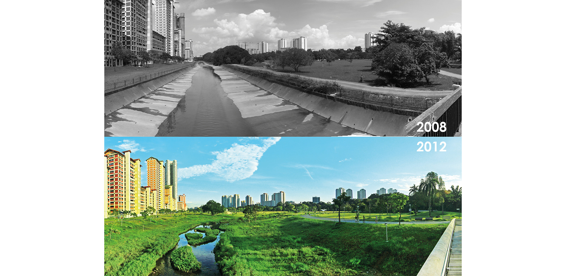
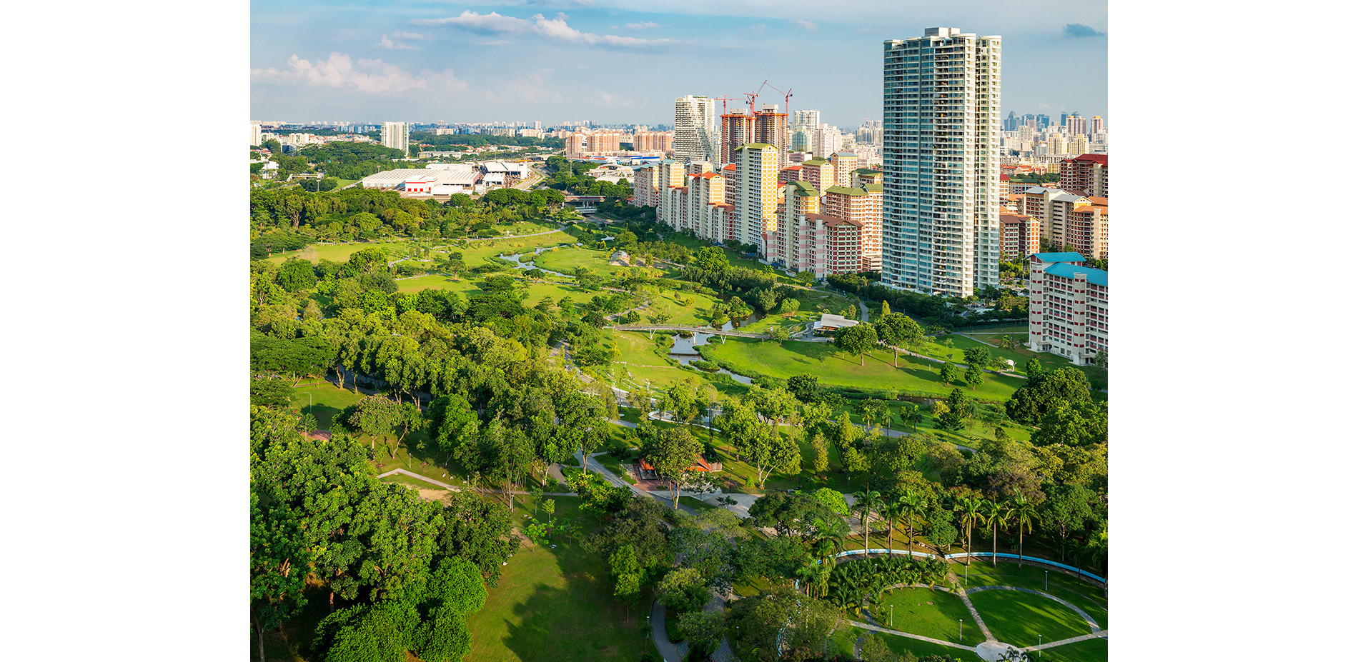
More River, More Park
Once a dividing utilitarian concrete channel that was inadequate for huge storm events, it is now a robust throbbing river that boasts 40% increase in capacity, 30% increase in biodiversity and 12% increase in recreational space.
Photo Credit: Ramboll Studio Dreiseitl
Media: Please submit high-resolution image requests to images@asla.org.
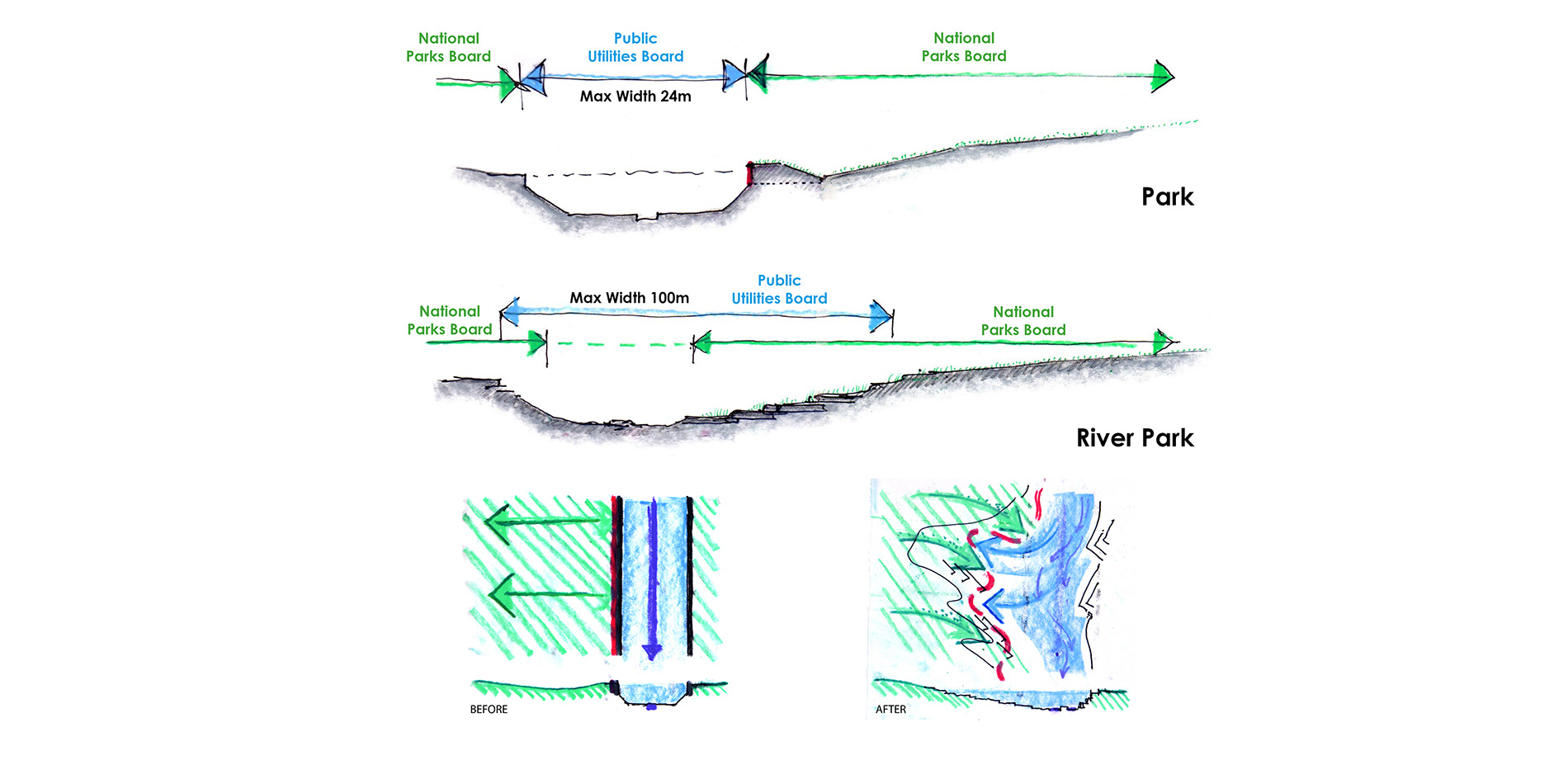
Multi-Agency Collaboration
Blurring the boundaries of jurisdiction does not mean chaos but rather multi-functional opportunities for social, cultural and environmental benefits.
Photo Credit: Ramboll Studio Dreiseitl
Media: Please submit high-resolution image requests to images@asla.org.
100% RECYCLED
All the concrete from the canal was reused in the river bed, cleansing biotope walls, footpaths and the “Recycle Hill”, a feature from which residents can get a vantage point of the integrated park and river.
Photo Credit: Ramboll Studio Dreiseitl
Media: Please submit high-resolution image requests to images@asla.org.
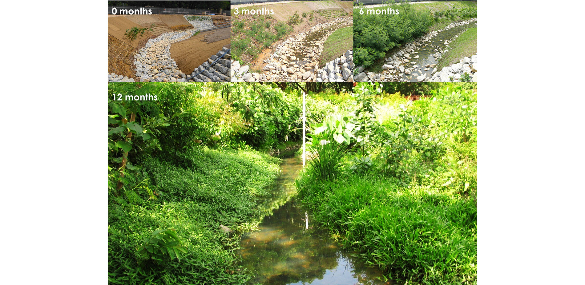
Pioneering Soil Bioengineering in the Tropics
Unprecedented at such a scale in the tropics, a one year study was conducted to test plant suitability and growth by using 12 bioengineering techniques along one of the side drains (60 meters) in the park.
Photo Credit: Ramboll Studio Dreiseitl
Media: Please submit high-resolution image requests to images@asla.org.
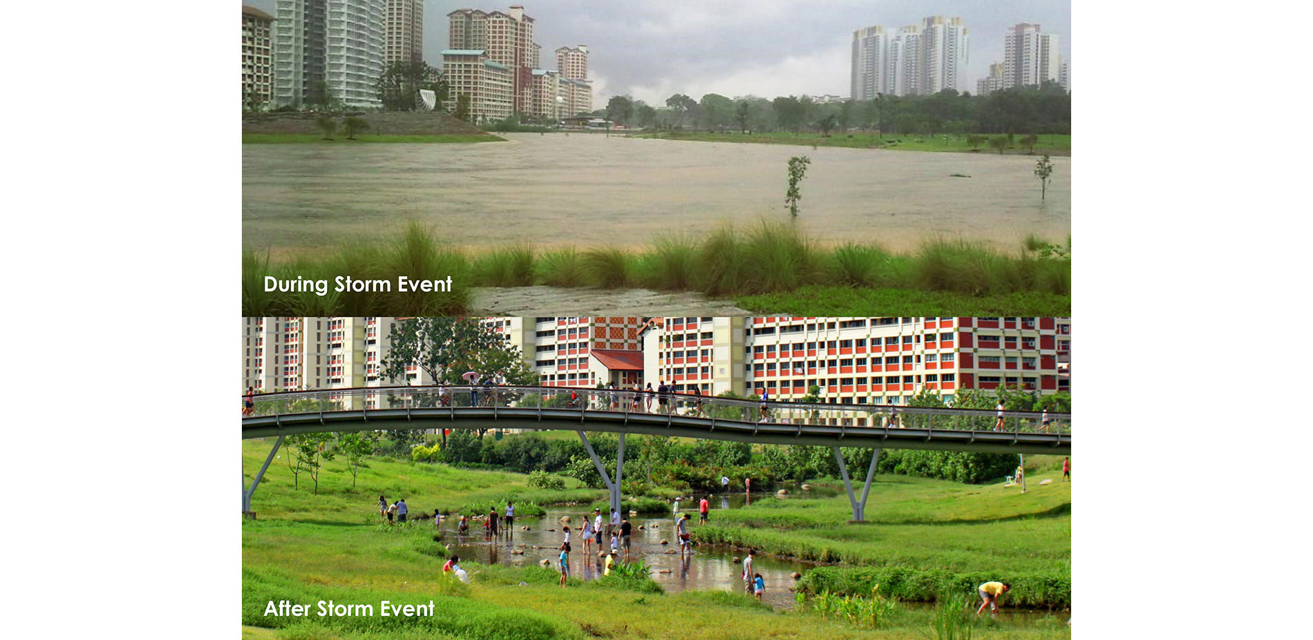
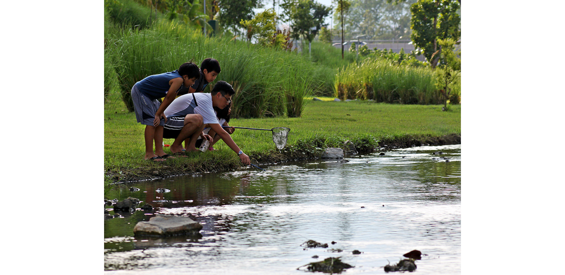
Stormwater Management
The Kallang River powerfully embraces the extremes of disastrous flooding by swelling and retaining large bodies of water then slowly discharging it downstream. After a few hours, river banks are once again open for play to the community.
Photo Credit: Ramboll Studio Dreiseitl
Media: Please submit high-resolution image requests to images@asla.org.
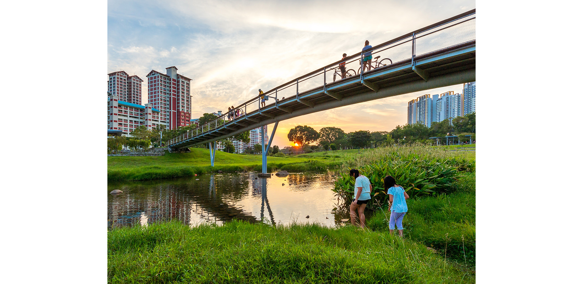
A Biophillic Design
Instead of the old approach of fencing, distance and fear; the soft and beautiful new river landscape brings water closer to the people. It is their place, their park, their river – something to enjoy.
Photo Credit: Lim Shiang Han
Media: Please submit high-resolution image requests to images@asla.org.
Embracing Wildlife
The varied width of the river replicates the diverse flow patterns which are characteristic of natural river systems and create valuable ecologically diverse habitats for flora and fauna.
Photo Credit: Ramboll Studio Dreiseitl
Media: Please submit high-resolution image requests to images@asla.org.
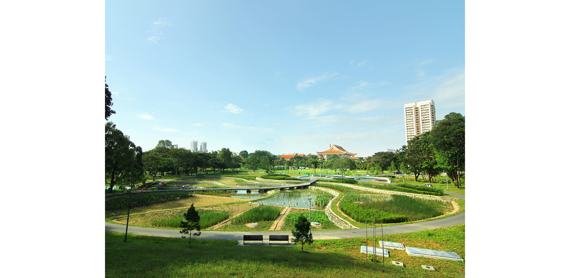
8,640,000 Liters of Pond Water Cleansed Daily
Since the park’s inception, water quality of the river and pond has been maintained without the use of chemicals via the Cleansing Biotope, a system of filtration through phytoremediation and sedimentation.
Photo Credit: Ramboll Studio Dreiseitl
Media: Please submit high-resolution image requests to images@asla.org.
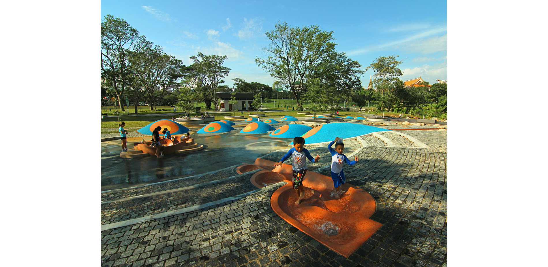
Water As An Asset
Play is 100% operated with recycled water from the Cleansing Biotope. The innovative and imaginative playground allows children to appreciate and learn about the value of water in a fun and interactive manner.
Photo Credit: Ramboll Studio Dreiseitl
Media: Please submit high-resolution image requests to images@asla.org.
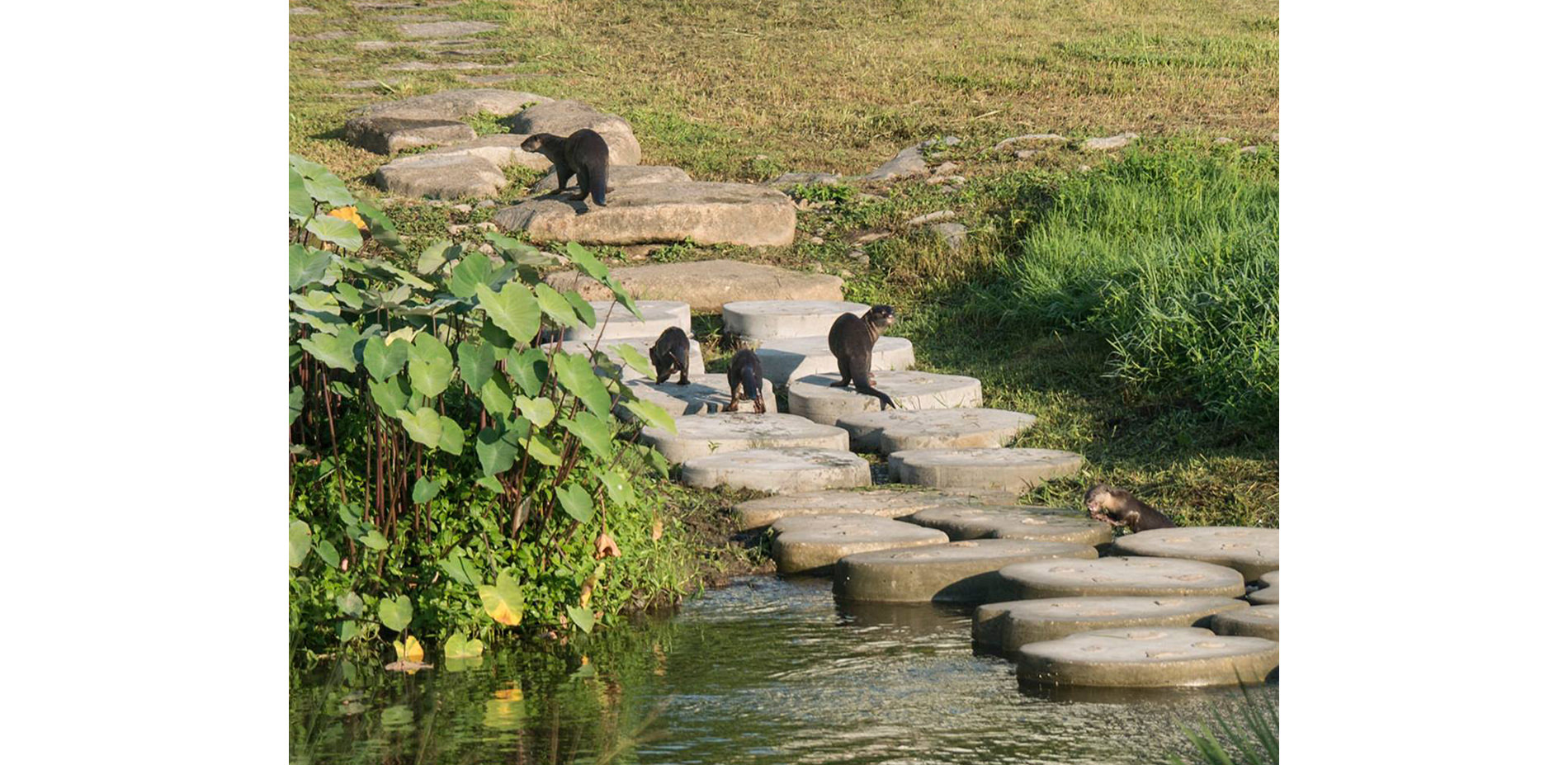
Once Extinct, Now A Resident
After its absence in the 70s and 80s, the presence of the naturalized river has allowed otters to make a comeback, generating excitement within the community while capturing local and international media attention!
Photo Credit: Max Khoo
Media: Please submit high-resolution image requests to images@asla.org.
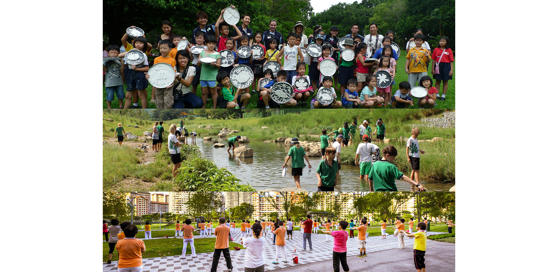
Community Participation
Community participation has also played a key role in designing elements of the park. School children have created art motifs for playgrounds, monitored river health and developed learning trails for both the park and river.
Photo Credit: Lim Shiang Han, Ramboll Studio Dreiseitl
Media: Please submit high-resolution image requests to images@asla.org.
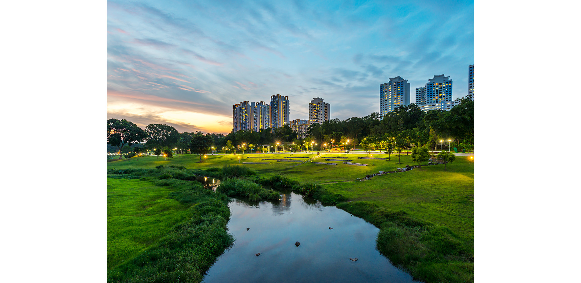
A Destination Park
The rejuvenation has injected new buzz into the mature estates and receives approximately six million visitors each year. The new park serves as a driver for Singapore’s symbolic capital and as a model for water sensitive urban design.
Photo Credit: Lim Shiang Han
Media: Please submit high-resolution image requests to images@asla.org.