


Honor Award
Hunters View Public Housing Neighborhood Redevelopment
San Francisco
GLS Landscape / Architecture and Daniel Solomon Design Partners, San Francisco
Client: Hunters View Associates, LP (The John Stewart Company, Devine & Gong,
Inc. and Ridge Point Non-Profit Housing Corporation)
 Close Me!
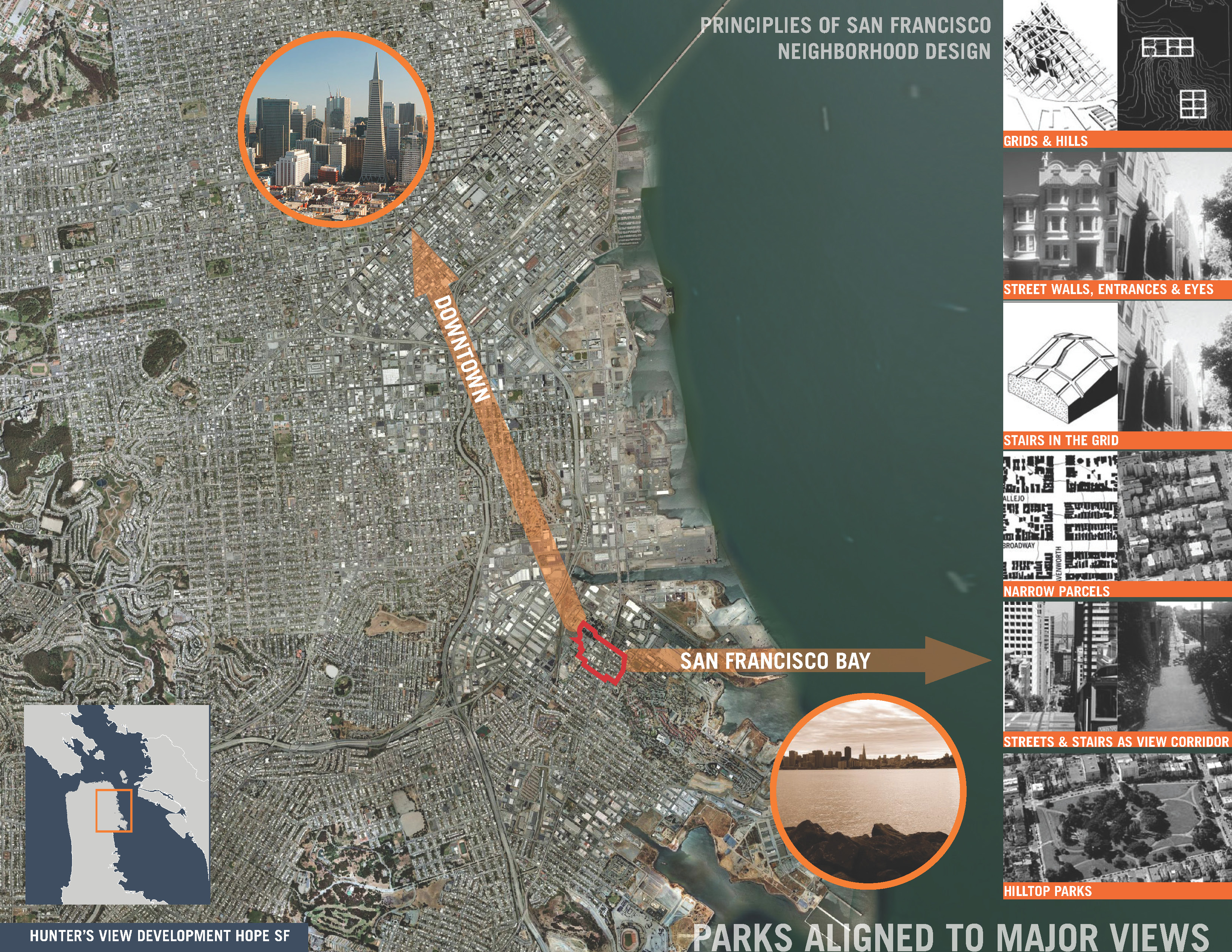
Parks Aligned to Major Views
Download Hi-Res ImageImage: GLS Landscape / Architecture
Image 3 of 15
 Close Me!
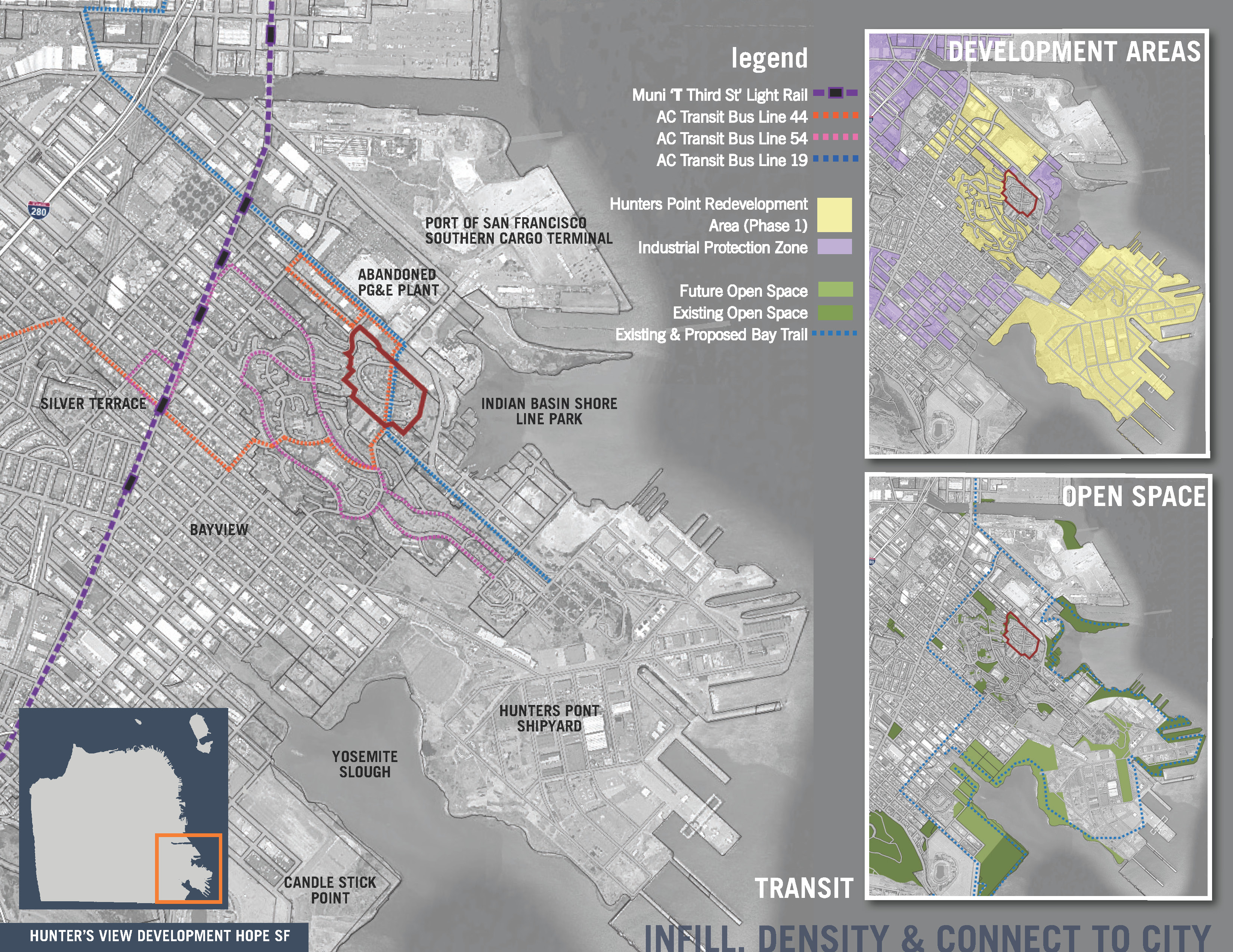
Infill, Density and Connect to City
Download Hi-Res ImageImage: GLS Landscape / Architecture
Image 4 of 15
 Close Me!
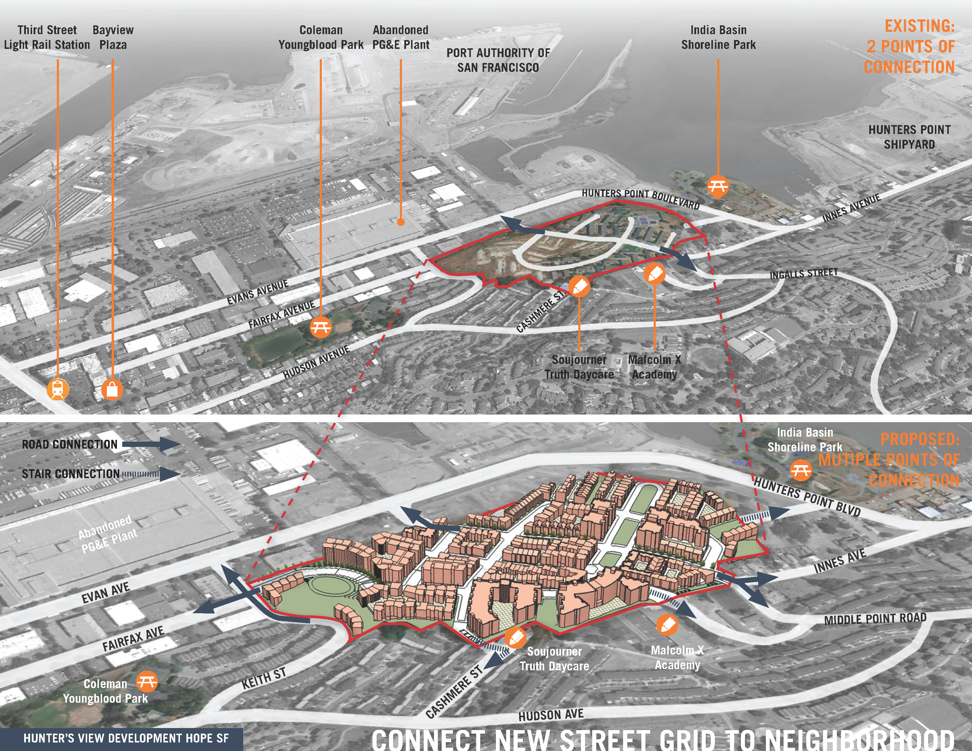
Connect New Street Grid to Neighborhood
Download Hi-Res ImageImage: GLS Landscape / Architecture
Image 6 of 15
 Close Me!
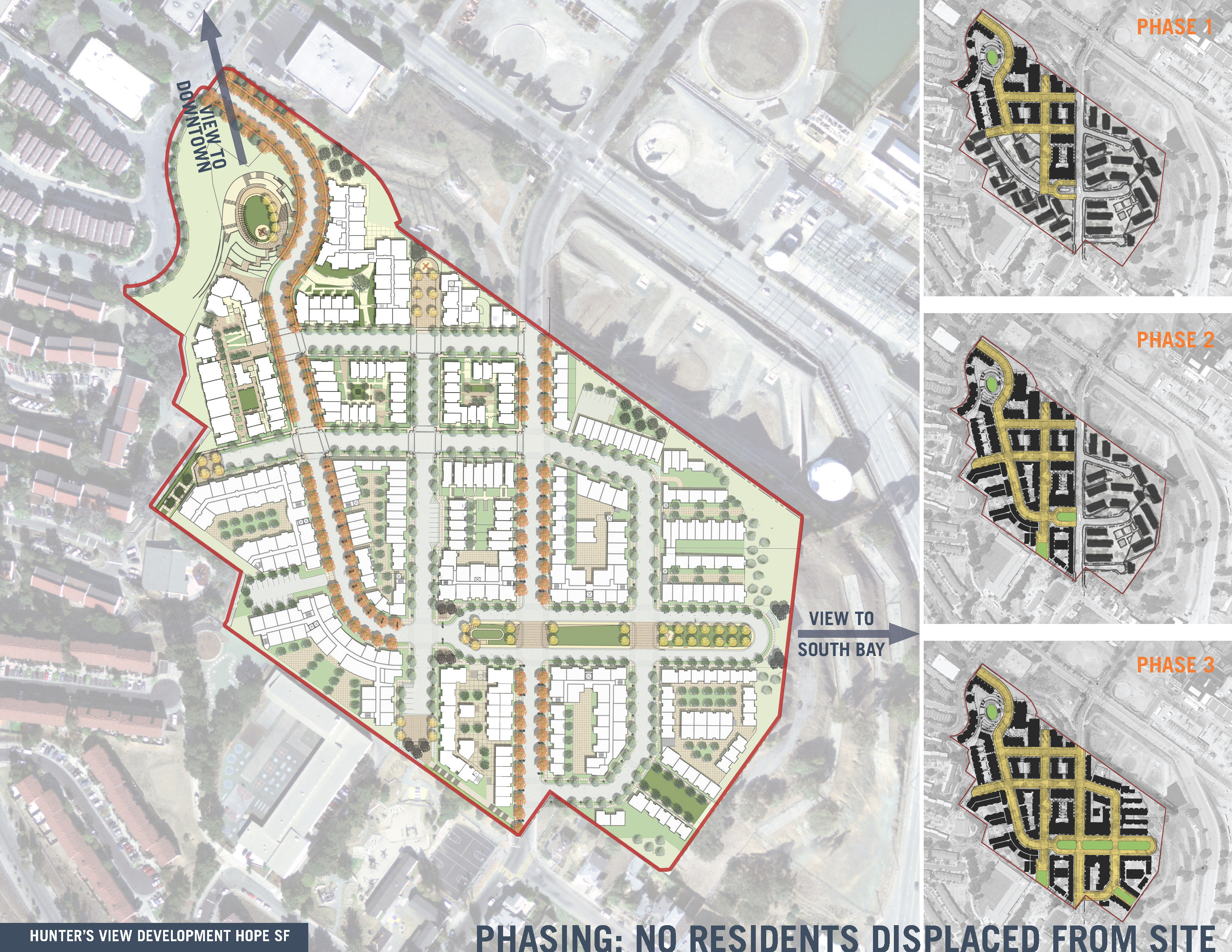
Phasing: No Residents Displaced From Site
Download Hi-Res ImageImage: GLS Landscape / Architecture
Image 7 of 15
 Close Me!
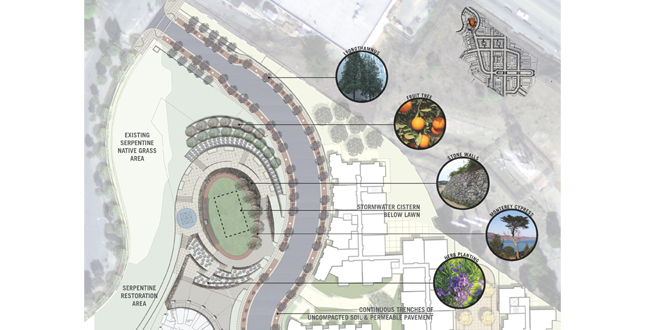
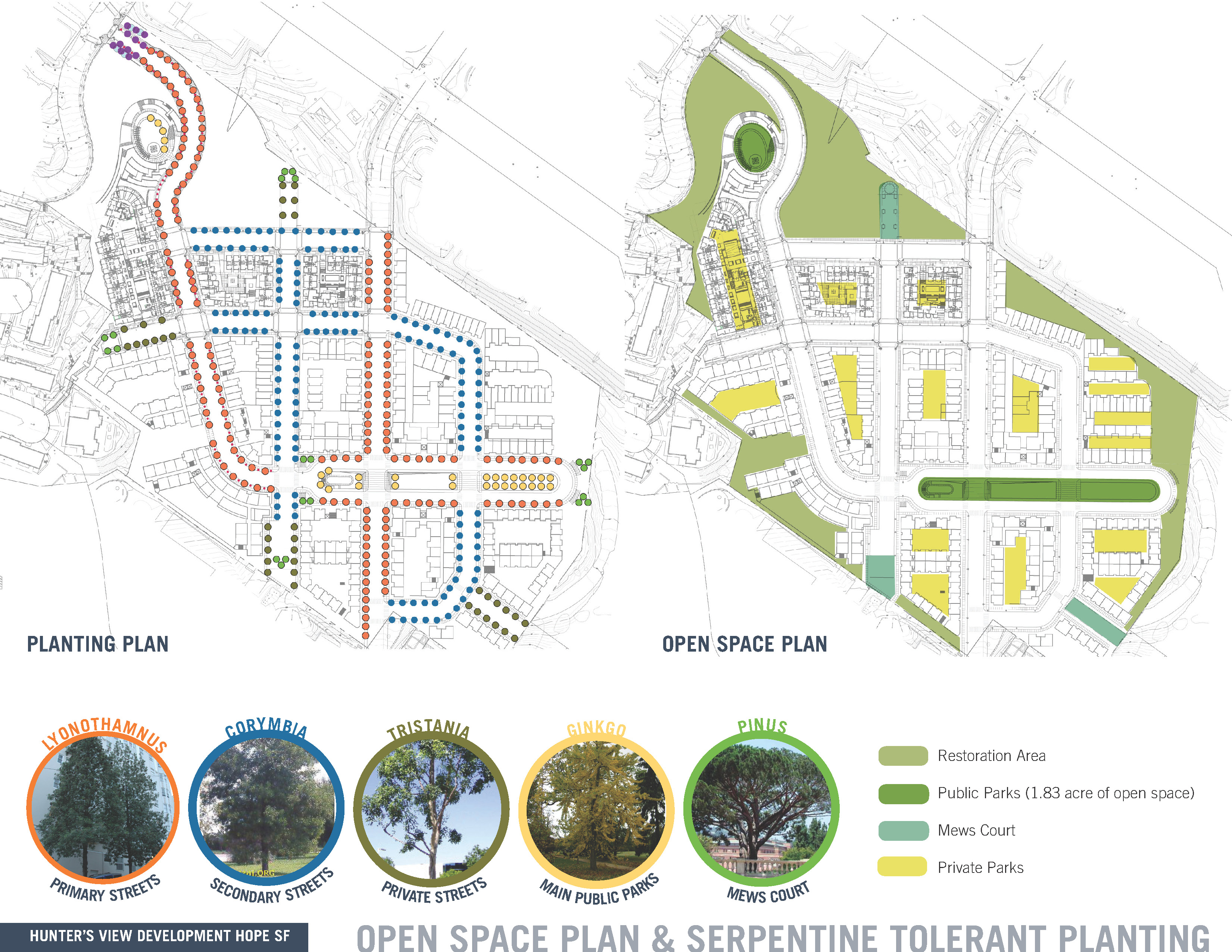
Open Space Plan & Serpentine Tolerant Planting
Download Hi-Res ImageImage: GLS Landscape / Architecture
Image 8 of 15
 Close Me!
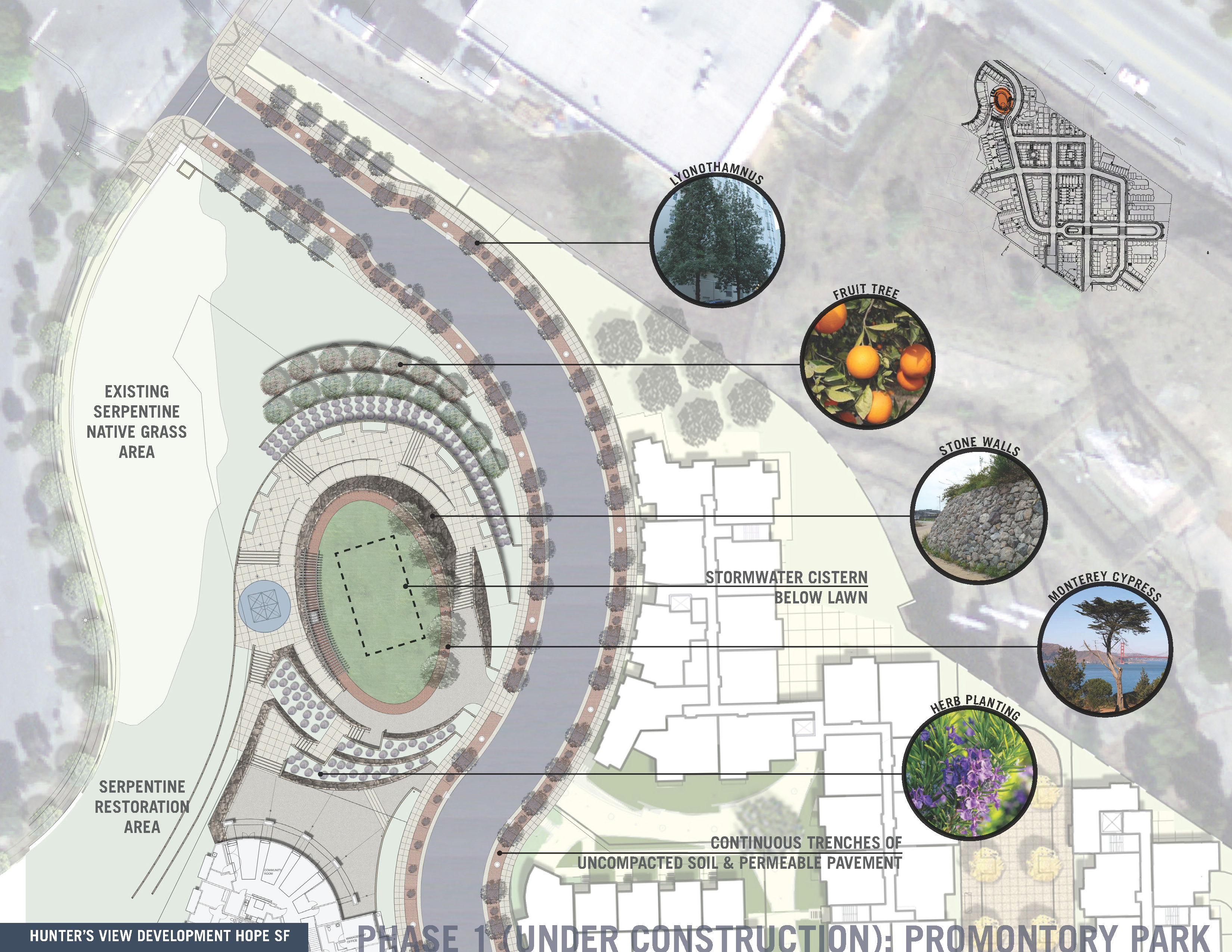
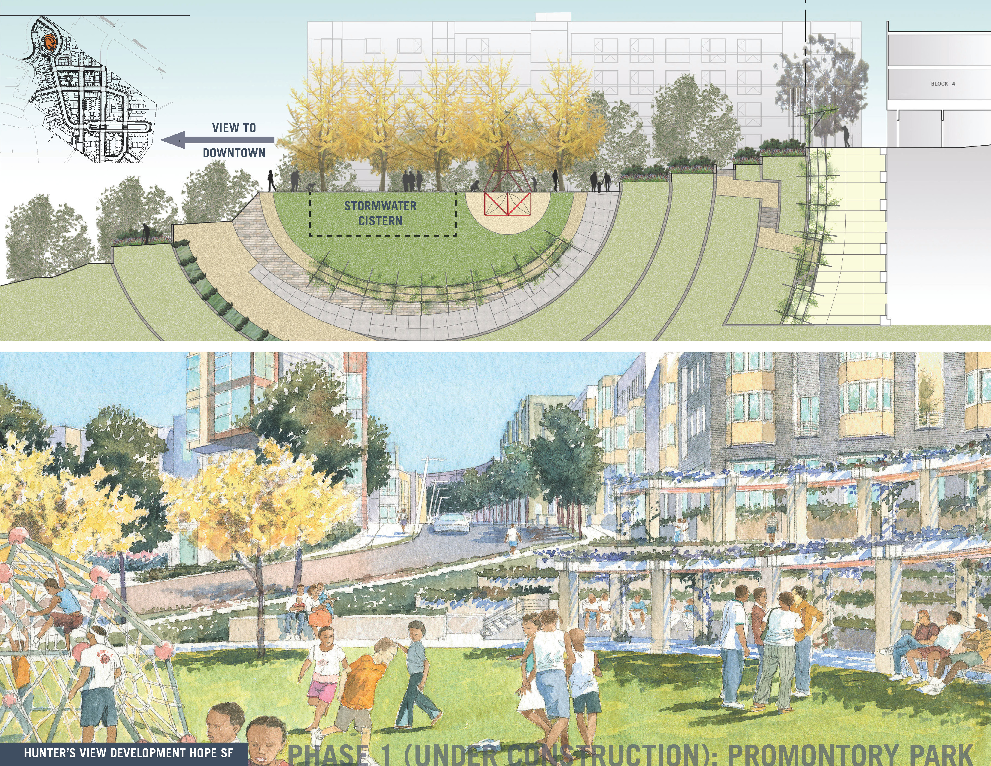
Phase 1 (Under Construction): Promontory Park
Download Hi-Res ImageImage: GLS Landscape / Architecture
Image 9 of 15
 Close Me!
Phase 1 (Under Construction): Promontory Park
Download Hi-Res ImageImage: GLS Landscape / Architecture
Image 10 of 15
 Close Me!
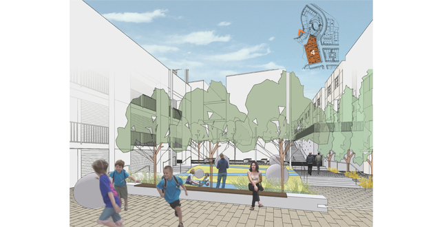
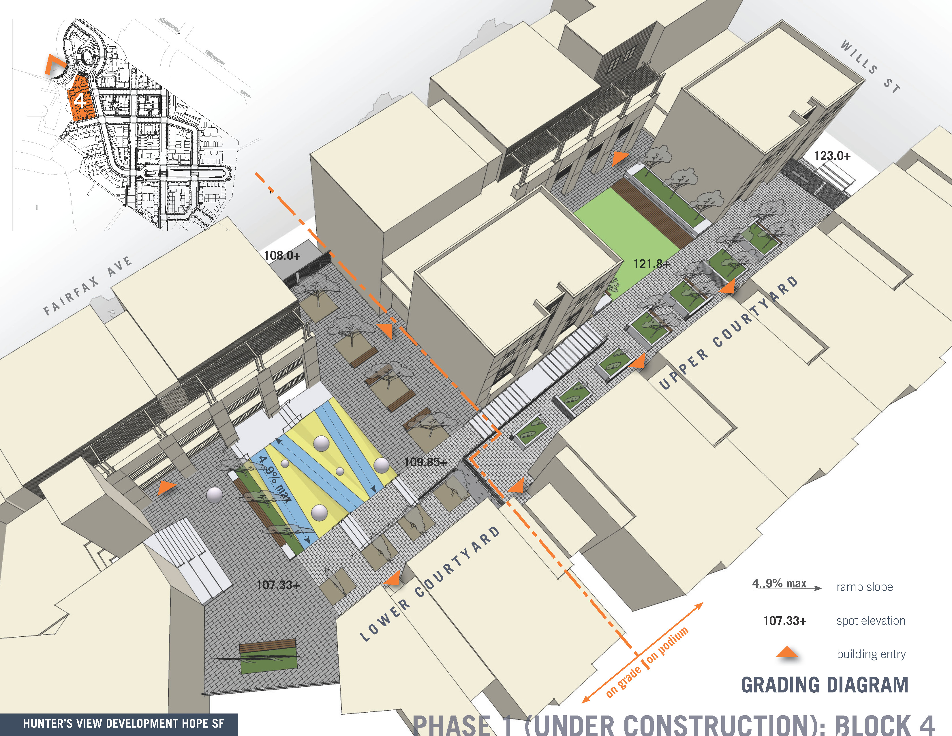
Phase 1 (Under Construction): Block 4
Download Hi-Res ImageImage: GLS Landscape / Architecture
Image 12 of 15
 Close Me!
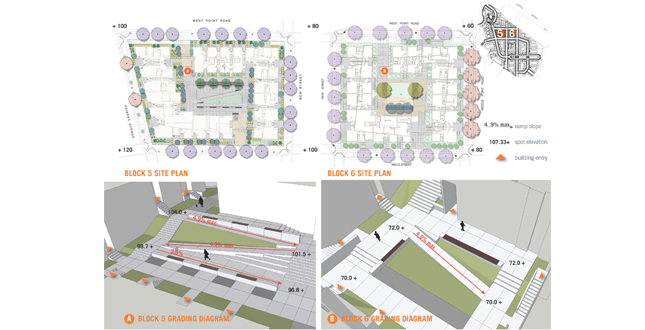
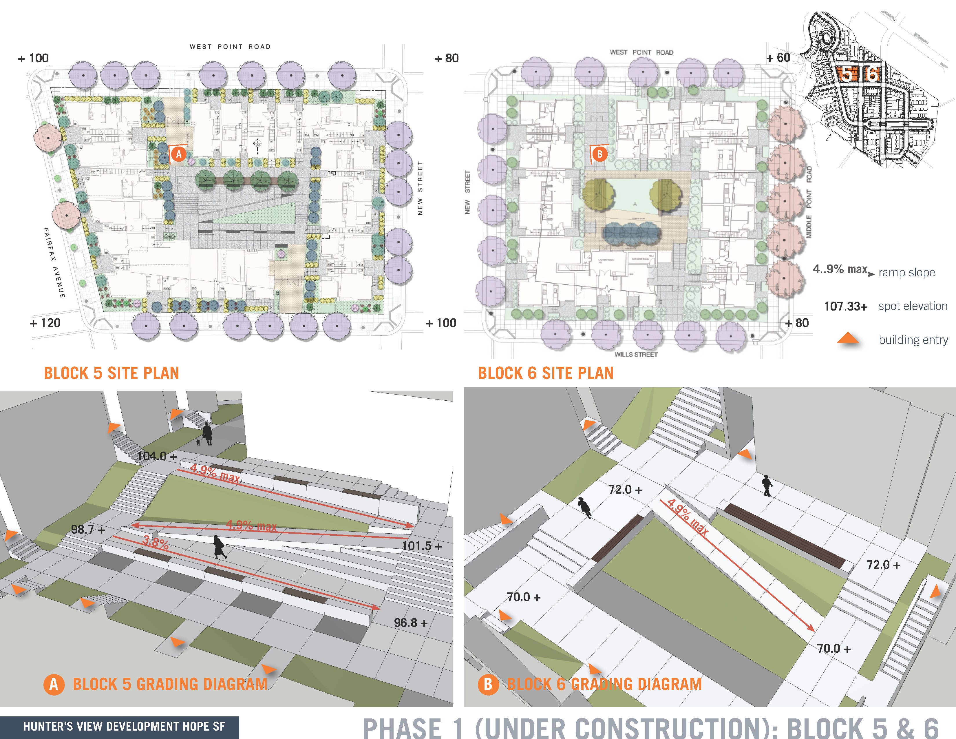
Phase 1 (Under Construction): Block 5 & 6
Download Hi-Res ImageImage: GLS Landscape / Architecture
Image 14 of 15
Project Statement
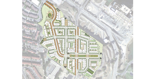
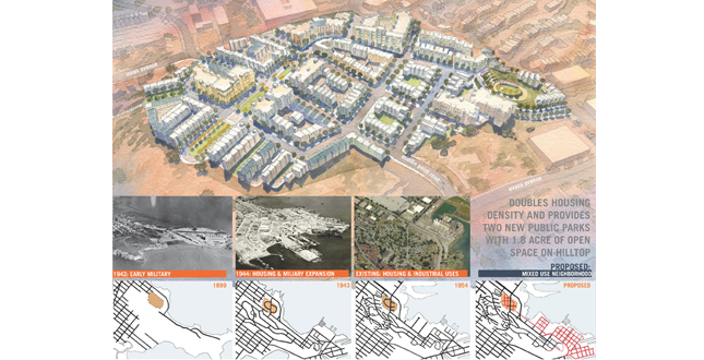
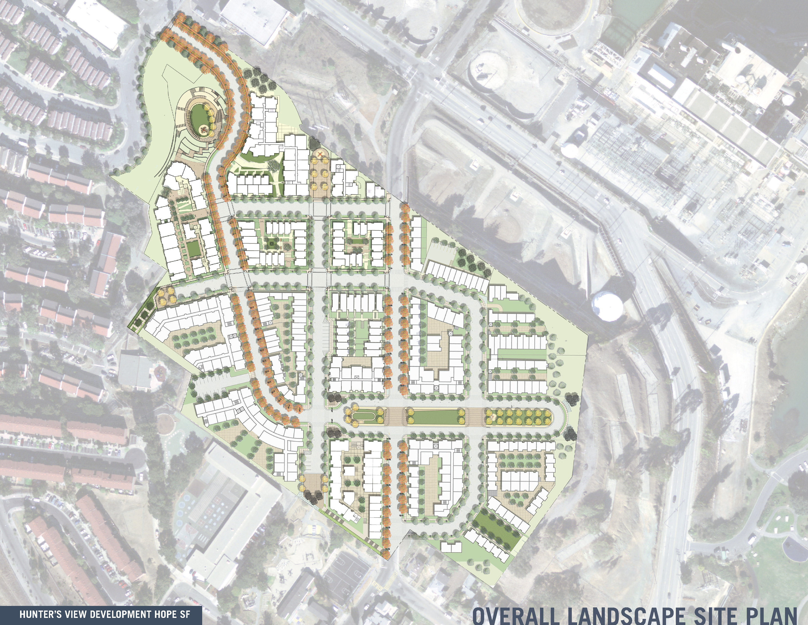
Located on a 22 acre site, the Hunter’s View neighborhood will replace San Francisco’s worst public housing with new public housing subsidized by new streets, parks and market rate housing. A new street grid supporting higher densities and dramatic views will replace the low density suburban site plan, which has left the neighborhood socially isolated from San Francisco and physically isolated from transit and services. This project is certified LEED Neighborhood Development Silver.
Project Narrative
—2011 Professional Awards Jury
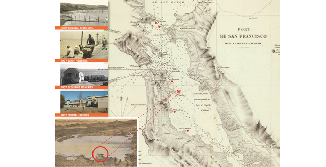
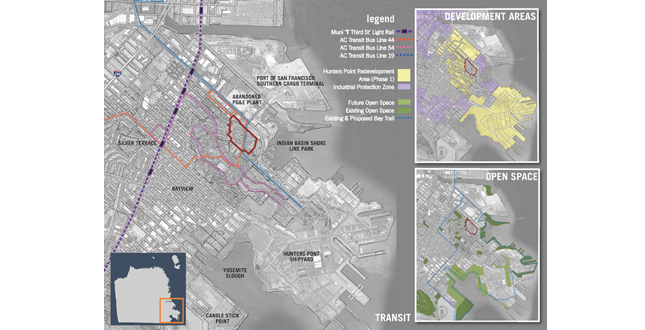
Few neighborhoods in San Francisco are more in need of improvements and opportunities for its residents than the public housing project in Hunters View. Located on a hillside above the former Hunters Point Naval Shipyard in the City’s long neglected southeast corner, it was chosen by the Mayor Gavin Newsom’s Office of Housing, the San Francisco Housing Authority and the San Francisco Redevelopment Agency as the first reconstruction project to be undertaken by the City’s innovative HOPE SF Program. HOPE SF is a public/private partnership which combines city, state and federal funding with local developers to replace the abandoned federal HOPE IV program. The Hunters View Neighborhood project aims to replace 267 units of poorly maintained, partially abandoned and federally owned housing with new housing, which will be subsidized by an additional 250 units of market rate housing.
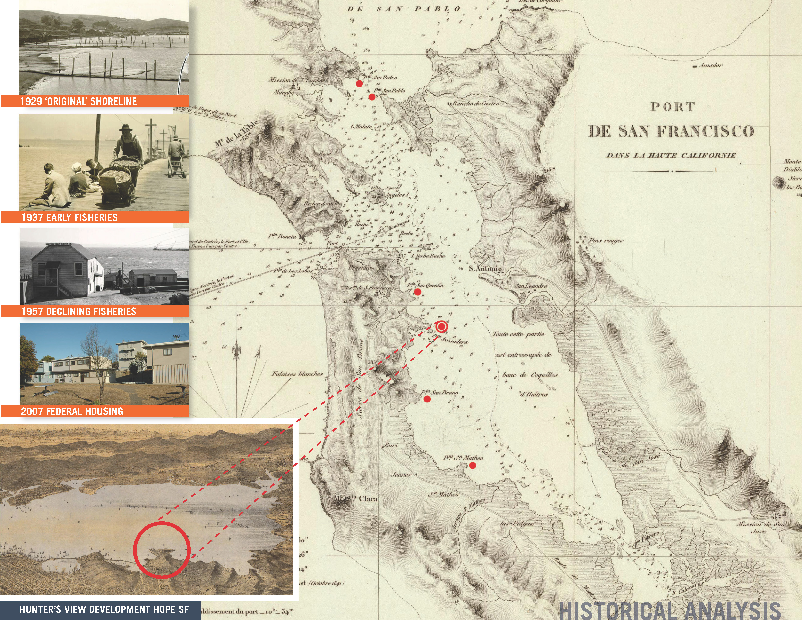
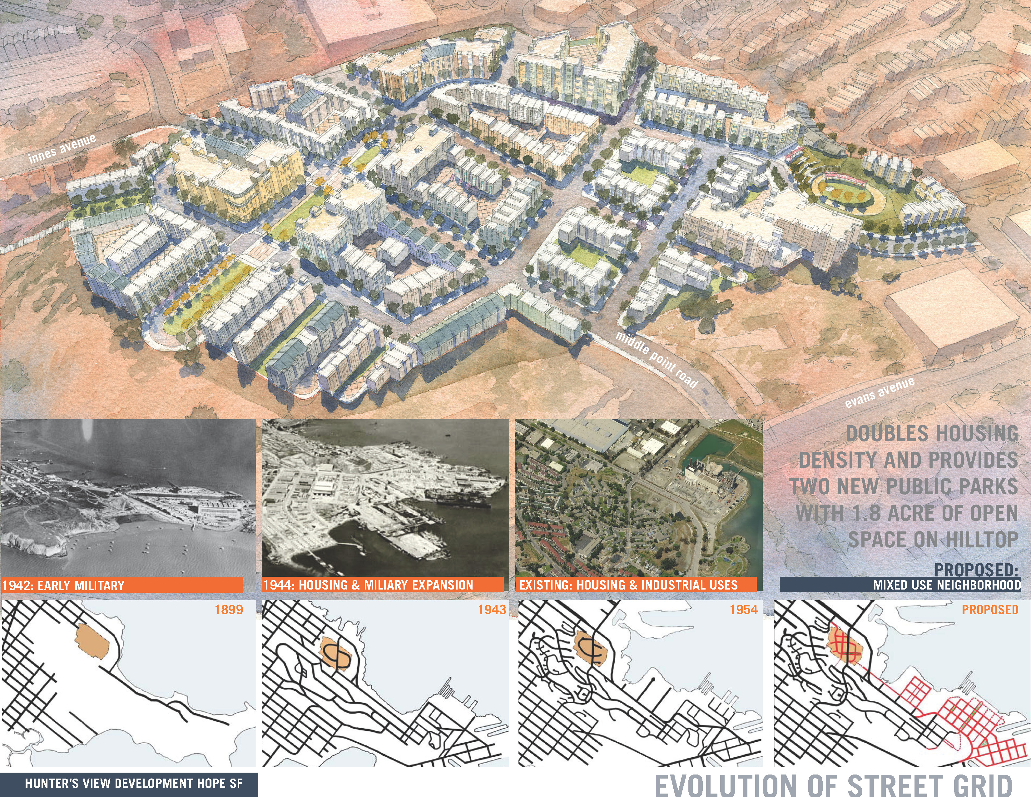
Originally built as part of the war effort in 1943 as temporary worker housing for nearby shipyards, the site was developed without attention to typical San Francisco design principals. Curving streets follow contours according to expediency resulting in few connections to the surrounding neighborhood. In 1954, the San Francisco Public Housing Authority converted the site to public housing, reusing the poorly designed streets and rebuilding some housing on many of the foundations intended to be temporary.
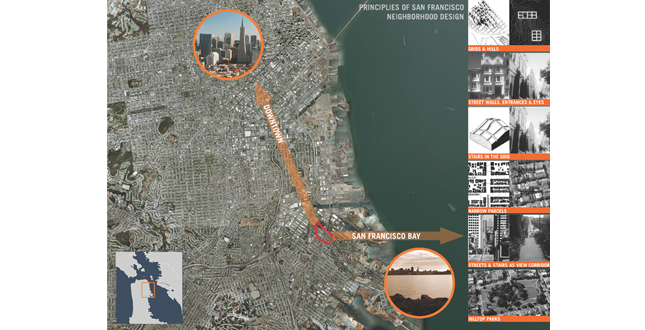
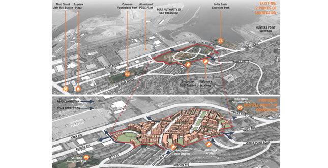
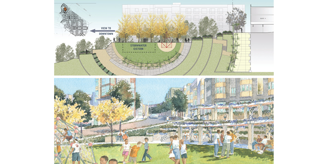
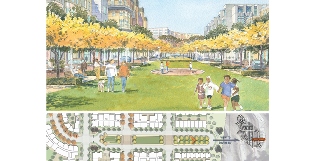
The redesign of the Hunters View site meets or exceeds the original HOPE VI guidelines, many of which are based upon traditional methods of planning that created San Francisco’s distinctive character. The current neighborhood has only two points of access for the 22 acres, making it unsafe, and difficult to police or service with public transit. A primary goal of the reconstruction is to reconnect the isolated site to the surrounding neighborhood with multiple street and pedestrian connections. A new grid of streets fronted by building entrances frequently stepping along the site’s steep slopes will extend the San Francisco urban pattern with surprising and dramatic views. Two new hilltop parks are oriented to views; one on axis to downtown and the other to the south bay. Public stairs and pedestrian linkages will further connect the site to the surrounding neighborhood and provide access to existing transit options.
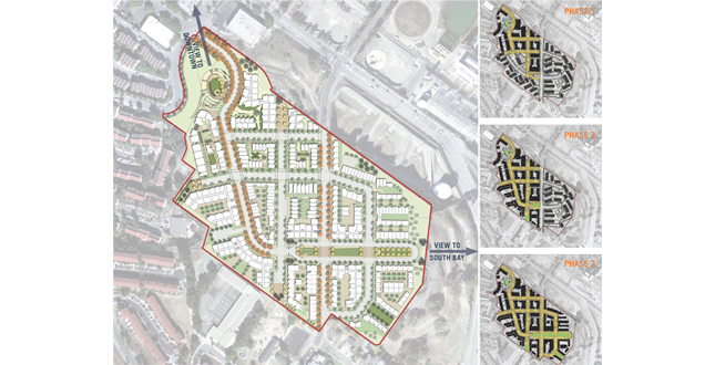
Residents of all ages, as well as members of the surrounding community, have participated in workshops and tours of parks and neighborhoods throughout the design process, and have provided input on the open space design, security and the construction phasing. By carefully phasing construction, current residents will not be required to relocate offsite at anytime during the process. Abandoned units will be repaired for temporary occupation so that residents in the construction area can relocate to those units until new units are complete. In the end, a mix of condominium owners, market rate renters, and renters of SF Housing Authority units will occupy the site. The plan provides for a mix of income levels and unit types on every street as is found in typical neighborhoods of San Francisco. Housing for seniors as well as community facilities and neighborhood retail are planned.
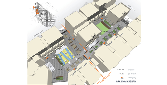
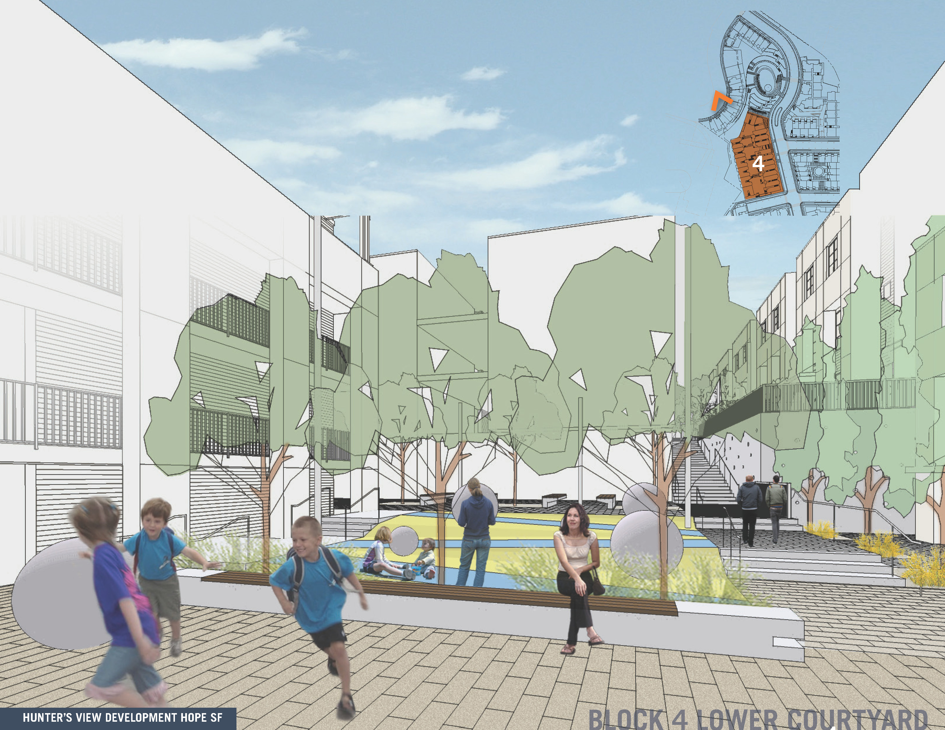
The first phase (currently under construction) consists of three blocks of public housing and the first oval shaped park. Promontory Park is similar to a traditional San Francisco hilltop park. It is sited on axis with the main Fairfax Street and captures impressive downtown views from a large community lawn shaded with Monterey Cypress trees and a large stormwater storage tank below. Terraces are planted with fruit trees and herbs at the request of children attending community design workshops. Despite the very steep slope, the majority of the developed site is accessible through the use of terraces and wide ramps.
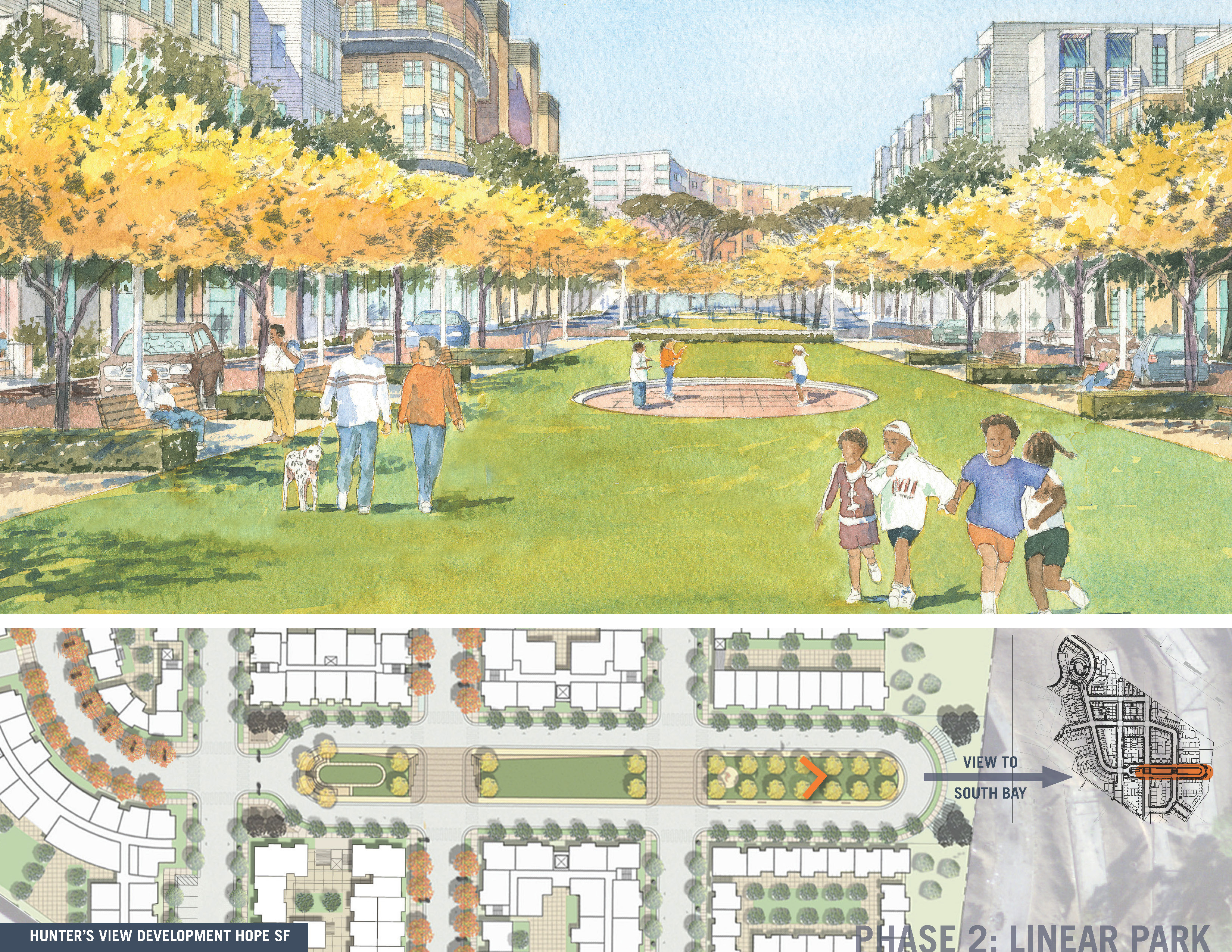
The linear Panhandle Park will be built in conjunction with the second and third phases of construction. Terminating Fairfax Avenue to the south at the highest point of the site, it has a tot lot and small amphitheater with views of the south bay. Every block has a secured but shared internal open space and several mews courts and smaller open spaces are distributed throughout the site, within short walking distance of every residence.
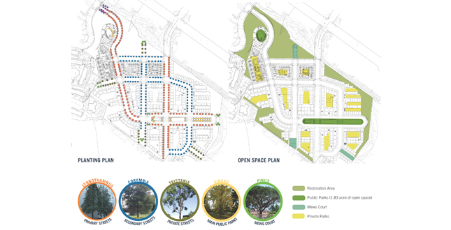
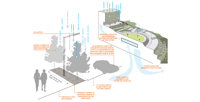
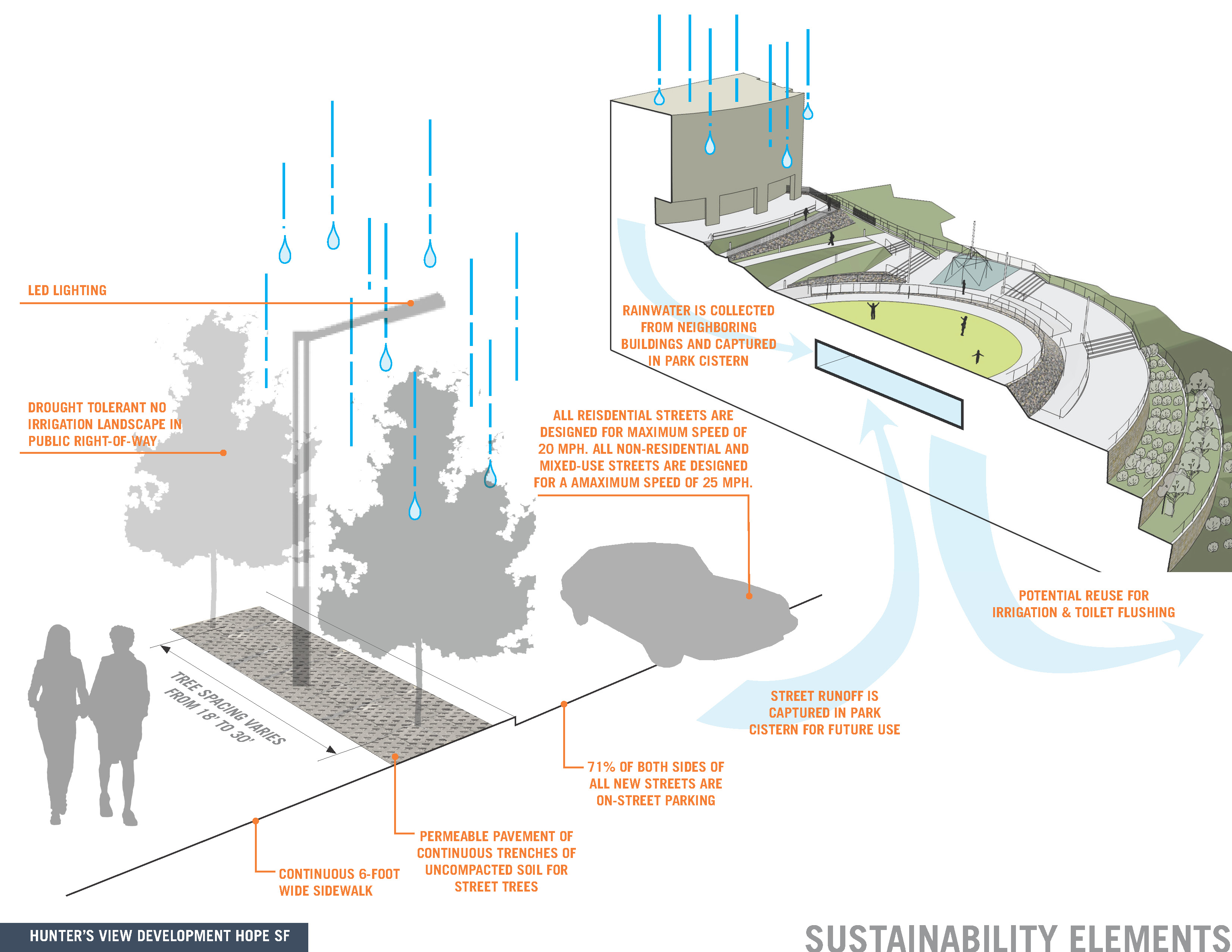
Street design furthers the recommendations of the San Francisco Better Streets Plan, which ensures that streets are inviting (so people will walk to public transit) and perform the multiple functions of accommodating pedestrians, bicycles, trees, stormwater management and infrastructure. Due to the density of infrastructure and the predominance of serpentine soils which have a dwarfing effect on trees, continuous trenches of specially site harvested and amended soils are provided in continuous uncompacted trenches and covered with pervious unit pavers. Stormwater from sidewalks drains to these pervious park strips between the sidewalk and the back of curb in the right of ways, while streets and housing blocks drain to a large cistern buried underneath Promontory Park. This water will be detained and slowly released to the City’s combined sewer system for treatment, and can be reused for irrigation in subsequent phases.
Trees have been selected for longevity, ease of maintenance, low water use and adaptability to existing serpentine soils. No irrigation (which is unheard of in California) will be provided in the right-of-ways. Shrub and ground cover plantings will be native and climate adapted Mediterranean plantings. Restoration plantings along the sites borders will be based on site inventory and seed collection prior to site grading.
Street and park lighting are low energy LED fixtures and the project is Certified LEED ND Silver.
Project Resources
Landscape Architect: GLS Landscape / Architecture
Gary Strang, ASLA; Dean Williams; Wendy Mok, ASLA
Client – Lead Developer: John Stewart Company
Jack Gardner; Margaret Campbell; Dan Levine
Master Architect: WRT/ Solomon E.T.C. Anne Torney; Daniel Solomon; Naomi Horowitz
Civil Engineer: Carlile Macy
Curtis L. Nichols, ASLA; Jim Fain
Renderer: Zendarski Studio
Art Zendarski