

«previous pageCOMMUNICATIONS CATEGORY
Honor Award
Interactive Mapping Project
Ujirany Group, Budapest, Hungary
client: The Cities of Budapest, Szeged, and Györ in partnership with the Hungarian State Arts Board
Project Statement
Nyugati Station is one of many underground transit hubs that connect the web of subways, street trams and bus terminals in the city of Budapest, Hungary. The Interactive Mapping Project was the winning entry in a public art competition that created temporary interactive art installations placed on the floor of the hub and in two other cities outside Budapest. The purpose of the installations was to encourage travelers and temporary visitors to see their city in a unique way and to be given a rare opportunity to share their thoughts on its strengths and weaknesses.
Project Narrative
With half of the world’s population now living in urbanized areas, the ability of individuals to form a community around them becomes increasingly difficult. Massive transportation networks move people throughout the city in virtual anonymity. Our culture’s rising dependence on technological communication devices allows individuals to depart from the physical space of the city and live almost exclusively in a virtual world of cell phones, television, and the internet.
Thousands of travelers pass through Nyugati Station transit hub in Budapest, Hungary, every day and like many modern cities, residents of Budapest tend to live isolated lives surrounded by strangers. The landscape architects who designed and created the Interactive Mapping Project sought to generate a series of temporary public art installations at Nyugati Transit Station and two other locations in order to break down the barriers that prevent individuals in an urban setting from communicating with each other. The installations also gave people the opportunity to interact with their city at a different scale and to reflect on the places they appreciated or wanted changed.
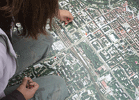
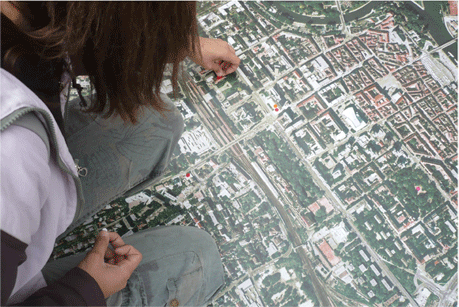
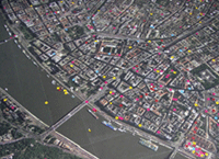
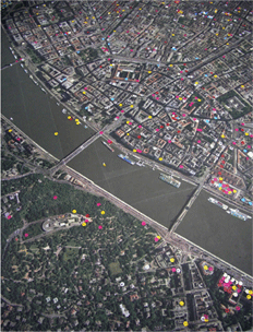
The Interactive Mapping Project consisted of a large satellite map of Budapest covering the floor of Nyugati Transit Station. A series of stickers placed on nearby pillars invited participants to label locations around the city they found to be noteworthy, either because of the location’s positive or negative attributes. The most popular locations marked were those indicating an individual’s home, which reinforced the personal nature of the project. Over time, the map was transformed from a simple orthophoto into a multi-dimensional model that represented how people viewed the city. Patterns began to emerge as certain places accumulated more labels than others.
As well as providing public data about each of the cities, the Interactive Mapping Project encouraged a spontaneous social experience. As hurried travelers were transformed into active participants in the installation, impromptu conversations emerged among strangers. Nyugati Station was temporarily converted into a public forum where the state of the city was discussed among its citizens. It became a place where social, ethnic, and economic boundaries were erased and people came together to share stories and ideas about the city in which they live.
Project Resources
Landscape Architects/Artists
Gábor Lendvai, Dominika Tihanyi
Curator for Nyugati Installation
Attila Nemes
Map Printing and Installation
M.ART Kft.
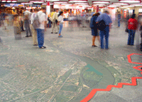
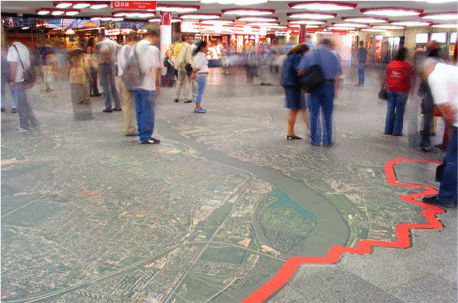
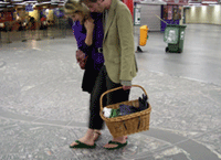
The Interactive Mapping Project at Nyugati Transit station. (Photo: Gábor Szohr)
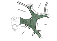
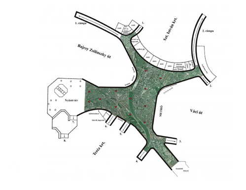
The overhead plan for the placement of the orthophoto on the floor of Nyugati Transit Station.
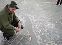
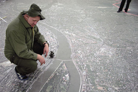
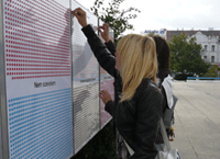
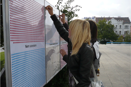
Visitors placed labels on the map that expressed their reaction to certain locations within Budapest. (Photo: Dominika Tihanyi)
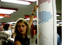
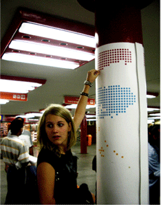
Label options included positive and negative signs, my home and locations that needed to be rehabilitated. (Photo: Gábor Szohr)
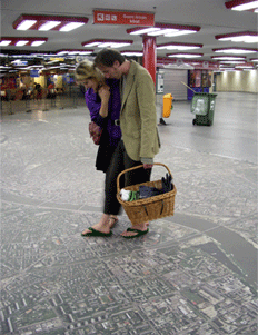
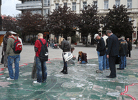
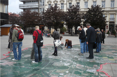
For many visitors, the map offered a unique opportunity to discuss how they related to the city around them. (Photo: Gábor Szohr)
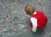
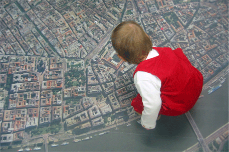
People of all ages were able to interact with the Mapping Project. (Photo: Johanna Muszbek)
"Amazing and engaging. The ultimate in communications."
— 2009 Professional Awards Jury
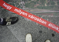
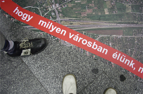
A description of the project was clearly marked along the edges of the map. (Photo: Dominika Tihanyi)
Over time, the map was transformed from a simple orthophoto into a multi-dimensional model that represented how people viewed the city of Budapest. Patterns began to emerge as certain places accumulated more labels than others. (Photo: Dominika Tihanyi)
The flexibility of the project allowed for people to interact with the map in multiple ways. (Photo: Gábor Szohr)
The Nyugati Station Mapping Project was so successful that the map was placed in two other cities in Hungary. (Photo: Dominika Tihanyi)
Individuals in the cities of Szeged and Györ were able to interact with the map of their city in the open air. (Photo: Dominika Tihanyi)