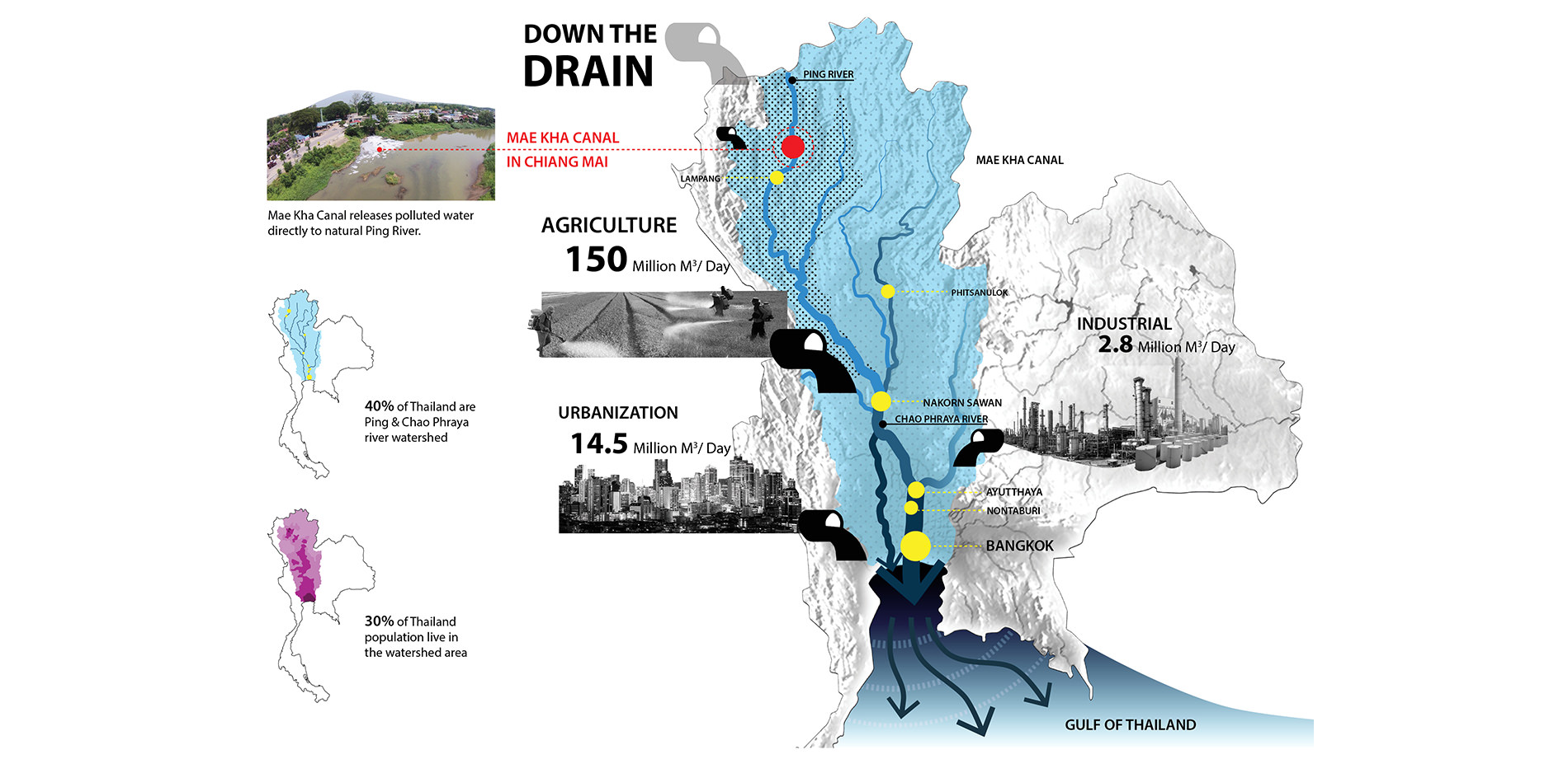
The degraded Mae Kha Canal is directly discharged polluted water into natural Ping River. This affects to overall Thailand’s water system and natural watershed that flow down the river to the Gulf of Thailand.
Photo Credit: Sunantana Nuanla-or, Dr. Manop Kaewmoracharoen CENRU, Watershed Architecture
Media: Please submit high-resolution image requests to images@asla.org.
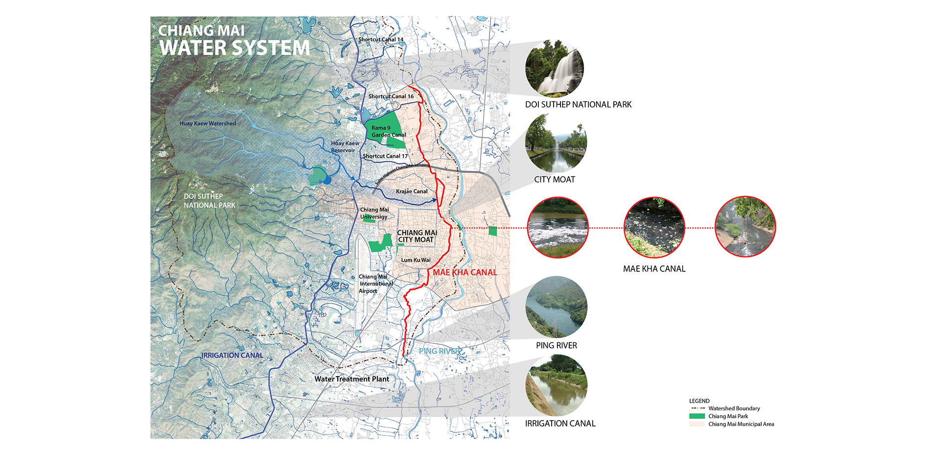
Situate in a mountainous area with the City Moat surrounds the city center, Chiang Mai benefits from freshwater sources. The water system of Chiang Mai is in excellent condition, except for Mae Kha Canal.
Photo Credit: Sunantana Nuanla-or
Media: Please submit high-resolution image requests to images@asla.org.
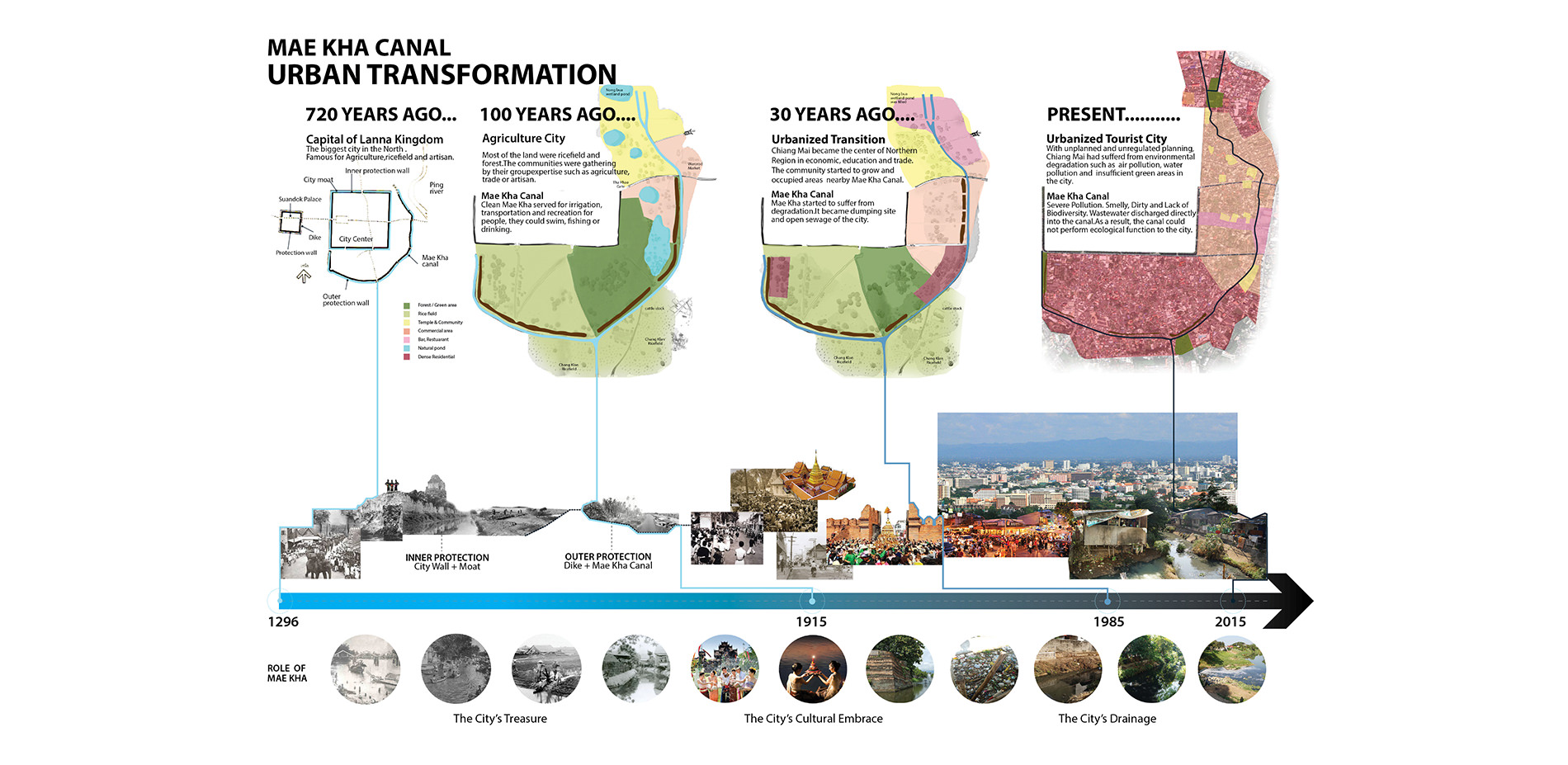
Excavated as a city’s second protection from flooding, Mae Kha had pivotal roles as a city guardian, irrigation system, and cultural features. Unfortunately, nowadays the city turns its back to the canal due to its degraded conditions.
Photo Credit: Sunantana Nuanla-or; KonJuaiBaan Group
Media: Please submit high-resolution image requests to images@asla.org.
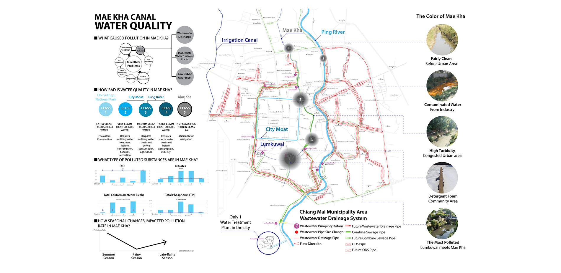
Mae Kha canal water quality and unnatural color are used to define site study area.
Photo Credit: Sunantana Nuanla-or, Dr. Manop Kaewmoracharoen CENRU
Media: Please submit high-resolution image requests to images@asla.org.
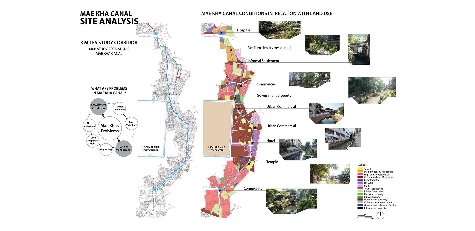
The water quality is getting worse as Mae Kha runs through urban areas. Moreover, the canal is suffered from management problems. The studied area has been defined accordingly leading to the investigation of land use map and existing conditions.
Photo Credit: Sunantana Nuanla-or
Media: Please submit high-resolution image requests to images@asla.org.
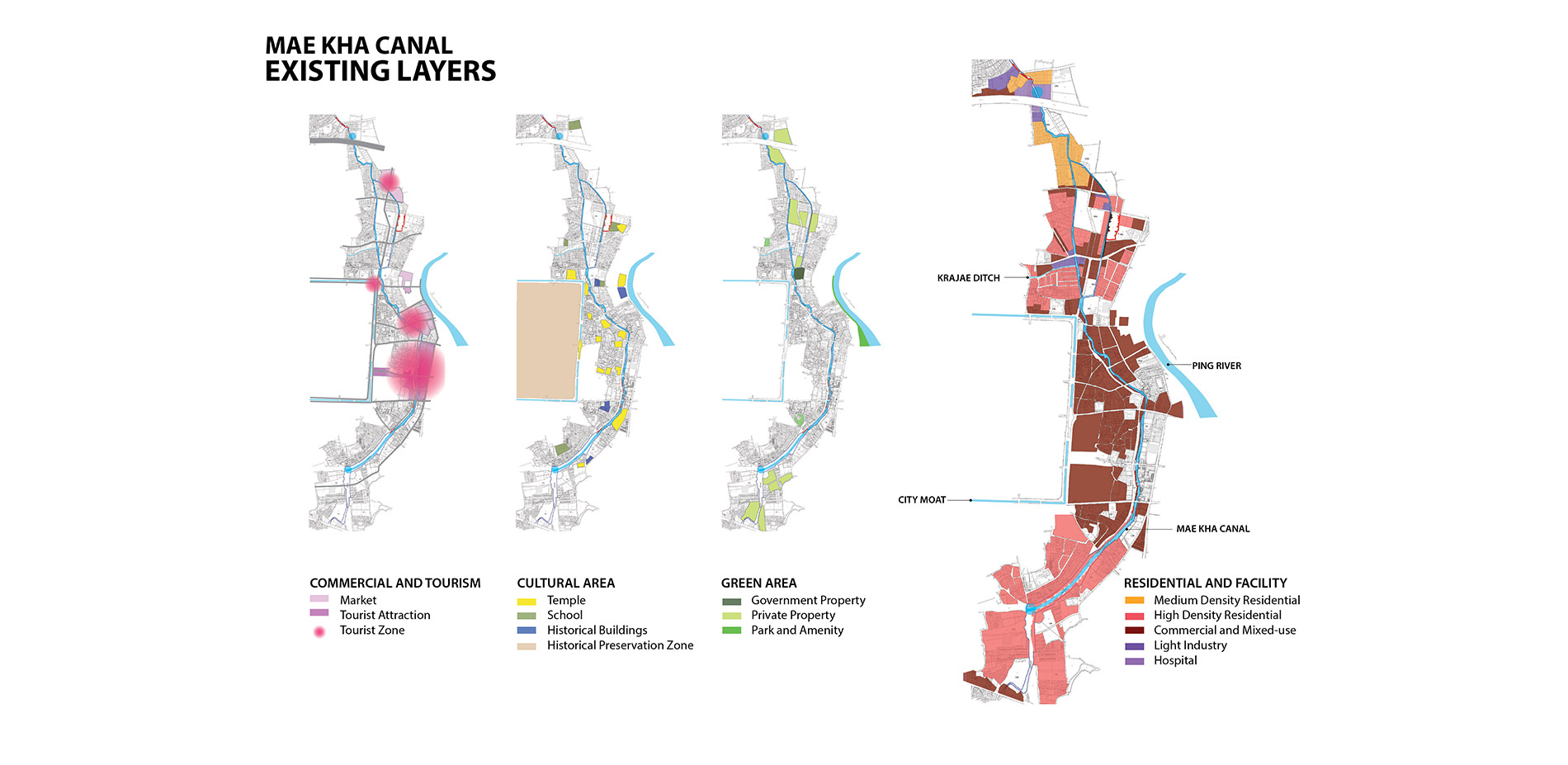
The study of existing city layers in relationship to Mae Kha Canal can be implemented for urban scale site framework and water treatment strategy.
Photo Credit: Sunantana Nuanla-or
Media: Please submit high-resolution image requests to images@asla.org.
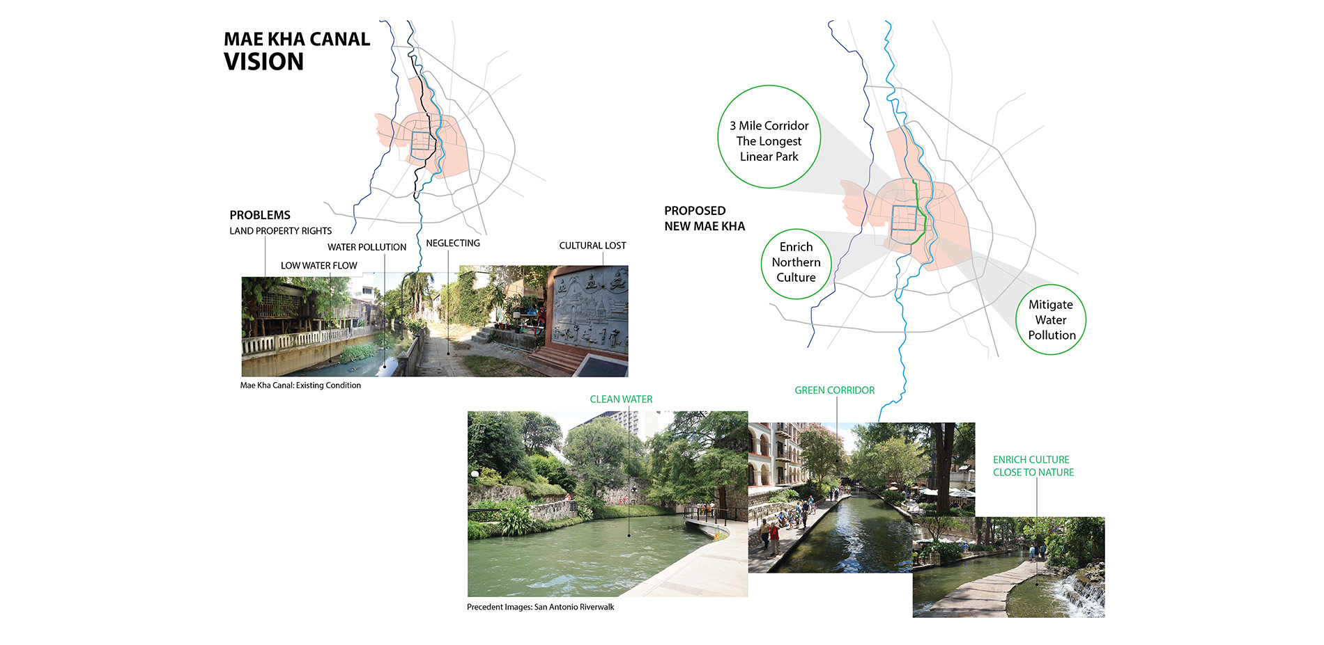
The project vision is to Bring Mae Kha Canal back to life and transform to be the longest linear park in the North of Thailand.
Photo Credit: Sunantana Nuanla-or
Media: Please submit high-resolution image requests to images@asla.org.
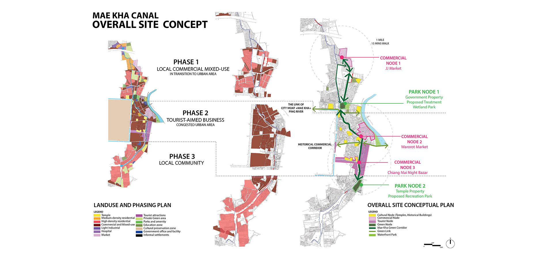
The proposal of the Linear Park framework suggests 3 development phases regarding land use. Promoting commercial nodes and park nodes will embrace diverse activities along the canal that encourage eco-tourism and community participation.
Photo Credit: Sunantana Nuanla-or
Media: Please submit high-resolution image requests to images@asla.org.
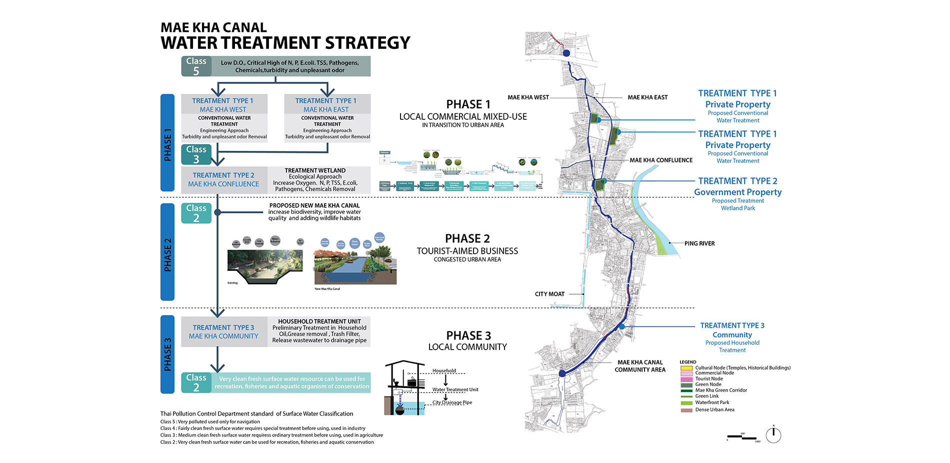
Ecological approach water treatment strategies are designed to match each land use type.
Photo Credit: Sunantana Nuanla-or
Media: Please submit high-resolution image requests to images@asla.org.
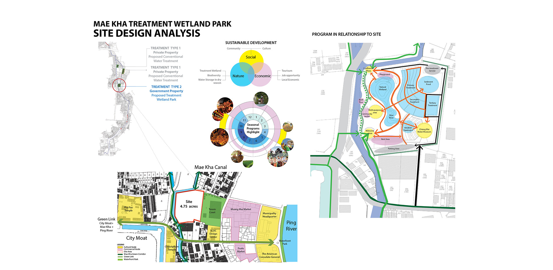
Selected Park node 1 in phase 1 as a prototype of ecological treatment site, this site is located in government property which ready to take action. Also, it is a great location to promote the connection of the three important water systems and emphasize the precious of water.
Photo Credit: Sunantana Nuanla-or
Media: Please submit high-resolution image requests to images@asla.org.
The proposed of new Mae Kha Canal increases diversity, improve water quality and provide wildlife habitats. Together with the series of treatment wetland on site and multi stakeholders cooperation, this will help Mae Kha Canal achieve its sustainability.
Photo Credit: Sunantana Nuanla-or
Media: Please submit high-resolution image requests to images@asla.org.
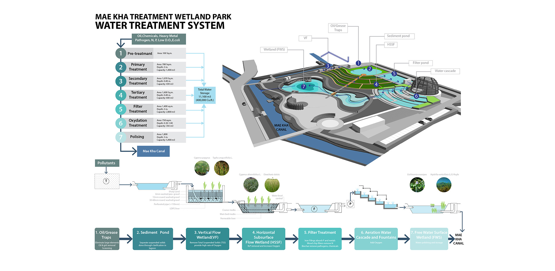
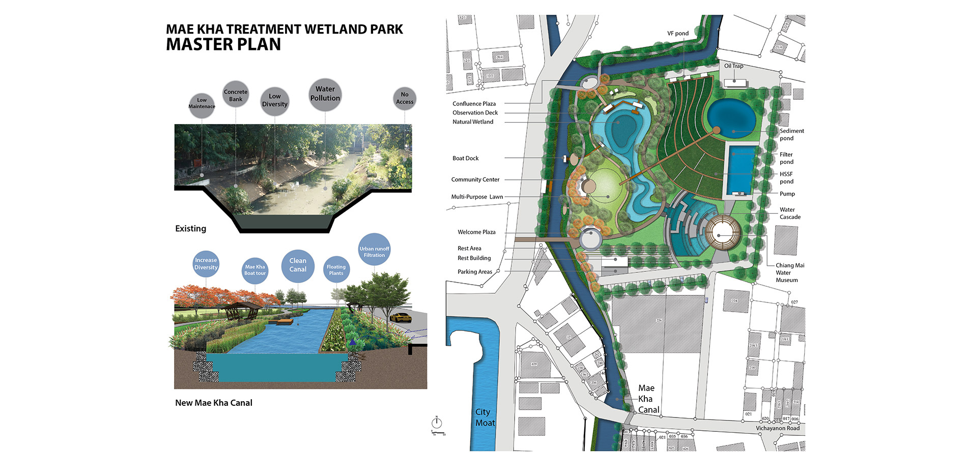
Site design at Park node 1 demonstrates a pilot project of wetland water treatment system.
Photo Credit: Sunantana Nuanla-or
Media: Please submit high-resolution image requests to images@asla.org.
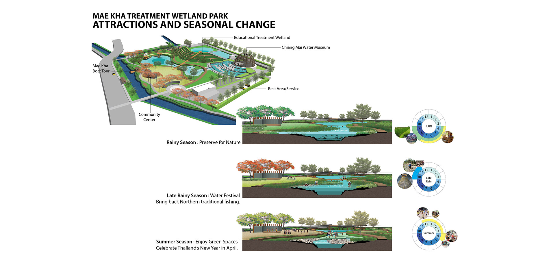
The treatment wetland will perform its ecological function differently in each seasons. Additionally, the Park houses diverse facilities that promote cultural and educational activities.
Photo Credit: Sunantana Nuanla-or
Media: Please submit high-resolution image requests to images@asla.org.
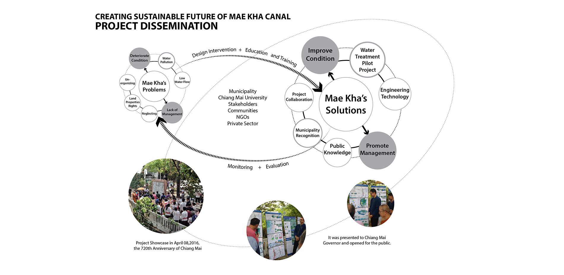
With a comprehensive study and design proposal, the project was disseminated at the 720th Chiang Mai City celebration with over 200 multi stakeholders participants.
Photo Credit: Dr. Manop Kaewmoracharoen, CENDRU
Media: Please submit high-resolution image requests to images@asla.org.